Country:
 City:
City:


How to get there: Take the N1 towards Saint-Louis and exit at the Usine du Gol junction. At the roundabout, take the second exit towards Saint-Louis centre. Pass the petrol station and take the second road on the left. Do not go past the bridge over the Ravine du Gol; if you do, turn back and take the first road on the right. At the next two roundabouts, take the second exit. When you reach a ‘give way’ sign, turn right. Cross a stream and then take the first right towards Bellevue. Take the first left, then go straight on at the junction. Follow the road to its end, then turn right and take the first left towards La Pièce Jeanne. Park at the end of the track.
Please note: just before it ends, the track splits into two ‘branches’ which rejoin shortly afterwards.
(S/E) From the end of the track, turn right onto a path that starts at a bend just after the letterbox at No. 22.
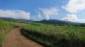
When you reach a house, follow the track to the left. Keep to the right at the next two tracks. Cross the Ravine Papaye and then head slightly downhill, enjoying the lovely views when the sugar cane has been cut. If this is the case, you can see the peaceful village of La Pièce Jeanne to the right, as well as Saint-Louis, Saint-Pierre and the Piton de Mont-Vert ahead of you.
(1) At the end of the track, turn left onto a concrete path from which you can see the Chaîne du Bois de Nèfles and the mountains above Les Makes. The views of the surrounding area are magnificent when the sugarcane has been cut! The path winds its way round a few bends, passing banana trees and a few fanjans. This section can, however, feel quite long and endless when the sun is at its highest! Follow the road to its end.
(2) Turn left onto a track that’s a bit slippery in places. Keep to the right at the next junction and pass close to some private land.
(3) The start of the path towards Les Makes is on the left of the track after a walk of about 25 minutes. The steps begin straight away and the slope is quite steep at the start. But your efforts are quickly rewarded with the first views. The path alternates between woodland and open areas. Some steps have been carved directly out of the earth: take care in wet weather, as they can be as slippery as soap! However, a few flat sections allow you to rest a little.
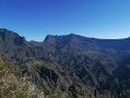
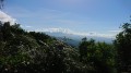
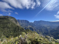
After about 30 minutes on this path, you can finally enjoy a beautiful view of the Plaine des Makes, which you could only have glimpsed until now. The path sometimes runs along a ridge, offering the advantage of several views of the Makes, the Plaine des Caffres, the Chaîne du Bois de Nèfles and the Tapage to the right, as well as the rolling countryside and the Étang-Salé les Bains to the left. The path is very scenic and, at times, quite wide along this ridge, and the panoramic views become increasingly spectacular. However, there are still a few steep sections. The path then moves away from the rampart, bending to the left. Descend slightly, cross a stream and then climb back up.
(4) Navigate a few hairpin bends, then continue for a few hundred metres along this path. Whilst the path leading up to Le Makes bends sharply to the right at a 90-degree angle, turn left onto the Sentier Grand Case at elevation 1074. The track is visible despite the poor condition of the path at the start: it is strongly recommendedthat you carry a GPS to ensure you don’t miss the start. The Sentier Grand Case is overgrown, but only for a very short stretch. You will then reach a sort of clearing and take the path that starts on the other side of it.
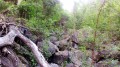
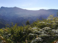
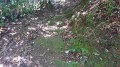
After the clearing, the path is clearly defined and well-maintained. It is impossible to lose your way, even though it is not marked on any map, especially as there are no junctions. The path winds its way through ferns for a long stretch at the start. Some sections are slippery, particularly the ‘soapy steps’. The ferns then give way to sabre grass. On the few open stretches, you can see the area between Saint-Louis and Saint-Pierre, as well as Piton de la Croix and Piton la Mare. Here too, the path sometimes runs along a ridge from which you can hear a few streams flowing, though they remain out of sight. You then pass close to some beautiful trees.
The path then passes a surprising grave – do not step on it or touch it! This marks the point where more than half of the Grand Case Trail has been completed. The path remains just as slippery and is more or less narrow in places, but it is clearly marked and unobstructed. Through a gap on the left, you can see the other side of a tributary of the Bras d’Éric.
(5) It takes about an hour’s descent to reach the end of the trail. Then take the track that continues straight on, passing a reservoir. The view over the Étang-Salé les Bains coast in Saint-Pierre is stunning after the reservoir and well worth stopping for a photo. Pass by a few plantations, taking the dirt track on the left each time. After a few minutes, this turns into a concrete path, with views of the coastline throughout.
(6) At the next junction, turn left onto the RD3. You’ll pass a few wayside shrines and cross a couple of streams.
(7) Follow this lovely road until you reach the sign on the right indicating the way to Bellevue. Keep left at this junction.
(8) Turn left at the next junction and follow the winding road back to the starting point, enjoying some stunning views provided the reeds have been cut back! This section can be quite gruelling when the sun is at its highest. (S/E)


 Visorando Member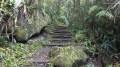
 Moderate

 Easy
Easy