Piton de la Croix

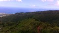
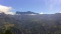
Piton la Croix is a peak in the commune of Étang-Salé. From its summit, you can enjoy one of the island’s most beautiful views! Indeed, from up there you have a 360° panorama stretching from Saint-Pierre to Étang-Salé-les-Bains, taking in Piton des Neiges, the hills above Étang-Salé, Saint-Louis, Le Tampon, L’Étang-Salé-les-Hauts, La Rivière and L’Entre-Deux! It’s also a wonderful spot for quiet reflection!

Details

313529
Creation:
Last update:
Last review:
  • Walking
    Activity: Walking
  • ↔
    Distance: 1.20 mi
  • ◔
    Average duration: 1h 05 
  • ▲
    Difficulty: Moderate

  • ⚐
    Back to start: Yes
  • ↗
    Ascent: + 630 ft
  • ↘
    Descent: - 630 ft

  • ▲
    Highest point: 3,068 ft
  • ▼
    Lowest point: 2,438 ft

Photos

Description of the walk

Access:

From St-Louis: Head towards Étang-Salé-les-Hauts. In the village, continue on the D11 towards Les Avirons, then turn right onto the D19 towards Les Canots (a sign indicates the direction to take for Les Canots). Follow this for about 1.5 km, then turn left onto the Chemin de l’Entre-Deux towards l’Entre-Deux-des-Canots (a sign indicates the direction to take for l’Entre-Deux-des-Canots). Drive for about 6 km, then park at the start of the path, which is on the left-hand side of the road and marked by a tourist sign.

From Les Avirons: Head towards Étang-Salé-les-Hauts. At the entrance to the village, cross the Ravine Sèche, then at the next junction turn left onto the D19 towards Les Canots (a sign indicates the direction to follow to reach Les Canots). Follow this for about 1.5 km, then turn left onto the Chemin de l’Entre-Deux towards l’Entre-Deux-des-Canots (a sign indicates the direction to take for l’Entre-Deux-des-Canots). Drive for about 6 km, then park at the start of the footpath, which is on the left-hand side of the road and marked by a tourist sign.

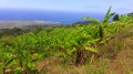
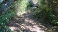
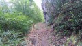
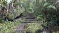
(S/E) Take the dirt track that starts to the right of the tourist sign and climbs towards Piton la Croix. It climbs gently but is very slippery! After the second bend, take the path that starts sharply to the left via some steps. The slope is steep throughout the climb but offers beautiful panoramic views from the very first few metres. It’s also not uncommon to come across guava trees. The path is, however, very slippery and climbs steadily all the way! It runs alongside a drainage channel, passes close to a wayside shrine and crosses a few benches where you can rest.

(1) At the first junction, turn right towards Piton la Croix. The path then follows a ridge, offering views over the Grand-Bras to the west and the Petit-Bras to the east. After a 30-minute climb, which is steep in places, you reach the summit of Piton la Croix and its famous cross. From there, you’re treated to a spectacular panorama over much of the south of the island and the hills of Étang-Salé! It’s one of the island’s most beautiful viewpoints! After the summit, the slope levels out.

(2) At the next junction, turn left onto the path that runs alongside a pipe. You’ll come across a table made of guava wood, which is a great spot for a picnic. Take care on the descent as the path is extremely slippery

(1) Carry on straight ahead, then return to the starting point via the same route (S/E).

Waypoints

  1. S/E : mi 0 - alt. 2,438 ft - Tourist signpost
  2. 1 : mi 0.39 - alt. 2,844 ft - At the junction, turn right
  3. 2 : mi 0.66 - alt. 3,064 ft - At the junction, turn left
  4. S/E : mi 1.2 - alt. 2,438 ft - Tourist signpost

Notes

Important notes: the path is very slippery. Make sure you wear good walking boots. Avoid this route during or after a spell of rain.
Suitable for a picnic.
There are several benches where you can rest.
At (2), you can continue on to Camp Jacquelin, or to Tévelave, Les Makes and La Pièce Jeanne by turning right.

Worth a visit

See the viewpoint at Piton la Croix.
See the cross at the summit of the piton and the wayside shrine on the path.

Reviews and comments

4.2 / 5
Based on 4 reviews

Reliability of the description
4 / 5
Ease of following the route
4.8 / 5
Route interest
3.8 / 5
drago nicolas
drago nicolas

Overall rating : 4.7 / 5

Date of your route : Jun 22, 2026
Reliability of the description : ★★★★★ Very good
Ease of following the route : ★★★★★ Very good
Route interest : ★★★★☆ Good
Very busy route : Yes

A really nice route – a bit of a challenge but accessible,
On the downside, it’s muddy! But well maintained

Machine-translated

User 25234841

Overall rating : 4.7 / 5

Date of your route : Jun 23, 2025
Reliability of the description : ★★★★☆ Good
Ease of following the route : ★★★★★ Very good
Route interest : ★★★★★ Very good
Very busy route : Yes

Completed in May 2025, the trail is very well maintained but quite slippery even in dry weather.
Numerous steps and a steep climb to the cross.
Superb view from the top
A few guava trees along the way for a touch of sweetness

Machine-translated

Delanoix
Delanoix

Overall rating : 4.3 / 5

Date of your route : Nov 18, 2018
Reliability of the description : ★★★☆☆ Average
Ease of following the route : ★★★★★ Very good
Route interest : ★★★★★ Very good

A narrow path with earthen steps that were extremely slippery due to the damp conditions in the area affecting the clay soil. Given the risk of rain, we had to turn back halfway along the route, for safety’s sake. It’s a shame, as the panoramic view from Piton must be even more beautiful once you reach the top.

Machine-translated

Abracadabram
Abracadabram

Overall rating : 3 / 5

Date of your route : Mar 19, 2018
Reliability of the description : ★★★★☆ Good
Ease of following the route : ★★★★☆ Good
Route interest : ★☆☆☆☆ Very disappointing

A difficult path, very slippery even when it isn’t raining, in poor condition despite having been upgraded, and rather uninteresting during the ascent. The view at the top, however, is remarkable.

Machine-translated

Other walks in the area

For more walks, use our search engine .

The GPS track and description are the property of this route's author. Please do not copy them without permission.