


Refine your search for walks in Saint-Jean-de-Couz
Saint-Jean-de-Couz walks


 The Gerbaix viewpoint from Côte Barrier
 Visorando Member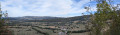
 5.49 mi
 +797 ft
 -801 ft
 3h 15
3h 15
 Moderate
 Departure from Saint-Jean-de-Couz (Savoie)
Rather than heading off to see the Grottes des Échelles and the Voie Sardes, I suggest heading to the Gerbaix viewpoint, setting off from the picturesque little hamlet of Côte Barrier through woodland and mountain pastures, with lovely scenery and impressive views.
Historical and prehistoric loop of Saint-Christophe la Grotte
 3.76 mi
+1,004 ft
-1,001 ft
2h 35
Moderate
Departure from Saint-Christophe (Savoie) (Savoie)
3.76 mi
+1,004 ft
-1,001 ft
2h 35
Moderate
Departure from Saint-Christophe (Savoie) (Savoie)
Short hike to discover prehistory at the Fru site and the historic passage of the Via Sarde between Lyon and Turin.
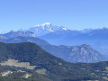
La Cochette
 3.94 mi
+1,371 ft
-1,371 ft
3h 00
Moderate
Departure from Entremont-le-Vieux (Savoie)
3.94 mi
+1,371 ft
-1,371 ft
3h 00
Moderate
Departure from Entremont-le-Vieux (Savoie)
A short mountain hike leading to an exceptional viewpoint.
Mont Outheran
 5.59 mi
+1,673 ft
-1,657 ft
4h 00
5.59 mi
+1,673 ft
-1,657 ft
4h 00
 Difficult
Departure from Entremont-le-Vieux (Savoie)
Difficult
Departure from Entremont-le-Vieux (Savoie)
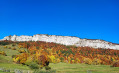
Mont Outheran is a long plateau stretching nearly 4 km, running roughly north-south between Col du Planet (1,184 m) and Col du Grapillon (1,509 m).
It is a rather wild area, and for good reason: access via the Pas du Cuert is not the easiest, and the descent to the Col du Mollard requires the utmost caution.
Warning: For those prone to vertigo, please read the wpt description carefully (2)
Foot of Mont Outhéran and Pointe de la Cochette
 4.18 mi
+1,611 ft
-1,611 ft
3h 20
Moderate
Departure from Entremont-le-Vieux (Savoie)
4.18 mi
+1,611 ft
-1,611 ft
3h 20
Moderate
Departure from Entremont-le-Vieux (Savoie)
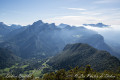
Starting from the small downhill ski slopes of the Désert d'Entremont, this is a very accessible walk offering two beautiful views of the Chartreuse massif, both from the foot of Mont Outhéran and from Pointe de la Cochette, the latter being the most spectacular. The ascents and descents take place in the shade of the woods and forests, offering a beautiful panorama of the Chartreuse massif. Unbeatable value for money!
La Cochette and Le Mont Outheran via the Pas du Cuert
 7.95 mi
+2,300 ft
-2,270 ft
5h 40
Difficult
Departure from Entremont-le-Vieux (Savoie)
7.95 mi
+2,300 ft
-2,270 ft
5h 40
Difficult
Departure from Entremont-le-Vieux (Savoie)
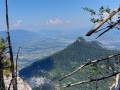
A lovely, short but scenic walk, featuring numerous viewpoints and an interesting section: the Pas du Cuert.
The Mont Outheran plateau
 6.84 mi
+1,683 ft
-1,667 ft
4h 35
Moderate
Departure from Entremont-le-Vieux (Savoie)
6.84 mi
+1,683 ft
-1,667 ft
4h 35
Moderate
Departure from Entremont-le-Vieux (Savoie)
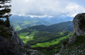
From a distance, Mont Outherand looks like a fortress, with several gaps in the limestone walls of the fort.
Near the Col du Mollard, a steep path allows attackers to overcome the fort's defences.
 Grand Carroz Snowshoe Circuit
 4.61 mi
+1,024 ft
-1,056 ft
4 hrs
4.61 mi
+1,024 ft
-1,056 ft
4 hrs
 Easy
Departure from Entremont-le-Vieux (Savoie)
Easy
Departure from Entremont-le-Vieux (Savoie)
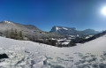
A snowshoe circuit in the Entremonts valley.
It is a loop alternating between ascents and descents, passages through forests and mountain pastures, shady slopes and sunny slopes, crossing the hamlet of Grand Carroz with its few houses.
La Roche Veyrand circular loop
 4.69 mi
+1,263 ft
-1,243 ft
4 hrs
Easy
Departure from Entremont-le-Vieux (Savoie)
4.69 mi
+1,263 ft
-1,243 ft
4 hrs
Easy
Departure from Entremont-le-Vieux (Savoie)
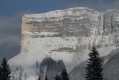
A circular route starting from Col de la Cluse (1170m), combining a wild route on the way there and a classic trail on the way back.
This outing is not very difficult, but can be a little physically demanding at times when you have to break trail in 40cm of powder snow.
Roche Veyrand - La Tournette Circular Loop
5.26 mi
+1,742 ft
-1,742 ft
3h 55
Moderate
Departure from Entremont-le-Vieux (Savoie)
A short hike in the heart of the Entremonts, offering stunning views from the summit and passing through beautiful meadows dotted with traditional old barns on the way back.
Trek around Mont Outheran starting from Désert d'Entremont
8.01 mi
+1,873 ft
-1,873 ft
6 hrs
Moderate
Departure from Entremont-le-Vieux (Savoie)
A beautiful hike to be done with or without snowshoes.
La Cochette loop in Chartreuse
 3.57 mi
+1,417 ft
-1,411 ft
4 hrs
Easy
Departure from Entremont-le-Vieux (Savoie)
3.57 mi
+1,417 ft
-1,411 ft
4 hrs
Easy
Departure from Entremont-le-Vieux (Savoie)
La Cochette in Chartreuse (1,618 m) is an easily accessible peak.
 Circuit of Mont Outheran, via the Col du Mollard, Col du Planet and Col du Grapillon
7.70 mi
+1,719 ft
-1,690 ft
3 hrs
Moderate
Departure from Entremont-le-Vieux (Savoie)
A mountain bike tour of Mont Outheran via the Col du Mollard, Col du Planet and Col du Grapillon, allowing you to explore its different sides with relatively limited elevation changes as the route never descends very far down.
The Pointière Circular
 3.48 mi
+515 ft
-509 ft
3 hrs
Easy
Departure from Entremont-le-Vieux (Savoie)
3.48 mi
+515 ft
-509 ft
3 hrs
Easy
Departure from Entremont-le-Vieux (Savoie)
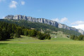
A lovely circular route in the Désert d’Entremont Nordic ski resort.
Mont Beauvoir Circular Walk
 3.82 mi
+1,555 ft
-1,552 ft
3h 05
Moderate
Departure from Saint-Pierre-de-Genebroz (Savoie)
3.82 mi
+1,555 ft
-1,552 ft
3h 05
Moderate
Departure from Saint-Pierre-de-Genebroz (Savoie)
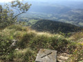
A lovely, well-structured circular loop, though it lacks a few viewpoints.Part of the route is off-track along the summit cliff.Facing south to south-west, then west for the descent, and entirely through woodland, this route is in the shade, although the box trees have been severely affected by the box tree moth.
Please note: on 4 August 2026, a user wrote => Circular route not feasible due to a local council order: path impassable.
Circular prehistoric route via the Sardinian route
 2.24 mi
+561 ft
-561 ft
1h 30
Easy
Departure from Saint-Christophe (Savoie) (Savoie)
2.24 mi
+561 ft
-561 ft
1h 30
Easy
Departure from Saint-Christophe (Savoie) (Savoie)
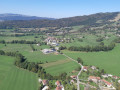
Go back in time a few centuries, or even a few thousand years, first by discovering the Sardinian road built in the 17th century, then the prehistoric paths on the trail of the Magdalenians and Azilians.
Please note that one path is closed in winter.
Circular Mont Beauvoir from Saint-Christophe-la-Grotte
 10.59 mi
+3,379 ft
-3,386 ft
7h 50
Difficult
Departure from Saint-Christophe (Savoie) (Savoie)
10.59 mi
+3,379 ft
-3,386 ft
7h 50
Difficult
Departure from Saint-Christophe (Savoie) (Savoie)
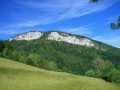
This circular loop combines a crossing of a little-visited summit offering views of the Chartreuse and the Avant Pays Savoyard with historic or documented passages: ascent via the Route Sarde and the Sentier du Beauvoir, return via the route Béatrice de Savoie and the Voie Royale.
Heritage sites around Saint-Christophe
 3.24 mi
+935 ft
-925 ft
2h 20
Moderate
Departure from Saint-Christophe (Savoie) (Savoie)
3.24 mi
+935 ft
-925 ft
2h 20
Moderate
Departure from Saint-Christophe (Savoie) (Savoie)
A breathtaking heritage walk following the Sardinian ‘Route Royale’. Viewpoints and gorges are also on the itinerary. There is also the option to visit the caves (at the Grottes tourist site).
Mont Outhéran circular walk from Saint-Thibaud-de-Couz
 Tourism professional
 10.00 mi
+3,911 ft
-3,881 ft
7 hrs
10.00 mi
+3,911 ft
-3,881 ft
7 hrs
 Very difficult
Departure from Saint-Thibaud-de-Couz (Savoie)
Very difficult
Departure from Saint-Thibaud-de-Couz (Savoie)
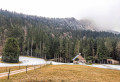
A challenging and demanding route: a steep climb at the start, a 5 km track, the Pas du Cuert and the return via a ridge littered with tricky sharp limestone pavements. Plenty of shade throughout the entire route (phew!). I’d rate it as very difficult due to the Pas du Cuert, the length of the walk and the descent from the plateau whilst tired.
Corbel - Saint-Pierre
 5.11 mi
+1,562 ft
-1,562 ft
3h 45
Moderate
Departure from Corbel (Savoie)
5.11 mi
+1,562 ft
-1,562 ft
3h 45
Moderate
Departure from Corbel (Savoie)
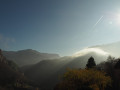
A circular route between two villages in Chartreuse.
This route's highest point is just over 1,000 metres, making it suitable for when temperatures have dropped.
At these altitudes, the hand of man is often present in the villages and hamlets. You will encounter old dwellings, fountains, bread ovens...
The route is well signposted.
Sentier des Fours et des Fontaines de Corbel
 Tourist office4.28 mi
+1,240 ft
-1,240 ft
3h 05
Moderate
Departure from Corbel (Savoie)
Tourist office4.28 mi
+1,240 ft
-1,240 ft
3h 05
Moderate
Departure from Corbel (Savoie)
The unique location of the village of Corbel has always required its inhabitants to manage their water resources carefully. Explore the village's ovens and fountains. Before running water arrived in 1989, each isolated house or hamlet depended on its own stone basin.
Route from Les Gandy
4.99 mi
+1,362 ft
-1,355 ft
4 hrs
Easy
Departure from Entremont-le-Vieux (Savoie)
Snowshoe route on a sunny slope in the Entremont valley.
This route combines well-marked sections with others that are a little more open.
In winter, this route is normally done on snowshoes. This was a snowshoe outing, but given the lack of snow at the end of January 2014, the snowshoes remained attached to our rucksacks.
The Mont Grêle lookout
 8.94 mi
+3,780 ft
-3,786 ft
7h 25
Moderate
Departure from Attignat-Oncin (Savoie)
8.94 mi
+3,780 ft
-3,786 ft
7h 25
Moderate
Departure from Attignat-Oncin (Savoie)
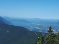
The Mont Grêle lookout point and Archelle’s summit.
Mont Grêle is a peak that is visible from the valley of Chambéry and the Aiguebelette region.
It is easily spotted thanks to or because of the pylons that are installed at the top. Up close, these towers have still look great, but they do not alone justify the purpose of the tour, which is interesting because it offers views over Lake Aiguebelette and Chartreuse.
The Government Castle
 7.26 mi
+1,775 ft
-1,798 ft
4h 55
Moderate
Departure from Saint-Pierre-d'Entremont (Savoie) (Savoie)
7.26 mi
+1,775 ft
-1,798 ft
4h 55
Moderate
Departure from Saint-Pierre-d'Entremont (Savoie) (Savoie)
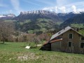
Around the two communes of Saint-Pierre d'Entremont, this walk covers the two departments of Savoie and Isère, exploring the architectural heritage and Carthusian landscapes. The most beautiful panorama can be seen from the esplanade of the Château du Gouvernement in Saint-Pierre d'Entremont (Isère).
Circular Saint-Pierre-d’Entremont loop, via the bottom of the Cirque de Saint-Même
9.14 mi
+1,804 ft
-1,781 ft
5h 45
Moderate
Departure from Saint-Pierre-d'Entremont (Savoie) (Savoie)
A circular route around Saint-Pierre-d’Entremont via the Cirque de Saint-Même, returning via the Torrent du Cozon gorges. The views are magnificent all along the way, and you reach the cirque on foot, rather than by car, to see the first waterfall. The route is marked and well signposted with numerous signs.
Roche Veyrand, circular from Saint-Pierre-d'Entremont
 4.92 mi
+2,612 ft
-2,592 ft
4h 30
Difficult
Departure from Saint-Pierre-d'Entremont (Savoie) (Savoie)
4.92 mi
+2,612 ft
-2,592 ft
4h 30
Difficult
Departure from Saint-Pierre-d'Entremont (Savoie) (Savoie)
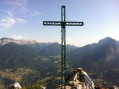
Roche Veyrand is a peak that proudly dominates the two Saint-Pierre-d'Entremont villages. Its steep slopes have made it possible to equip a Via Ferrata. This route is a classic in the Entremonts: it climbs directly up a steep path close to the equipped cliff, then descends via a wide forest detour that takes you through several hamlets of Saint-Pierre-d'Entremont (Savoie).
The summit and the Roche Veyrand circuit
 8.34 mi
+3,156 ft
-3,150 ft
6h 35
Difficult
Departure from Saint-Pierre-d'Entremont (Savoie) (Savoie)
8.34 mi
+3,156 ft
-3,150 ft
6h 35
Difficult
Departure from Saint-Pierre-d'Entremont (Savoie) (Savoie)
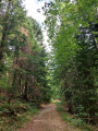
Starting from Saint-Pierre-d’Entremont, the climb to the summit of Roche Veyrand is steady and at times steep, with sections secured by cables where you’ll need to use your hands, but there are no technical difficulties or vertiginous sections. The rest of the route is a pleasant walk, mainly through woodland, which takes you all the way round Roche Veyrand via the Col de la Cluse, then down into the Corbel valley before climbing back up via the Pas de la Coche to return to the starting point. Given the nature of the ascent, this walk is not recommended for novice walkers (IBP = 97).