Heritage sites around Saint-Christophe

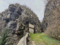
A breathtaking heritage walk following the Sardinian ‘Route Royale’. Viewpoints and gorges are also on the itinerary. There is also the option to visit the caves (at the Grottes tourist site).

Details

31666316
Creation:
Last update:
Last review:
  • Walking
    Activity: Walking
  • ↔
    Distance: 3.24 mi
  • ◔
    Average duration: 2h 20 
  • ▲
    Difficulty: Moderate

  • ⚐
    Back to start: Yes
  • ↗
    Ascent: + 935 ft
  • ↘
    Descent: - 925 ft

  • ▲
    Highest point: 1,936 ft
  • ▼
    Lowest point: 1,335 ft

Photos

Description of the walk

Park in the car park near the Saint-Martin bridge

(S/E). Start the route with a return walk along the Gorges de l’Échaillon.
To do this, head south, cross the Guiers Vif via the Saint-Martin Bridge and, at the signpost, take the path on the left. Follow the Gorges to the dead end (Take care after rain, as the path is slippery).

(1) Return to the starting point.

(S/E) Take the path on the right onto theGR®9. There are some pleasant views along this fairly steep stretch leading to a junction known as l’Échaillon.

(2) Stay on theGR®9, continuing straight ahead towards Corbel. This section through the woodland presents no difficulty; after offering a viewpoint over the Grande Sure, it enters a beautiful, peaceful forest before reaching a junction of paths known as Les Charmilles.

(3) Leave theGR®9, which continues straight ahead, and follow the Sentier du Belvédère, marked in yellow, to the left. Less than 1 km further on, you’ll reach the junction known as Bois de la Ravoire.

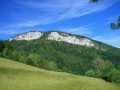
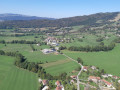
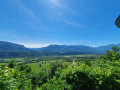
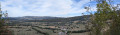
(4) Head straight on towards the viewpoint, which is about a hundred metres away. Enjoy a 180° panoramic view stretching from the Grande Sure to Mont Beauvoir. Continue along the route until, a little further on, you reach another junction of paths.

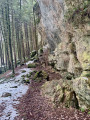
(5) Turn left towards the Grottes tourist site. Further on, the path turns into a ladder-like flight of steps (take extreme care after rain) before reaching the Voie Sarde.

(6) Turn right if you wish to visit the caves (guided tours only).
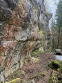
Take this old royal road to the left. Information boards and the Charles Emmanuel II memorial are located along this section.
Further on, the Voie Sarde path turns into a small road before joining the D46.
Follow it to the left to return to the car park and finish the walk (S/E).


Waypoints

  1. S/E : mi 0 - alt. 1,371 ft - Pont Saint Martin car park
  2. 1 : mi 0.19 - alt. 1,483 ft - Dead end. Échaillon Gorges
  3. 2 : mi 0.62 - alt. 1,752 ft - L’Échaillon junction
  4. 3 : mi 1.34 - alt. 1,864 ft - Les Charmilles junction
  5. 4 : mi 1.8 - alt. 1,886 ft - Bois de la Ravoire junction
  6. 5 : mi 2.42 - alt. 1,903 ft - Trail junction
  7. 6 : mi 2.61 - alt. 1,650 ft - Sarde Route
  8. S/E : mi 3.24 - alt. 1,371 ft - Pont Saint Martin car park

Notes

A video of the walk is available via the following link: https://youtu.be/jAMndw9_nxA
Avoid this route the day after it has rained.
Take extreme care when using the steps between (5) and (6).

Worth a visit

Guided tour of the caves: turn right at point (6).
Gorges du Guiers Vif.
Saint-Pierre-de-Chartreuse.

Always be cautious and plan ahead when you're outdoors. Visorando and the author of this route cannot be held responsible for any accidents occurring on this route.

The GR® and PR® markings are the intellectual property of the Fédération Française de Randonnée Pédestre.

Reviews and comments

4.3 / 5
Based on 4 reviews

Reliability of the description
4.3 / 5
Ease of following the route
4.3 / 5
Route interest
4.5 / 5
Michel MAJEAN
Michel MAJEAN

Overall rating : 4.3 / 5

Date of your route : Jul 06, 2026
Reliability of the description : ★★★★☆ Good
Ease of following the route : ★★★★☆ Good
Route interest : ★★★★★ Very good
Very busy route : Yes

a very interesting historical tour

Machine-translated

Bisserain73
Bisserain73

Overall rating : 5 / 5

Date of your route : Mar 12, 2026
Reliability of the description : ★★★★★ Very good
Ease of following the route : ★★★★★ Very good
Route interest : ★★★★★ Very good
Very busy route : No

You can link directly to (3) and (5).

Machine-translated

JCParavy
JCParavy

Overall rating : 4.7 / 5

Date of your route : Nov 30, 2025
Reliability of the description : ★★★★★ Very good
Ease of following the route : ★★★★★ Very good
Route interest : ★★★★☆ Good
Very busy route : No

Route taken in the morning, before the forecast rain, with a few variations.
From the plateau, instead of going straight up to La Fru, I continued above the Gorges de l'Echaillon to the Crosat road: this is not a variation to be recommended, as the path is very overgrown with branches and brambles, in a state of neglect, and then you can only return to Les Charmilles by road.
At Les Charmilles, to fully appreciate the heritage of the area, you must visit the nearby Magdalenian site of La Fru.
Given the weather, I did not return to the Belvédère de Gerbaix but went directly from Les Charmilles to the Sentier des Chèvres.
The La Ravoire plateau, which I have visited many times, remains a sure bet for a half-day outing whatever the season.
I'm adding a few photos, but they're from winter.

Machine-translated

Cariche
Cariche

Overall rating : 3.3 / 5

Date of your route : Apr 24, 2023
Reliability of the description : ★★★☆☆ Average
Ease of following the route : ★★★☆☆ Average
Route interest : ★★★★☆ Good
Very busy route : Yes

A lovely, interesting walk, but the numerous signposts and many paths often leave us unsure which way to go. It’s not a problem, though, as it’s a short walk.

Machine-translated

Other walks in the area

For more walks, use our search engine .

The GPS track and description are the property of this route's author. Please do not copy them without permission.