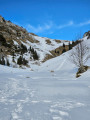
The Pointière Circular

A lovely circular route in the Désert d’Entremont Nordic ski resort.

Details

957384
Creation:
Last update:
Last review:
  • Snowshoeing
    Activity: Snowshoeing
  • ↔
    Distance: 3.48 mi
  • ◔
    Duration according to the author: 3 hrs 
  • ▲
    Difficulty: Easy

  • ⚐
    Back to start: Yes
  • ↗
    Ascent: + 515 ft
  • ↘
    Descent: - 509 ft

  • ▲
    Highest point: 4,137 ft
  • ▼
    Lowest point: 3,832 ft

Photos

Description of the walk

Park in the car park at the Désert Nordic ski centre, opposite the restaurant and the picnic area.
In winter, the shared section of this snowshoe route and the circular loop are signposted in garnet red with the number 4 in blue.

(S/E) Start below the lodge, take the snowshoe route and follow it alongside the D45. Head for the car park at the small downhill ski resort of Les Bruyères.

(1) Continue along this route to reach the car park at the Col de la Cluse.

(2) Turn left towards the Col du Cucheron; shortly afterwards, you’ll reach a junction of tracks.

(3) Stay on the cross-country ski trail, making sure to keep to the right-hand side (this is a shared route, clearly signposted). Reach the Col du Cucheron.

(4) Leave the shared cross-country ski and snowshoe trail here and head left onto snowshoe route no. 4. You’ll come to a sharp left-hand bend.

(5) Leave the wide track and turn left (follow the markings) onto trail no. 4. Begin a short climb to reach the highest point (1,261 m).

(6) Begin a good descent, following the ridge line. You’ll reach a large meadow; turn left at the edge of the woodland to return to the junction of the trails.

(3) Retrace your steps along the route you took on the way out to return to the car park where you started (S/E).

Waypoints

  1. S/E : mi 0 - alt. 3,845 ft - Nordic ski car park
  2. 1 : mi 0.57 - alt. 3,927 ft - Les Bruyères
  3. 2 : mi 0.93 - alt. 3,832 ft - Turn left - Col de la Cluse
  4. 3 : mi 1.05 - alt. 3,845 ft - Crossroads of trails
  5. 4 : mi 1.42 - alt. 3,993 ft - Col du Cucheron
  6. 5 : mi 1.65 - alt. 4,003 ft - Crossroads with a bend
  7. 6 : mi 1.95 - alt. 4,137 ft - Highest point
  8. S/E : mi 3.48 - alt. 3,852 ft - Nordic ski car park

Notes

Nothing in particular to report, apart from making sure you follow the signposting, which is perfectly laid out with numerous signs along the entire circular route.

Worth a visit

A stop at the Entremont-le-Vieux cheese dairy is a must.
A visit to the Cave Bear Museum opposite the cheese dairy will round off this outing.

Reviews and comments

3.9 / 5
Based on 4 reviews

Reliability of the description
3.8 / 5
Ease of following the route
4.5 / 5
Route interest
3.5 / 5
Lemaitre Christian
Lemaitre Christian

Overall rating : 4 / 5

Date of your route : Jan 29, 2021
Reliability of the description : ★★★★☆ Good
Ease of following the route : ★★★★★ Very good
Route interest : ★★★☆☆ Average
Very busy route : No

A walk done in fair weather, starting from the Col de la Cluse to avoid walking along the roadside; it’s therefore quite short, at 1 hour 15 minutes. The start, along the cross-country ski trail, isn’t very exciting, but the rest of the route is more enjoyable.

Machine-translated

Nutstreck
Nutstreck

Overall rating : 4.3 / 5

Date of your route : Mar 07, 2020
Reliability of the description : ★★★★★ Very good
Ease of following the route : ★★★★★ Very good
Route interest : ★★★☆☆ Average

It’s best to park at the Col de la Cluse, where there’s a small car park that will save you a rather tedious round trip along the road.
A circular loop, ideal for getting back into the swing of things. Unfortunately, there aren’t many scenic spots along the route, and as it’s situated near cross-country ski trails, peace and quiet isn’t guaranteed at the weekend!

Machine-translated

EtienneF38
EtienneF38

Overall rating : 4.3 / 5

Date of your route : Feb 16, 2019
Reliability of the description : ★★★★☆ Good
Ease of following the route : ★★★★☆ Good
Route interest : ★★★★★ Very good

I completed this hike on snowshoes and the route is perfectly suited to this. Much of the route follows the cross-country ski trails; it is very well signposted and offers some lovely views of Mont Blanc in places. No doubt due to a lapse in concentration, I strayed from the marked route at point 4, at the sharp bend. I continued along the track that leads downhill, which is signposted for fat bikes. This wasn’t a problem, as at the bottom of this track you can easily rejoin the planned route. I’d recommend it.

Machine-translated

mariesweety
mariesweety

Overall rating : 3 / 5

Date of your route : Sep 13, 2018
Reliability of the description : ★★☆☆☆ Disappointing
Ease of following the route : ★★★★☆ Good
Route interest : ★★★☆☆ Average

This walk is certainly appealing in winter on snowshoes, but in our opinion it’s not particularly interesting in summer. It’s more convenient to set off directly from the Col de la Cluse car park, which saves you 1.5 km of tarmac road (there are cows in the mountain pastures). At the Col du Cucheron, we walked 1 km to the left, only to end up back where we started and set off along the Grand Jet. It was a lovely day all the same. The scenery is magnificent.

Machine-translated

Other walks in the area

For more walks, use our search engine .

The GPS track and description are the property of this route's author. Please do not copy them without permission.