Circuit of Mont Outheran, via the Col du Mollard, Col du Planet and Col du Grapillon

A mountain bike tour of Mont Outheran via the Col du Mollard, Col du Planet and Col du Grapillon, allowing you to explore its different sides with relatively limited elevation changes as the route never descends very far down.

Details

1680831
Creation:
Last update:
Last review:
  • Mountain biking
    Activity: Mountain biking
  • ↔
    Distance: 7.70 mi
  • ◔
    Duration according to the author: 3 hrs 
  • ▲
    Difficulty: Moderate

  • ⚐
    Back to start: Yes
  • ↗
    Ascent: + 1,719 ft
  • ↘
    Descent: - 1,690 ft

  • ▲
    Highest point: 4,944 ft
  • ▼
    Lowest point: 3,720 ft
  • ⚐ Country: France
  • ⚐
    Areas: Alps, Chartreuse
  • ⚐ City: Entremont-le-Vieux (73670)
  • ⚑
    Start/End: N 45.465783° / E 5.863421°
  • ❏
    IGN map(s): Ref. 3333OT, 3333OTR

  • ◶
    Type of surface:
  •  
     
     
     33% Road  34% Byway  33% Path
  • ⇧
    Bike carrying: Not specified
  • ▲
    Difficulty: Not specified
  • Hour-by-hour weather

Description of the route

Reach the Désert ski resort (in the commune of Entremont-le-Vieux), either from the CD1006 via the Cols de Coux des Egaux and de la Cluse, or from the Vallée des Entremont via the Col du Granier and Entremont-le-Vieux.
Park at a large bend on the CD45 (at 1,172m), where the cross-country skiing area is located in winter.

(S/E) Set off due north on the Col du Mollard road, which turns into a dirt track as it enters the forest, for a steady, rolling climb leading to the Col du Mollard and its cross.

(1) Descend the fairly steep forest track opposite towards Saint-Cassin; let the Col des Fontanettes path branch off to the right, and when the track approaches the stream, cut across to descend to the left over the bridge over the Merderet.

(2) Head up the track opposite, on the left bank of the stream, to reach the Col du Planet.

(3) Head back down the Saint-Thibaud-de-Couz side along the passable forest track; turn left at the Prairie du Planet to continue along the forest track, which rises gently. After a level stretch, reach the junction at 1,238m.

(4) Let the road descend to the right, then turn left onto a wide forest track that runs the entire length of the western flank of Mont Outheran. Initially level, it then rises gradually and then more steeply, following the contours of the terrain. After another section that is more or less level, it reaches the hamlet of Pré Orcel at an altitude of 1,433m.

(5) Here, the Col du Grapillon path branches off to the left and back (northwards): take this to climb a few hairpin bends (a narrow, steep section where you’ll often have to push your mountain bike) before the gradient eases for a traverse south-eastwards to the wide pass of the Col (1,509 m).

(6) Descend opposite, on the Entremont side, along the rough, signposted forest track which makes two wide bends. At around 1,420m, leave the track and head off to the left, following the view towards the summit of the Téléski des Bruyères (a short climb).

(7) Below the ski lift’s top station, take the path opposite that follows the ski run. Leave the forest to find yourself amidst some rather steep alpine ski runs, but a path allows you to descend by heading eastwards across the slopes, then turning right to descend back down the centre. The slope levels out; you’ll reach a path branching off to the left, leading to the Nantet chalets and the Col de la Cluse road (CD45).

(8) Follow this road to the left; it takes you back to the starting point (S/E).

Waypoints

  1. S/E : mi 0 - alt. 3,848 ft - Nordic Centre car park
  2. 1 : mi 1.32 - alt. 4,334 ft - Col du Mollard
  3. 2 : mi 2.29 - alt. 3,720 ft - Bridge over the Merderet
  4. 3 : mi 2.52 - alt. 3,881 ft - Granges / Col du Planet
  5. 4 : mi 3.47 - alt. 4,058 ft - Junction with the forest road
  6. 5 : mi 5.88 - alt. 4,708 ft - Pré Orcel
  7. 6 : mi 6.15 - alt. 4,944 ft - Col du Grapillon (1509m)
  8. 7 : mi 6.53 - alt. 4,672 ft - Finish at the Bruyères ski lift
  9. 8 : mi 7.36 - alt. 3,960 ft - Junction with the CD 45 - Col de la Cluse
  10. S/E : mi 7.7 - alt. 3,848 ft - Nordic Centre car park

Notes

The route remains at high altitude but is generally fairly easy and not very technical; there are a few steeper sections: descents from the Col du Mollard and the Col du Grapillon (summit), and the ascent to the Col du Grapillon from (5).

The traverse along the western slope passes close to several springs.

Worth a visit

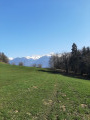
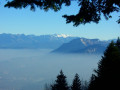
Passing along all sides of the mountain offers varied views of the surrounding area. However, the number of unobstructed views is limited by the predominantly wooded nature of the route.

Alternative route: from (6), you can easily climb to the right on a round trip to La Cochette (110m elevation gain) for an unobstructed view of the Chartreuse.

Reviews and comments

5 / 5
Based on 2 reviews

Reliability of the description
5 / 5
Ease of following the route
5 / 5
Route interest
5 / 5
B.B.
B.B.

Overall rating : 5 / 5

Date of your route : May 17, 2022
Reliability of the description : ★★★★★ Very good
Ease of following the route : ★★★★★ Very good
Route interest : ★★★★★ Very good
Very busy route : Yes

Very enjoyable. At the Col du Grapillon, we climbed up to the Pointe de Cochette – a superb view – a little gem well worth a visit.

Machine-translated

mollets aiguisés
mollets aiguisés

Hike cancelled due to mist and rain in the Chartreuse on 6 June 2019

Machine-translated

kiwi07
kiwi07

Overall rating : 5 / 5

Date of your route : Jan 07, 2019
Reliability of the description : ★★★★★ Very good
Ease of following the route : ★★★★★ Very good
Route interest : ★★★★★ Very good

Can be done as a Nordic ski tour in the opposite direction

Machine-translated

Other walks in the area

For more walks, use our search engine .

The GPS track and description are the property of this route's author. Please do not copy them without permission.