


Refine your search for walks in Saint-Georges (Tarn-et-Garonne)
Saint-Georges (Tarn-et-Garonne) walks


 In the countryside around Saint-Georges
 Visorando Member
 9.68 mi
 +292 ft
 -282 ft
 4h 40
4h 40
 Moderate
 Departure from Saint-Georges (Tarn-et-Garonne) (Tarn-et-Garonne)
This walk more or less follows aPR® route called “Les Quatre Communes”; it is marked in yellow for the most part, so it is very easy to follow.
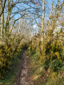
Circular Combes loop starting from Saint-Symphorien
 3.50 mi
+299 ft
-279 ft
1h 50
Moderate
Departure from Puylaroque (Tarn-et-Garonne)
3.50 mi
+299 ft
-279 ft
1h 50
Moderate
Departure from Puylaroque (Tarn-et-Garonne)
Walk between limestone plateaus and valleys, dry stone walls and a 17th-century dovecote in the hamlet of Racanière.
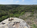
La Salle loop starting from Saint-Symphorien
 6.83 mi
+584 ft
-574 ft
3h 40
Moderate
Departure from Puylaroque (Tarn-et-Garonne)
6.83 mi
+584 ft
-574 ft
3h 40
Moderate
Departure from Puylaroque (Tarn-et-Garonne)
This loop allows you to discover the Causse in all its different aspects: cultivated areas, wooded areas, dry stone walls bordering the plots and the crossing of hamlets with typical Quercy houses.
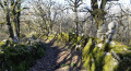
The Cairns Circular, starting from Saint-Symphorien
 4.54 mi
+482 ft
-456 ft
2h 30
Moderate
Departure from Puylaroque (Tarn-et-Garonne)
4.54 mi
+482 ft
-456 ft
2h 30
Moderate
Departure from Puylaroque (Tarn-et-Garonne)
This circular walk allows you to discover the Causse in all its different guises: wooded areas, dry-stone walls, hamlets with typical Quercy-style houses, and a 17th-century dovecote.
Farinel circular starting from Saint-Symphorien
3.61 mi
+322 ft
-331 ft
1h 55
 Easy
Departure from Puylaroque (Tarn-et-Garonne)
Easy
Departure from Puylaroque (Tarn-et-Garonne)
A family-friendly route that takes walkers from peaceful woodland through to a vantage point overlooking the valley before passing through the hamlet of Foury. The return journey follows the valley, alongside the River Sietges.
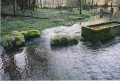
Route des puits et fontaines de Mouillac
 Association / Club / Walk leader
 3.00 mi
+315 ft
-341 ft
1h 40
Easy
Departure from Mouillac (Tarn-et-Garonne) (Tarn-et-Garonne)
3.00 mi
+315 ft
-341 ft
1h 40
Easy
Departure from Mouillac (Tarn-et-Garonne) (Tarn-et-Garonne)
A walk that will allow you to discover, as you wander along the path, a series of wells, some large, some small, featuring different architectural styles and shapes. Some are curiously clustered in places where water was most easily accessible. This walk will also introduce you to the particularly remarkable flora and fauna of the protected Mouillagol Valley site.
The Mouillac waterway
4.43 mi
+427 ft
-456 ft
2h 25
Easy
Departure from Mouillac (Tarn-et-Garonne) (Tarn-et-Garonne)
This circular walk offers a wide variety of landscapes, alternating between open fields, wooded slopes and cool valleys. The route passes through former agricultural areas, downy oak woods, dry stone walls and typical Quercy region dwellings.
Circular route between Causse and the valley
3.86 mi
+272 ft
-272 ft
2h 00
Moderate
Departure from Mouillac (Tarn-et-Garonne) (Tarn-et-Garonne)
Along the route, walkers pass through a wide variety of natural environments and landscapes. Intermittent watercourses: the bed of the Lère Morte, visible depending on the season. Former farming areas, evidence of an agricultural past linked in particular to hemp production. Riparian forest and wooded slopes: cool, shady areas dominated by mosses and undergrowth. Downy oak forests: stands adapted to stony, dry soils. Limestone cliffs: rock formations marking the relief of the causse. The route offers a succession of contrasting landscapes: fields, forest, open valley, cliffs, causse.
Discover Saint-Symphorien
 5.60 mi
+659 ft
-669 ft
3h 10
Moderate
Departure from Caylus (Tarn-et-Garonne)
5.60 mi
+659 ft
-669 ft
3h 10
Moderate
Departure from Caylus (Tarn-et-Garonne)
This lovely walk will take you along a variation ofthe GRP® trail that runs alongside the Ruisseau des Sietges (a tributary of the La Lère), the beautiful hamlets of Perrière (restored houses, stone walls, carved calvary and cazelle) and Saint-Symphorien (a former 15th-century priory, cemetery with dry stone enclosures, spring and restored stone basin). Part of the route is through woodland (magnificent boxwood paths) and the return journey is along quiet little roads on the limestone plateau.
Around the Gourgue
 4.01 mi
+522 ft
-509 ft
2h 20
Easy
Departure from Saint-Antonin-Noble-Val (Tarn-et-Garonne)
4.01 mi
+522 ft
-509 ft
2h 20
Easy
Departure from Saint-Antonin-Noble-Val (Tarn-et-Garonne)
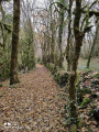
Walk between the limestone plateau and the valley with old mossy box trees, views of the Roc d'Anglars, and the discovery of a cave and the Trou de la Gourgue with its turquoise blue water that supplies part of the village of Saint-Antonin-Noble-Val.
Autour de Saint-Antonin-Noble-Val et au-dessus des Gorges de l'Aveyron
 9.14 mi
+1,407 ft
-1,401 ft
5h 25
Moderate
Departure from Saint-Antonin-Noble-Val (Tarn-et-Garonne)
9.14 mi
+1,407 ft
-1,401 ft
5h 25
Moderate
Departure from Saint-Antonin-Noble-Val (Tarn-et-Garonne)
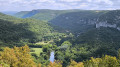
This hike, starting from one of the most beautiful villages in France, Saint-Antonin-Noble-Val, will also allow you to discover the Gorges de l'Aveyron. This 14 km loop will give you a beautiful view of the limestone plateaus between Rouergue and Quercy. You will also find a place of historical memory with the Maquis d'Ornano.
The Cirque de Bône
 5.60 mi
+673 ft
-676 ft
3h 10
Moderate
Departure from Saint-Antonin-Noble-Val (Tarn-et-Garonne)
5.60 mi
+673 ft
-676 ft
3h 10
Moderate
Departure from Saint-Antonin-Noble-Val (Tarn-et-Garonne)
This path follows the edge of the Aveyron river and then goes around the Cirque de Bône. There are several viewpoints from which you can admire the Aveyron valley and the limestone cliffs.
Côte de "Ouf" and Cirque de Bône
 8.10 mi
+1,404 ft
-1,394 ft
4h 55
8.10 mi
+1,404 ft
-1,394 ft
4h 55
 Difficult
Departure from Saint-Antonin-Noble-Val (Tarn-et-Garonne)
Difficult
Departure from Saint-Antonin-Noble-Val (Tarn-et-Garonne)
This is a beautiful loop along the banks of the Aveyron River, reaching a surprising viewpoint over the Cirque de Bône.
The climb to the viewpoint is a tough one called the Côte de Ouf.
Numerous landscapes of Saint-Antonin-Noble-Val and its river await hikers.
The return journey passes at the foot of Brousse through pretty woods and, in part, along the Aveyron once again.
Loop in Saint-Antonin-Noble-Val overlooking the Cirque de Nibousou
 11.08 mi
+1,811 ft
-1,788 ft
6h 40
Moderate
Departure from Saint-Antonin-Noble-Val (Tarn-et-Garonne)
11.08 mi
+1,811 ft
-1,788 ft
6h 40
Moderate
Departure from Saint-Antonin-Noble-Val (Tarn-et-Garonne)
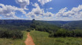
This is a loop that will take you up from the banks of the Aveyron to the Grotte de la Gourgue.
You will return via the Cirque de Nibouzou.
This is a variation of thePR®18.
The Cirque de Bône via the Côte de Ouf
 5.61 mi
+646 ft
-650 ft
3h 10
Moderate
Departure from Saint-Antonin-Noble-Val (Tarn-et-Garonne)
5.61 mi
+646 ft
-650 ft
3h 10
Moderate
Departure from Saint-Antonin-Noble-Val (Tarn-et-Garonne)
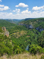
This is a lovely, varied and undulating hike, partly along the banks of the Aveyron, offering superb views of the Cirque de Bône. To reach this viewpoint, you will have to climb the aptly named Côte de Ouf. From the plateau, you will overlook the river and the cirque before starting your return to the pretty village of Saint-Antonin-Noble-Val.
Circular route between Saint-Antonin-Noble-Val and Sainte-Sabine
7.61 mi
+712 ft
-741 ft
4h 05
Moderate
Departure from Saint-Antonin-Noble-Val (Tarn-et-Garonne)
Starting from the bridge over the Aveyron, this route offers a gentle climb up to the plateau, enjoying the shade of the Roc d'Anglars, then on to the village of Sainte-Sabine with its pretty houses. All that remains is to slip into the shade and head towards the plain to find the banks of the river and return to Saint-Antonin-Noble-Val.
Cirque de Nibousou in Saint-Antonin-Noble-Val
 4.69 mi
+715 ft
-705 ft
2h 45
Moderate
Departure from Saint-Antonin-Noble-Val (Tarn-et-Garonne)
4.69 mi
+715 ft
-705 ft
2h 45
Moderate
Departure from Saint-Antonin-Noble-Val (Tarn-et-Garonne)
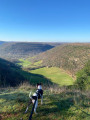
A loop on the heights of Saint-Antonin-Noble-Val with a passage through the undergrowth, around the Cirque de Nibousou and on the plateau.
Beautiful panoramic views of the Cirque de Nibousou and the Gorges de l'Aveyron.