In the countryside around Saint-Georges

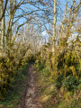
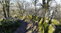
This walk more or less follows aPR® route called “Les Quatre Communes”; it is marked in yellow for the most part, so it is very easy to follow.

Details

40573473
Creation:
Last update:
Last review:
  • Walking
    Activity: Walking
  • ↔
    Distance: 9.68 mi
  • ◔
    Average duration: 4h 40 
  • ▲
    Difficulty: Moderate

  • ⚐
    Back to start: Yes
  • ↗
    Ascent: + 292 ft
  • ↘
    Descent: - 282 ft

  • ▲
    Highest point: 745 ft
  • ▼
    Lowest point: 512 ft

Description of the walk

Car park in the centre of the village of Saint-Georges.

(S/E) Follow the C1 road to the left, towards “Cayriech”, for about 1 km, until you reach the hamlet of Laliquié.

(1) Take a grassy track on the left before reaching the woods. Follow this track straight on for about 800 m until you reach a junction.

(2) Turn onto the path on the right and follow it along the edge of the woods until you reach a stone-paved road. Continue straight on to the hamlet of Fustié.

(3) Turn left. After 400 m, cross the Route des Causses and carry on straight ahead along the grassy track through the woods to join the D9.

(4) Follow the D9 to the left for 500 m and, after the bend, turn onto a grassy track to the right, before the houses. This joins a wider track which you should follow to the left to rejoin the D9 straight ahead.

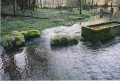
(5) Continue along the D9 to the right for about 500 m, then take thefirst road on the right for 50 m, continuing straight on through the bend along a grassy track. Pass the wash house and arrive at the tarmac road, level with the Camp de Judes Memorial.

(6) At the memorial, carry on along the road to the left and rejoin the D9 once again. Turn right, then after 30 metres turn left, then left again after 150 metres, and carry on straight ahead to join another road.

(7) Cross it by turning right then left, to take the path opposite and follow it straight on until you reach another tarmac road. Take this road to the right and, at thefirst junction, cross over to take the gravel path opposite.

(8) Walk for about 300 m, then take thefirst path on the left to reach the vicinity of the D926.

(9) About thirty metres before you reach it, follow the grassy path to the left. At the next junction, turn left again and continue to the end of the path.

(10) Continue along the path to the right, first along the edge of the woods and then through the woods, keeping straight on until you reach a tarmac road at a place called Le Gendre.

(11) Cross it and take the stony track opposite, as far as the hamlet of Ferrié. Continue along the road to the left, pass through the hamlet and follow the road to the next junction.

(12) Turn right onto the road and, after about 80 metres, opposite the water tank, take the grassy path on the right. Follow the Ruisseau de Tapon and you’ll come out onto the road opposite the church.

(13) Carry on along the road to the left. You’ll reach Saint-Martin de Caussanille at the end of the road.

(14) Turn right, carry on straight ahead, pass the cemetery and the town hall, and reach the village of Saint-Georges and its car park in the centre of the village (S/E).

Waypoints

  1. S/E : mi 0 - alt. 663 ft - Saint-Georges car park
  2. 1 : mi 0.61 - alt. 600 ft - Laliguié hamlet
  3. 2 : mi 1.07 - alt. 610 ft - Junction in the woods
  4. 3 : mi 1.8 - alt. 548 ft - Fustié hamlet
  5. 4 : mi 2.53 - alt. 558 ft - D9
  6. 5 : mi 3.39 - alt. 518 ft - D9
  7. 6 : mi 3.85 - alt. 531 ft - Camp de Judes Memorial
  8. 7 : mi 4.52 - alt. 610 ft - Cross the road
  9. 8 : mi 5.07 - alt. 623 ft - Cross the road
  10. 9 : mi 5.66 - alt. 653 ft - Before the D926
  11. 10 : mi 5.91 - alt. 689 ft - Edge of the woods
  12. 11 : mi 6.9 - alt. 735 ft - A place known as Le Gendre
  13. 12 : mi 8.08 - alt. 607 ft - Crossroads
  14. 13 : mi 8.39 - alt. 640 ft - Church
  15. 14 : mi 8.66 - alt. 646 ft - Saint-Martin de Caussanille
  16. S/E : mi 9.68 - alt. 663 ft - Saint-Georges car park

Notes

(13) Drinking water available from a tap next to the church near the cemetery

Worth a visit

Always be cautious and plan ahead when you're outdoors. Visorando and the author of this route cannot be held responsible for any accidents occurring on this route.

The GR® and PR® markings are the intellectual property of the Fédération Française de Randonnée Pédestre.

Reviews and comments

4.3 / 5
Based on 2 reviews

Reliability of the description
4 / 5
Ease of following the route
5 / 5
Route interest
4 / 5
archimbald ortie
archimbald ortie

Overall rating : 4.3 / 5

Date of your route : May 20, 2024
Reliability of the description : ★★★★☆ Good
Ease of following the route : ★★★★★ Very good
Route interest : ★★★★☆ Good
Very busy route : No

A pleasant, easy and varied walk with no significant elevation gain; currently of interest for its flora and birdsong.
Given the current wet weather, some sections of the path are muddy with no alternative route: make sure your shoes are waterproof if necessary.
There are a few sections of road after Lalande and, unfortunately, particularly from the 14-kilometre mark to the finish.

Machine-translated

merigeau
merigeau

Overall rating : 4.3 / 5

Date of your route : Apr 15, 2024
Reliability of the description : ★★★★☆ Good
Ease of following the route : ★★★★★ Very good
Route interest : ★★★★☆ Good
Very busy route : No

A walk that can be done in winter provided it isn’t too damp, as there is little shade but plenty of small tarmac roads
The highlight is the section at the Sepfonds Jewish camp, where information boards recount the entire history of the camp

Machine-translated

Other walks in the area

For more walks, use our search engine .

The GPS track and description are the property of this route's author. Please do not copy them without permission.