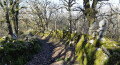
Route des puits et fontaines de Mouillac

A walk that will allow you to discover, as you wander along the path, a series of wells, some large, some small, featuring different architectural styles and shapes. Some are curiously clustered in places where water was most easily accessible. This walk will also introduce you to the particularly remarkable flora and fauna of the protected Mouillagol Valley site.

Details

57529663
Creation:
Last update:
Last review:
  • Walking
    Activity: Walking
  • ↔
    Distance: 3.00 mi
  • ◔
    Average duration: 1h 40 
  • ▲
    Difficulty: Easy

  • ⚐
    Back to start: Yes
  • ↗
    Ascent: + 315 ft
  • ↘
    Descent: - 341 ft

  • ▲
    Highest point: 951 ft
  • ▼
    Lowest point: 728 ft

Photos

Description of the walk

Once you’ve parked on the Patus, at the foot of the old mill, you can admire the church and its magnificent presbytery.

(S/E) Head towards the cross in front of the church. Facing the chancel, turn right onto the small path that runs alongside the church and the vicarage. Then leave the stone cross on your left and turn right onto the path that descends to the crossroads and its metal cross.

(1) Turn right and follow the path which climbs gently up to the Fonmalnette village fountain.

(2) Carry on straight ahead and follow the road to the right until you reach a group of private wells.

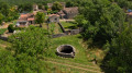
(3) Turn left onto the road, head uphill and continue to the right. Head straight up towards the well on the Patus de Perrufe and its viewpoint. As you pass, admire the porch of an old farmhouse on your right, where you can catch a glimpse of the outbuildings.

(4) Carry on along the path, then head to the right. At the bend, take the first right again, and continue to the crossroads.

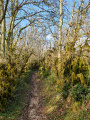
(5) Keep left through the woodland. At the Fork in the road, turn right, then carry on straight ahead until you reach Cavaillé. At the junction with the road, turn left, then take the first right onto a lovely little path that winds down towards the Fontaine du Mouillagol.

(6) Follow the path, then carry on straight ahead along the small track (which is sometimes flooded further down when the Mouillagol is in flood! You’ll eventually reach a road (elevation 246).

(7) Turn left and enter the village, walk alongside a low dry-stone wall recently built by the Apicq and pass in front of Mouillac Town Hall (the former village school). Turn right and you’ll arrive at (S/E).

Waypoints

  1. S/E : mi 0 - alt. 876 ft - Patus, Mouillac Church
  2. 1 : mi 0.18 - alt. 814 ft - Crossroads
  3. 2 : mi 0.52 - alt. 827 ft - Wells: the village fountain “Fon Malnette”
  4. 3 : mi 0.78 - alt. 860 ft - Group of private wells
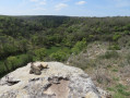
  5. 4 : mi 1.05 - alt. 925 ft - Well on the Patus de Peruffe – viewpoint
  6. 5 : mi 1.34 - alt. 846 ft - Crossroads
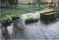
  7. 6 : mi 2.14 - alt. 745 ft - Mouillagol Fountain
  8. 7 : mi 2.75 - alt. 820 ft - Route
  9. S/E : mi 3 - alt. 876 ft - Patus, Mouillac Church

Worth a visit

Wells and fountains, dry-stone walls…

To find out more: The heritage discovery booklet
The first heritage route in the Causses du Quercy, created by the APICQ, this booklet explores the small-scale heritage sites linked to water in the commune of Mouillac and the scarcity of water, a shared resource throughout history.

Reviews and comments

4.8 / 5
Based on 2 reviews

Reliability of the description
4.5 / 5
Ease of following the route
5 / 5
Route interest
5 / 5
Gerard Lasserre
Gerard Lasserre

Overall rating : 5 / 5

Date of your route : Mar 02, 2026
Reliability of the description : ★★★★★ Very good
Ease of following the route : ★★★★★ Very good
Route interest : ★★★★★ Very good
Very busy route : No

Very suitable for pensioners who do not walk much.

Machine-translated

PascWil
PascWil

Overall rating : 4.7 / 5

Date of your route : Sep 29, 2024
Reliability of the description : ★★★★☆ Good
Ease of following the route : ★★★★★ Very good
Route interest : ★★★★★ Very good
Very busy route : No

We weren’t at all familiar with the Mouillac area… A lovely walk, rich in rural heritage (fountains, Roman wells, the ‘Chemin des Puits’, pretty hamlets, dovecotes and stone houses), featuring the enchanting and mysterious site of the Mouillagol fountain. The walk was a bit short, but there’s the option to extend it with a longer alternative route… something to do next time. We stuck to the PR1 trail and there were so many beautiful things to see.
Mouillac is a lovely village offering a welcome spot to stop for a bite to eat, with a remarkable view of the surrounding countryside. What’s more, the village is peaceful and welcoming.

Machine-translated

Other walks in the area

For more walks, use our search engine .

The GPS track and description are the property of this route's author. Please do not copy them without permission.