The Cairns Circular, starting from Saint-Symphorien

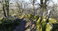
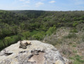
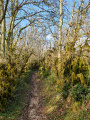
This circular walk allows you to discover the Causse in all its different guises: wooded areas, dry-stone walls, hamlets with typical Quercy-style houses, and a 17th-century dovecote.

Details

3001966
Creation:
Last update:
Last review:
  • Walking
    Activity: Walking
  • ↔
    Distance: 4.54 mi
  • ◔
    Average duration: 2h 30 
  • ▲
    Difficulty: Moderate

  • ⚐
    Back to start: Yes
  • ↗
    Ascent: + 482 ft
  • ↘
    Descent: - 456 ft

  • ▲
    Highest point: 1,099 ft
  • ▼
    Lowest point: 653 ft
  • ⚐ Country: France
  • ⚐ City: Puylaroque (82240)
  • ⚑
    Start/End: N 44.23232° / E 1.68035°
  • ❏
    IGN map(s): Ref. 2140E
  • Hour-by-hour weather

Photos

Description of the walk

S4 marked circular walk by the La Symphorine Association

Park below the church of Saint-Symphorien, near the cemetery

(S/E) Just below the former priory of Saint-Symphorien, with your back to the meadow and the information board, take the path on the right. Continue for about 100 m, then take the GRP® path on the left for about 200 m.

(1) At the junction in the left-hand bend, leave the GRP® and take the path on the right; you’ll soon reach another crossroads of paths.

(2) Ignore the path on the right – which will be the return route – and turn left. Head north along a path that climbs through the woods, ignoring any side paths.

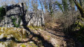
(3) At the junction, turn right. Carry on straight ahead, heading north-east. You’ll reach a junction by a dry-stone ruin on the left-hand side.

(4) Then turn left and, immediately afterwards, right. Ignore a path on the right, take a few bends through the woodland and you’ll come out onto a road.

(5) Follow the road to the right until you reach the hamlet of Cavaillès Basses.

(6) Leave the road and take a path on the right. Ignore all the turnings on the right and you’ll reach the hamlet of Racanière (17th-century dovecote).

(7) At the road, take the track on the right. You’ll come out onto a road; follow it to the right.

(8) After about 250 m, leave the road via the path on the right. Walk down to the bottom of a small valley and then turn left.

(2) At the crossroads you passed on the way out, carry on straight ahead.

(1) Follow the GRP® to the left to return to the starting point (S/E).

Waypoints

  1. S/E : mi 0 - alt. 653 ft - The meadow by the church and the former priory
  2. 1 : mi 0.2 - alt. 663 ft - Start of the path
  3. 2 : mi 0.3 - alt. 673 ft - Crossroads at the end of the circular loop
  4. 3 : mi 0.87 - alt. 883 ft - Crossroads
  5. 4 : mi 1.32 - alt. 932 ft - Dry-stone ruin
  6. 5 : mi 2.21 - alt. 1,099 ft - Route
  7. 6 : mi 2.48 - alt. 1,010 ft - Cavaillès Basses
  8. 7 : mi 3.36 - alt. 906 ft - Racanière
  9. 8 : mi 3.71 - alt. 856 ft - Path on the right
  10. S/E : mi 4.54 - alt. 653 ft - Meadow and information board

Notes

S4 circular loop marked by the La Symphorine Association
You’ll need to stock up on provisions in Puylaroque or Caylus, as this circular route follows quiet country lanes with no nearby villages.

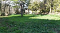
In fine weather, the meadow at the start (owned by the municipality of Puylaroque) is the perfect spot for a picnic break. You will also find an information board about the La Symphorine Association. For everyone’s comfort and out of respect for others, please leave this place as clean as you found it

During the hunting season, from late August to late February, please do not stray from the marked paths, which are all rural tracks open to the public and listed in the Tarn-et-Garonne PDIPR (on either side of the path, the land is private property).

Worth a visit

Saint Symphorien, a village nestled at the bottom of a valley: the Siétges.
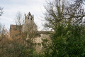
- A 15th-century church listed in the inventory in 1948, though its origins date back further.
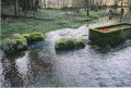
- A miraculous spring and its legends.
- A peaceful cemetery, facing the sky and the sun.
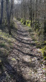
- Paths lined with dry-stone walls.
- The wildlife is varied. In particular, from spring to autumn, you may spot hares, hares, red squirrels and roe deer; during the day, numerous butterflies – some of which are protected – reptiles such as the ocellated lizard, and amphibians such as the green tree frog, the agile frog or the salamander; and in the evening, at dusk, the flight of bats, owls and barn owls. With a bit of luck, the friendly black-and-white badger might make an appearance.
- As for the flora, from the end of winter onwards, the spotted fritillary (or water tulip) appears along the edges of the paths near the stream and in the wet meadows. Then, from spring through to summer, the 30 varieties of orchids bloom one after the other, alongside many other plants. This festival of colours comes to an end in late autumn with the blooming of purple colchicum in the damp meadows.
- Box trees: curiosities of nature, picturesque, vaguely eerie in the autumn mist, providing a protective canopy during heatwaves, and inspiring the wildest imagination.

Reviews and comments

4.4 / 5
Based on 3 reviews

Reliability of the description
4.7 / 5
Ease of following the route
4.3 / 5
Route interest
4.3 / 5
Beddymou
Beddymou

Overall rating : 3.3 / 5

Date of your route : May 10, 2024
Reliability of the description : ★★★★☆ Good
Ease of following the route : ★★★☆☆ Average
Route interest : ★★★☆☆ Average
Very busy route : No

A lovely walk to start with – very pretty and shaded, I love it.
Then, halfway through, the tracker stopped showing my location on the route, yet I reached the next marker without any trouble.
There was a section along the road that was too long, where a dog gave me quite a fright; luckily, its owner called it back, so I avoided an attack.
All in all, I was very happy with the first part and the end, even though I had to be a bit resourceful to avoid the flooded path.

Machine-translated

Tachmal
Tachmal
• Edited:

Overall rating : 5 / 5

Date of your route : Sep 24, 2023
Reliability of the description : ★★★★★ Very good
Ease of following the route : ★★★★★ Very good
Route interest : ★★★★★ Very good
Very busy route : No

A short, very pleasant walk along lovely, shaded paths

Machine-translated

Jccejg
Jccejg

Overall rating : 5 / 5

Date of your route : Jun 22, 2020
Reliability of the description : ★★★★★ Very good
Ease of following the route : ★★★★★ Very good
Route interest : ★★★★★ Very good
Very busy route : Yes

A great, easy walk
Pleasant, well-maintained trails
👍

Machine-translated

Other walks in the area

For more walks, use our search engine .

The GPS track and description are the property of this route's author. Please do not copy them without permission.