


Refine your search for walks in Saint-Florent
Saint-Florent walks


 From Saint Florent to Saleccia via the coastal path
 Visorando Member
 11.03 mi
 +423 ft
 -413 ft
 5h 25
5h 25
 Moderate
 Departure from Saint-Florent (Haute-Corse)
This coastal hike allows you to explore this desert via a very pleasant trail and swim in idyllic coves.
From the Citadel of Saint-Florent to Campu Maggiore Beach in Farinole
 Association / Club / Walk leader8.47 mi
+673 ft
-656 ft
4h 30
Moderate
Departure from Saint-Florent (Haute-Corse)
Association / Club / Walk leader8.47 mi
+673 ft
-656 ft
4h 30
Moderate
Departure from Saint-Florent (Haute-Corse)
From Saint-Florent to Farinole along the coast, this return route allows you to discover hidden swimming spots as well as the path carved into the limestone cliffs, “marking the transition between the schistose Cap Corse peninsula and the Agriate Desert”.
The scenery, perfect for photography, is fabulous. On the outward journey, you’ll see the gulf, the ridge of Cap Corse and, on rare occasions, the mainland coastline, which can be glimpsed on clear, windy days. On the return journey, the view opens up to the south towards Saint-Florent, the Nebbiu plain and its foothills, notably featuring the Tenda range and its highest peak, Monte Astu. To the west, the coastline stretches widely from Anse de Fornali to Punta di Cuza, situated between the beaches of Lotu and Saleccia.
⚠️ Hiking is prohibited from March to August as this is the nesting season. See practical information.
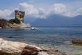
Loto Beach via the coast from Saint-Florent
 13.86 mi
+912 ft
-899 ft
7h 10
13.86 mi
+912 ft
-899 ft
7h 10
 Difficult
Departure from Saint-Florent (Haute-Corse)
Difficult
Departure from Saint-Florent (Haute-Corse)
This hike takes you through part of the Agriates desert along the coastal path, from Saint-Florent to Loto beach, passing through picture-postcard landscapes.
Circular walk from Roya to Punta di Cepo via the coastal path
6.19 mi
+528 ft
-505 ft
3h 20
 Easy
Departure from Saint-Florent (Haute-Corse)
Easy
Departure from Saint-Florent (Haute-Corse)
A lovely circular route along the coastal path starting from Roya Beach in Saint-Florent. A smooth ride along the coast on the outward leg. The return leg follows an inland track with panoramic views of the gulf, Cap Corse, Saint-Florent and the mountain range surrounding the Nebbiu region.
See restrictions on use of the route in the practical information section, subject to weather conditions
Loop via Saint-Florent starting from Oletta
 5.36 mi
+351 ft
-348 ft
2h 45
Easy
Departure from Oletta (Haute-Corse)
5.36 mi
+351 ft
-348 ft
2h 45
Easy
Departure from Oletta (Haute-Corse)
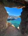
From the outskirts of Oletta, an old mule track leads to Saint-Florent across the plain. At its end stands the Cathedral of Nebbio, well worth a visit or a return visit.After a short detour through the vineyards of the Patrimonio appellation, which offers a superb view of the gulf and the start of Cap Corse, the walker reaches the town, its citadel and its harbour.The quays, once home to fishing boats, are now home to the largest marina on the ‘Isle of Beauty’. Once you’ve crossed the Pont Neuf over the Aliso, the renovated sea wall and Roya beach reveal much more accessible attractions such as angling and swimming.The return journey follows a rural municipal path lined with shepherds’ huts – known as ‘pagliaghji’ – built from white Saint-Florent stone.
See restrictions on use of the route in the practical information section, subject to weather conditions
From Olzu Beach to Calanca di à Torre
3.36 mi
+180 ft
-177 ft
1h 40
Easy
Departure from Saint-Florent (Haute-Corse)
From Olzu beach, follow the coastal path to admire the beautiful coves and inlets. Wear sturdy footwear.
The Brietta Spring at Patrimonio
 2.90 mi
+771 ft
-758 ft
2h 00
Easy
Departure from Barbaggio (Haute-Corse)
2.90 mi
+771 ft
-758 ft
2h 00
Easy
Departure from Barbaggio (Haute-Corse)
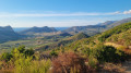
This walk offers a splendid panoramic view of the Patrimonio valley and its vineyards, in conditions that are very rare in Corsica over this distance: a wide, easy-to-walk path that winds along the mountainside. It is therefore a very easy route, though it does involve some elevation gain. Above all, it offers extraordinary views of the vineyards, the limestone cliffs and the sea between the hills. Best done at the end of the day in hot weather, or very early in the morning to catch the beautiful light that photographers will appreciate. The only slightly frustrating thing is that it’s a return trip.
The heritage trail in Patrimonio
2.08 mi
+446 ft
-430 ft
1h 20
Easy
Departure from Patrimonio (Haute-Corse)
Thanks to this route, which takes in places and monuments steeped in history as well as magnificent natural surroundings, the municipality of Patrimonio—which initiated and oversaw this project—offers a lovely walk of just over 3 km. This informative walk allows you to discover the village’s historical and architectural heritage via well-shaded paths or riverside routes, which are very pleasant in summer and, for the lucky residents, at any time of year.
In the vineyards of Patrimonio
 5.99 mi
+456 ft
-469 ft
3h 10
Moderate
Departure from Patrimonio (Haute-Corse)
5.99 mi
+456 ft
-469 ft
3h 10
Moderate
Departure from Patrimonio (Haute-Corse)
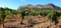
A beautiful walk, surrounded by the vineyards of Patrimonio, between Monte San'Angelo and Col de Teghime.
Le tour de la colline de Cotolone à Oletta
2.83 mi
+574 ft
-554 ft
1h 50
Easy
Departure from Oletta (Haute-Corse)
Starting from the former Saint-François convent in Oletta, this is a lovely walk through the countryside, ideal for families as it is easy going and well shaded.There are several points of interest along the route, and a lovely fountain, two-thirds of the way along, means you don’t need to carry drinking water with you.Parking is available, including on market days, which take place in the square in front of the convent every Tuesday and Friday from 1 June to 30 September, in the morning.
This route is strongly advised against from 15 July to 31 October 2026
See practical information
Circular route, Saint-François Convent – Oletta
 2.76 mi
+827 ft
-823 ft
2h 00
Easy
Departure from Oletta (Haute-Corse)
2.76 mi
+827 ft
-823 ft
2h 00
Easy
Departure from Oletta (Haute-Corse)
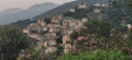
With a suggested tour of Oletta’s historic centre, explore the narrow streets that have been completely renovated by the local council yet retain their old-world charm.There’s no chance of getting lost: the lower and upper alleyways lead walkers back to the Church of Sant’Andria and its Piaza Nova; from this square or the Muntaghjò steps (at the top of the village), the views are remarkable.As the local footpaths and narrow streets are partially sheltered from the strong sunshine, this walk can be enjoyed in any season.
Extension/Alternative Route: Visit to the hamlet of Romanacce – a 1 km round trip starting from point no. 3 in the Muntaghjò district
As the Oletta Town Hall website states, “…even though the hamlet is no longer inhabited, it lives on through the miracle of the painting of the Virgin Mary that took place there in 1737”. The house where the miracle occurred can be visited free of charge, as can the adjoining Chapel of Saint Anthony.
See restrictions on use of the route in the practical information section, subject to weather conditions
Chjassu Maria Ghjentile
 3.02 mi
+745 ft
-719 ft
2h 00
Easy
Departure from Oletta (Haute-Corse)
3.02 mi
+745 ft
-719 ft
2h 00
Easy
Departure from Oletta (Haute-Corse)
This walk between Poggio d’Oletta and Oletta was created by our association in March 2024 to honour the memory of the heroine from Poggio, Maria Ghjentile. In the spring of 2025, it underwent a significant and interesting modification. Thanks to the joint efforts of the ‘Conca d’Oru, Patrimonio Vineyard – Gulf of Saint-Florent’ Grand Site de France and the local authorities concerned, a new route has been drawn up which is sure to meet the needs of walkers.Two start/finish options are available, each with its own car park: the square by the former Saint François convent in Oletta and the car park at the town hall in Poggio d’Oletta.
Update dated 3 September 2025: the modification to the route between Poggio Town Hall and Oletta Church, proposed by our association, avoids the need to cross and then follow the Poggio-D38 road for 350 metres.
See restrictions on use of the route in the practical information section, subject to weather conditions
Nature, heritage and local character of the Oletta and Poggio d’Oletta plains
5.02 mi
+1,079 ft
-1,086 ft
3h 15
Moderate
Departure from Oletta (Haute-Corse)
Starting from the former Saint-François Convent, this walking route takes you, between the villages of Oletta and Poggio d’Oletta, to the remains of agricultural and pastoral areas from the recent past, as well as, much further back in time, the ruins of the San Petru di Mozenzana Chapel, dating fromthe 7th century. A leap forward to the18th century brings us to the events of 25 and 26 September 1769. Inscriptions on the south façade of the convent recall the tragic story of the Poggio heroine Maria Ghjentile, whose ruined house stands in the hamlet of Monticello. Returning tothe 21st century, walkers will have had the opportunity to discover, along the route, vineyards and olive groves – ‘the two pillars of the Mediterranean terroir’ – with a superb, multifaceted wine cellar serving as the highlight.
Route at Poggio d’Oletta via Monte Magna and the San Petru chapel
 2.98 mi
+951 ft
-945 ft
2h 10
Easy
Departure from Poggio-d'Oletta (Haute-Corse)
2.98 mi
+951 ft
-945 ft
2h 10
Easy
Departure from Poggio-d'Oletta (Haute-Corse)
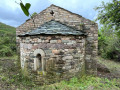
Monte Magna is situated at the western edge of the municipality of Poggio d’Oletta.Before reaching the summit, walkers will probably be tempted to take a short round trip to explore the ruins of the Chapel of San Petru di Mozenzana, whose first apse is thought to date fromthe 7th century. This dating, combined with the building’s relatively good state of preservation, is undoubtedly what makes it such a moving place.
You will need to return to the main path to reach the summit of Monte Magna at an altitude of 233 metres. The360°viewsfrom there are exceptional. As well as the villages, the Nebbiu plain and the Tenda massif, you can admire the landscapes of the ‘Conca d’Oru – Patrimonio Vineyard – Gulf of Saint-Florent’ triptych , which have earned this natural site its place in the Grands Sites de France network.
This route is strongly discouraged from 15 July to 31 October 2026
See practical information
The Piedalbuccio loop
1.30 mi
+226 ft
-207 ft
0h 50
Easy
Departure from Oletta (Haute-Corse)
This walking route (U Giru di Piedalbuccio) was created in March 2020 around the rapidly developing residential area of Piedalbuccio. At the time, it was necessary to adapt to the lockdown from March to April 2020, linked to the ‘Covid-19’ pandemic, which restricted time spent outside the home to a maximum of one hour. This route therefore allowed residents to stretch their legs close to home, avoiding the time wasted on road journeys. Even today, in an area where urban development has stabilised, this route remains hugely popular, which in turn minimises the need for maintenance.
Chjassu Maria Gentile between Poggio d'Oletta and Oletta
 Local authority
 2.78 mi
+646 ft
-656 ft
1h 50
Moderate
Departure from Poggio-d'Oletta (Haute-Corse)
2.78 mi
+646 ft
-656 ft
1h 50
Moderate
Departure from Poggio-d'Oletta (Haute-Corse)
The Chjassu Maria Gentile is a pretty walking loop connecting the neighbouring villages of Poggio d'Oletta and Oletta. The route offers rich and varied landscapes: villages, scrubland, oak forests, streams...
Its name is a tribute to Maria Gentile, a young heroine of the area who became a symbol of courage when, in 1769, at the age of just 20, she defied French soldiers who had sentenced the inhabitants of Oletta to death for plotting a conspiracy. Maria Gentile's fiancé, like his companions, was sentenced to death and executed without the right to a burial. Maria, refusing to abandon her fiancé's body, decided to defy the ban and, at nightfall, set out to recover it and give him a proper burial. Since then, Maria Gentile has been considered the Antigone of Corsica.
The Mont Zucarrello circular walk starting from Oletta
7.14 mi
+2,644 ft
-2,638 ft
5h 35
Moderate
Departure from Oletta (Haute-Corse)
Mount Zuccarello is the highest peak in the municipality of Oletta. It rises to an altitude of955 m and forms part of the Serra mountain range, continuing on from Cap Corse.This route begins with a passage through Muntaghjò, a neighbourhood where, in the Middle Ages, the powerful Montalti family had built a castellu. The rest of the route takes place in mid-mountain terrain, starting with the ascent to the Col de Sant’Antonio and ending at the summit of the mountain, the highest point of the hike. The return journey begins with a beautiful escarpment near the Monts Stretti, before passing through the Col de San Giovanni. From there, splendid views of the Nebbiu and Conca d’Oru natural areas follow one after another all the way to Oletta.
From 15 July to 31 October 2026
it is strongly advised not to take this route
see practical information
The village of Oletta seen from Mount Tuda, circular route
 3.84 mi
+1,024 ft
-1,004 ft
2h 40
Moderate
Departure from Oletta (Haute-Corse)
3.84 mi
+1,024 ft
-1,004 ft
2h 40
Moderate
Departure from Oletta (Haute-Corse)
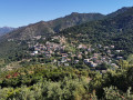
Oletta is undoubtedly one of Corsica’s most ‘photogenic’ villages. This is due to its natural beauty, its location and the excellent state of repair of its monuments and buildings in general.But there is real value in exploring our village from Mont Tuda, which also offers 360° views.The route takes you past the Mersulaccia Fountain, along the recently reopened local footpaths, past the Saint-François Convent, through the hamlet of Piedalbuccio and into the heart of the village: these are the main points of interest along this route.
“Tip: follow the route in the correct direction to climb Mont Tuda via its southern slope. This applies regardless of your chosen starting point (Municipal Car Park on the D38 or Saint-François Convent on the D82).”
See restrictions on use of the route in the practical information section, subject to weather conditions