Britzingen New Year’s Eve Run

A charming tour through the villages and vineyards of the Markgräflerland region.

Details

n°29292183
Creation:
Last update:
Last review:
  • Walking
    Activity: Walking
  • ↔
    Distance: 6.36 mi
  • ◔
    Average duration: 3h 10 
  • ▲
    Difficulty: Moderate

  • ⚐
    Back to start: Yes
  • ↗
    Ascent: + 282 ft
  • ↘
    Descent: - 256 ft

  • ▲
    Highest point: 1,010 ft
  • ▼
    Lowest point: 738 ft

Description of the walk

Starting point: Britzingen Winegrowers’ Co-operative, Markgräflerstr. 25–29, 79379 Müllheim-Britzingen

(S/E) The beautiful running route begins in Britzingen by the church and follows a tarmac path with lovely views towards Betberg-Kaiserstuhl, down to the small hamlet of Güttigheim, where you will have already completed the first kilometre.

(1) The route then continues to the left and, at the next junction, turns right, passing meadows and vineyards through St. Ilgen (2), a district of Sulzburg-Laufen.

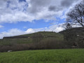
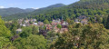
(3) Above St. Ilgen, where you then have to turn left towards Buggingen, a magnificent view opens up to the west for runners and walkers, stretching across the Vosges to the Grand Ballon and Markstein; to the south-west of this spot, the Hochblauen towers above, and you can look back towards Britzingen, where you can clearly see how beautifully the village is nestled amongst the vineyards. At the K494, we turn right.

(4) By now, we have already walked 4 kilometres and, upon reaching Buggingen, we arrive at the lowest point of the New Year’s Eve run route. We then turn left onto the local footpath towards Dattingen.

(5) At the 5.5-kilometre mark, we cross the retention basin – commonly known as the dam – and continue towards the western outskirts of Dattingen, with the Hochblauen and the Black Forest mountain range, including the Belchen and Schauinsland, always in view.

(6) At the junction behind the retention basin, we turn right and then take the second left, past the Gnadenhöfle.

(7) Beyond that, we turn left and then keep straight on, past the Dattingen shooting range, through the village, then right onto ‘Am Brünnenplatz’ and keep left onto ‘Am Bach’.

(8) The “toughest part of the route” begins at the church. The runners already have 7.5 km under their belts at this point and must now tackle a long climb up to the L125, flanked on both sides by hundreds of vines.

(9) From here, the route continues to the left towards Britzingen and the finish line. Just before entering the village, there is one more short, steep climb to tackle.

(10) The route then follows Ehebachstraße and Markgräflerstraße back to the finish line at St Johannes’ Church in Britzingen (S/E)

Waypoints

  1. S/E : mi 0 - alt. 981 ft - Britzingen Winegrowers’ Co-operative
  2. 1 : mi 0.49 - alt. 883 ft - Güttigheim, on the left
  3. 2 : mi 1.29 - alt. 856 ft - St. Ilgen
  4. 3 : mi 1.55 - alt. 919 ft - Towards Buggingen, turn left
  5. 4 : mi 2.7 - alt. 764 ft - Buggingen
  6. 5 : mi 3.38 - alt. 771 ft - Retention basin
  7. 6 : mi 3.73 - alt. 791 ft - Junction behind the retention basin
  8. 7 : mi 4.09 - alt. 804 ft - Gnadenhöfle
  9. 8 : mi 4.68 - alt. 820 ft - Church
  10. 9 : mi 5.27 - alt. 932 ft - L125
  11. 10 : mi 5.89 - alt. 932 ft - Ehebachstrasse and Markgräflerstrasse
  12. S/E : mi 6.36 - alt. 984 ft - Britzingen Winegrowers’ Co-operative

Notes

The route is exactly 10 km long, involves a climb of approximately 120 metres in altitude and is entirely tarmac-surfaced except for a 200-metre stretch.

The traditional end-of-year run in Britzingen is attracting more and more runners. Many of these participants enjoy training on the New Year’s Eve route, and year in, year out there are always lots and lots of first-time New Year’s Eve runners who like to run the route in the run-up to the event.

The New Year’s Eve run route is therefore permanently signposted throughout the year, ensuring there is always a training or walking option for ‘outdoor enthusiasts’

The new red-and-white signs, which are positioned at all significant changes in direction from the start right through to the finish, display the current kilometre marker, a QR code and the direction of the run.

Information about the New Year’s Eve Run is available on the TV Britzingen website

www.silvesterlauf-britzingen.de

If you have any further questions, please feel free to contact Herbert Hebek on 07631-6898

Public transport: ‘Post’ bus stop in Britzingen

Parking:
There are very few parking spaces in the vicinity of the Neuefelshalle. However, it is possible to park in the new housing development (west of the L 124 coming from Staufen). Coming from the direction of Buggingen, parking is available in the Biefang industrial estate and on the western section of Ehebachstrasse.

Worth a visit

🍽️ Places to eat:
Britzingen Village Shop Co-operative eG
Markgräfler Str. 33
79379 Müllheim

Gasthaus Hirschen
Markgräfler Str. 22
79379 Müllheim

Gasthaus zur Krone
Markgräfler Straße 32
79379 Müllheim

Reviews and comments

5 / 5
Based on 1 review

Reliability of the description
5 / 5
Ease of following the route
5 / 5
Route interest
5 / 5
dinamaria
dinamaria

Overall rating : 5 / 5

Date of your route : Oct 13, 2025
Reliability of the description : ★★★★★ Very good
Ease of following the route : ★★★★★ Very good
Route interest : ★★★★★ Very good
Very busy route : Yes

A magnificent route between vineyards and typical villages

Machine-translated

Other walks in the area

For more walks, use our search engine .

The GPS track and description are the property of this route's author. Please do not copy them without permission.