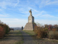
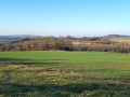
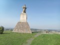
Ruins of the Rendez-Vous farm in Blainville-sur-l’Eau

A short walk through the Damelevières woods from Blainville-sur-l’Eau, taking you to the ruins of the Rendez-Vous farm

Details

2362932
Creation:
Last update:
Last review:
  • Walking
    Activity: Walking
  • ↔
    Distance: 4.47 mi
  • ◔
    Average duration: 2h 10 
  • ▲
    Difficulty: Easy

  • ⚐
    Back to start: Yes
  • ↗
    Ascent: + 151 ft
  • ↘
    Descent: - 151 ft

  • ▲
    Highest point: 866 ft
  • ▼
    Lowest point: 705 ft

Description of the walk

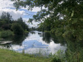
Start from the banks of the Meurthe (parking available).

(S/E) Cross the bridge, then turn immediately right onto the path marked with a Red Cross and go through the tunnel under the railway line.

(1) Turn right onto Rue de Vitrimont, which goes round the water tower. After about 100 metres, take the steps opposite, then turn right to walk alongside the forest.

(2) Turn onto the path branching off to the right into the forest, indicated by the signpost (not very visible), then turn left at a right angle.

(3) At the water tower, turn right and join the wide forest track, which you follow to the right towards the north-east.

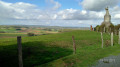
(4) At the junction, turn left and walk past the ruins of the Rendez-Vous farm. 100 metres further on, turn left onto the forest track heading south-west.

(5) Turn left onto the path that runs between plots nos. 25 and 26, and follow it until you rejoin the forest track taken earlier.

(6) Turn right onto a road, then turn left and walk alongside the secondary school to reach the water tower.

(3) Return via the same route as on the way out to the car park near the bridge over the Meurthe (S/E).


Waypoints

  1. S/E : mi 0 - alt. 715 ft - Car park near the bridge over the > - Meurthe (rivière)
  2. 1 : mi 0.45 - alt. 778 ft - Rue du Vitrimont
  3. 2 : mi 0.87 - alt. 807 ft - Path
  4. 3 : mi 1.25 - alt. 820 ft - Water tower
  5. 4 : mi 1.97 - alt. 866 ft - Ruins of the Rendez-vous farm
  6. 5 : mi 2.65 - alt. 814 ft - Plots 25–26
  7. 6 : mi 3.02 - alt. 830 ft - Secondary school
  8. S/E : mi 4.47 - alt. 715 ft - Car park near the bridge over the Meurthe

Reviews and comments

3.9 / 5
Based on 3 reviews

Reliability of the description
4.5 / 5
Ease of following the route
4.3 / 5
Route interest
3 / 5
ziz
ziz

Overall rating : 4.3 / 5

Date of your route : Mar 06, 2022
Reliability of the description : ★★★★★ Very good
Ease of following the route : ★★★★★ Very good
Route interest : ★★★☆☆ Average
Very busy route : No

I was rather disappointed by the start of the walk: a stretch through rubbish on the edge of the railway line, which was completely uninteresting, followed by a walk alongside a housing estate that was equally charmless. In fact, the forest walk only really begins at point no. 3, where you can also park, so you can easily enjoy the circular forest walk – which is lovely in itself – without having to endure the pointless half-hour that precedes it, especially with children.
So, to sum up, it’s a nice family walk, but only from point no. 3 onwards.

Machine-translated

Christecol
Christecol

Overall rating : 3.5 / 5

Date of your route : Dec 07, 2021
Reliability of the description : Not used / Not applicable
Ease of following the route : ★★★★☆ Good
Route interest : ★★★☆☆ Average
Very busy route : No

A short, leisurely walk this November. I extended it slightly (by 1 km) by continuing along the path to PI 4, then turning left to follow the Clos Pré stream through the forest and heading back up towards PI 5.
The forest I walked through was mainly high forest, and there were a few chainsaws in action whilst I was there.

Machine-translated

The user account associated with this content has been deleted.

Other walks in the area

For more walks, use our search engine .

The GPS track and description are the property of this route's author. Please do not copy them without permission.