The romantic Hohlgasse and the Liliental Forestry Research Station

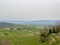
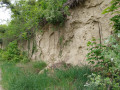
This circular walk takes you through the picturesque Liliental valley, home to the Baden-Württemberg State Forestry Research Institute. Research is carried out there to determine which tree species will best suit our needs in the future in the face of climate change. Along the way, you’ll also pass the ‘Romantische Hohlgasse’, a path that winds through the Ice Age limestone deposits from the Alpine region.

Details

n°47167696
Creation:
Last update:
Last review:
  • Walking
    Activity: Walking
  • ↔
    Distance: 4.48 mi
  • ◔
    Average duration: 2h 35 
  • ▲
    Difficulty: Easy

  • ⚐
    Back to start: Yes
  • ↗
    Ascent: + 620 ft
  • ↘
    Descent: - 604 ft

  • ▲
    Highest point: 1,417 ft
  • ▼
    Lowest point: 892 ft
  • ⚐ Country: Germany
  • ⚐ City: Ihringen 
  • ⚑
    Start/End: N 48.067222° / E 7.675847°
  • ❏
    IGN map(s): Ref. 3818O
  • Hour-by-hour weather

Photos

Description of the walk

Start: You start at the Liliental hiking car park. The address for your sat-nav is Lilienhof 7 in Ihringen.

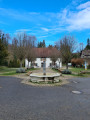
(S/E) Follow the path downhill from the car park, past the “Zur Lilie” restaurant and along the arboretum. A library of trees from all over the world has been created here for future generations.

(1) At the first junction, turn right onto Gegenbühlweg. Follow this path as far as the maple trial plots.

(2) Keep to the left before the maple trial plots and continue to follow the path uphill through the maple species. You are still on Gegenbühlweg. This continues through the collection of oak species and birches.

(3) At the end of the experimental plots, take the left-hand turn onto Romantische Hohlgasse. The path leads you uphill through the Ice Age limestone deposits from the Alpine region and into the forest.

(4) At the fork in the forest, keep left and follow the Hundskehlenweg.

(5) At the junction in the clearing, turn right and follow the Hohrain path.

(6) After you have passed the summit of the Gagenhart, turn right at the next fork and continue to follow the path through the forest. The path leads you downhill to the Unterer Mühlentalweiher.

(7) There, turn right and follow the path through the willow species reserve.

(8) When you reach the Upper Mühlentalweiher, take the path sharply to the left and follow the Gegenbühlweg. You will now pass the display of different cherry varieties.

(2) You’ll reach the Gegenbühlweg again and follow it to the left.

(1) You’ll then come back to the junction you passed on the way there and turn left. You’ll pass the arboretum and the ‘Zur Lilie’ inn again.

(S/E) Once you’ve passed the restaurant, it’s just a few metres further uphill and you’ll be back at the Liliental hiking car park.

Waypoints

  1. S/E : mi 0 - alt. 925 ft - Liliental hiking car park
  2. 1 : mi 0.29 - alt. 1,024 ft - Junction on Gegenbühlweg
  3. 2 : mi 0.44 - alt. 1,043 ft - Fork in the path at the maple trial plots
  4. 3 : mi 0.83 - alt. 1,181 ft - Turn-off onto the Romantische Hohlgasse
  5. 4 : mi 1.42 - alt. 1,365 ft - Turn-off onto the Hundskehlenweg
  6. 5 : mi 1.68 - alt. 1,381 ft - Turn-off to Hohrain
  7. 6 : mi 2.69 - alt. 1,230 ft - Fork in the path after the summit of the Gagenhart
  8. 7 : mi 3.07 - alt. 896 ft - Junction at the Lower Mühlentalweiher
  9. 8 : mi 3.6 - alt. 1,043 ft - Junction at the Oberes Mühlentalweiher
  10. S/E : mi 4.48 - alt. 925 ft - Liliental hiking car park

Worth a visit

The “Zur Lilie” inn, near the Liliental hiking car park, is a great place to stop for a break.

Reviews and comments

5 / 5
Based on 1 review

Reliability of the description
5 / 5
Ease of following the route
5 / 5
Route interest
5 / 5
calou68920
calou68920

Overall rating : 5 / 5

Date of your route : Aug 24, 2026
Reliability of the description : ★★★★★ Very good
Ease of following the route : ★★★★★ Very good
Route interest : ★★★★★ Very good
Very busy route : Yes

A lovely walk – easy and very pleasant, with a low difficulty level. It’s easy to find your way and there’s plenty of shade along most of the route. The walk starts and ends at the restaurant, where you can also stop for a drink.

Machine-translated

Other walks in the area

For more walks, use our search engine .

The GPS track and description are the property of this route's author. Please do not copy them without permission.