Country:
 City:
City:


Coming from Breisach and just before you reach Ihringen, take a small road on the left towards Blankenhornsberg/Staatsweingut. About 2 km further on, park in the car park below the winery.
Yellow Diamond markings
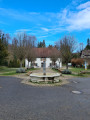
(S/E) From the car park, head towards the winery and walk to the right of the building (beautiful flower garden) to continue slightly uphill along the small tarmac road overlooking the vineyard. 300 m further on, ignore the small tarmac road leading uphill to the left and continue along the track. Then ignore a wide path on the right leading downhill and continue uphill (Yellow Diamond) to reach a junction at a place called “Am Hochbuck”.
(1) Ignore the path on the left – which will be your return route – and turn right towards Wilde Steige. Take the narrow path climbing through the forest, then descending alongside the vineyards. Beautiful views of the Belchen. At a telecoms mast, the path enters the vineyard and leads to a junction at the place known as Wilde Steige.
(2) Cross the wide path and head straight on towards Kreuzenbuck/Gute Eck. Following the same signposting, stay between the forest and the vineyards, ignoring all the paths on the right leading into the vineyards, until you reach a junction at the hamlet of Gute-Eck. Leave the path, which climbs towards Duttental, and turn left onto the tarmac road leading downhill towards Kreuzenbuck/Jägerdenkmal. You’ll reach the hamlet of Kreuzenbuck-Pass some 250 m further on.
(3) Cross the road and head uphill towards Kreuzenbuck/Jägerdenkmal. Begin a 300-metre climb on tarmac before rejoining a stony path, and arrive at the hamlet of Kreuzenbuck Jägerdenkmal.
(4) Leave the road heading uphill and turn left towards Rischbühl. Continue along the wide, carriageable track. 1 km further on, at a junction, leave the road on the left and take a grassy track on the right. You’ll reach a tarmac road. Take this on the left, heading slightly downhill towards Schiebebück/Bachenbückle. Lovely view of the village of Bickensohl and a panoramic view of the “Totenkopf”. You’ll reach a large junction at a place called Backenbückle.
(5) Ignore the three tarmac roads leading downhill and head slightly to the left onto a stony track towards Schiebebück. Walk alongside the vineyard. At a junction, turn left, following the sign for Lösshohlwege-Pfad, and after about twenty metres you’ll reach another junction opposite a mast.
(6) Turn right, towards Lösshohlwege-Pfad. After a cobbled section and a rest area on the left, do not miss the junction; turn left, leaving the downhill track behind. Follow the signs for Bitzenberg/Ackharren. Stay at the edge of the forest, ignoring a path leading downhill to the right. “Panorama of the Vosges”. After two hairpin bends, you’ll reach the road visible below. Pass two small roads joining from the left, and 50 m further down, join the main road linking Ackarren to Bickensohl, at a place called Bitzenberg.
(7) Cross with care and follow this road to the right for 50 m, before leaving it at a small car park to take a wide path leading uphill to the left, towards Fraental/Ackharren Kirche, at a place called Bickensohler Steinfelsen. Stay on this wide path (Panorama Weg), ignoring the paths climbing up into the vineyards and those leading down towards the village. You will arrive at the hamlet of Frauental.
(8) Turn right towards Ebnet (Panorama Weg), leaving the signposted route to Steinfelsen on your right. At the Schneckenberg shelter, ignore the path leading downhill to the left and continue along the Panorama Weg on level ground. At a junction, near a garden shed, turn left and, 50 metres further on, you’ll reach the hamlet of Am Schneckenberg.
(9) Head straight on towards Ebnet, leaving the sign for Katzenstein on your right. 300 m further on, at the hamlet of Ebnet, turn right towards Krütteracker. 50 m further on, you’ll reach a cross at a junction in the hamlet of Hofacker-Kreuz.
(10) Continue along the road towards Krüttacker. After 50 m, ignore a path branching off to the right into the vineyards and, a few metres further on, at the hamlet of Schlossberg Krüttacker, turn left towards Schlossberggipfel. 100 m further on, at the hamlet of Schlossberg Oberer Ebnet, cross a small road and start climbing towards Schlossberggipfel. Stay on the wide path to reach the locality known as Schlossberg Rittersprung. Turn left and, 50 m further on, you will reach the locality known as Vorm Schlossberggipfel.
(11) Continue left, heading uphill towards Schlossberggipfel. At a wooden hut, continue left, heading uphill, to reach the Schlossberggipfel summit a few metres further up. “Enjoy the view”.
(12) To head back down, follow the same path you took on the way up, towards Hofacker-Kreuz, and return to the spot known as Vorm Schlossberggipfel.
(11) Turn left, heading towards Hofacker-Kreuz/Ackharren Kirche. Ignore the paths leading into the vineyards and continue towards the crossroads, at the cross you saw on the way up. Ignore the small tarmac road branching off to the left, and cross a short grassy stretch to reach the hamlet of Hofacker-Kreuz.
(10) Take the steep, cobbled path, ignoring the track on the right. About a hundred metres further down, cross a small road and continue the descent towards the village (signposted ‘Ackharrer Schlossbergpfad’). At the entrance to the village, head towards the church, passing to the left of the restaurant ‘Zur Krone’ (stairs), following the signs for ‘Castellberg-Hütte’. Walk past the church, a bus stop and an information board, then take the road uphill towards Castellberg-Hütte. Walk past the hamlet of Willburg, ignore the path branching off to the right and, after a few minutes’ climb, you’ll reach Castellberg-Hütte.
(13) Then turn right, towards Im Buchwald/Blankenhornsberg, and ignore the tarmac road leading to Fohrenbück. Follow a wide path into the forest. Ignore a path leading downhill to the right, then reach a junction at the hamlet of Im Buchwald. Head uphill to the left, towards Kohlplatz, and ignore the path leading down towards Hinter-Winklen. Continue to the hamlet of Kohlplatz.
(14) Ignore the path on the right leading to Hinter-Winklen and continue straight on towards Am Hochbuck. About 250 metres further on, at a junction, follow the signposting carefully along the path leading downhill, taking care not to turn right. At the bottom of a short descent, you’ll reach the hamlet of Am Hochbuck, where you’ll rejoin the path you took on the way there.
(1) Head straight on towards Blankenhorstberg to return to the Blankenhorstberg car park (S/E).


 Visorando Member

 Easy
Easy  Association / Club / Walk leader