Country:

 City:
City:


Park in the Pré Chabert car park. Take the Bachas chairlift to reach the start of the walk at the top station.
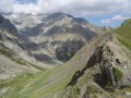
(S/E) Set off straight ahead as you leave the top station, pass underneath the Eychauda chairlift and then climb generally beneath it. Head for the Col de l’Eychauda.
(1) Take the path on the right towards the Pic de l’Yret. Just below the Crête des Neyzets, you’ll reach a crossroads of paths.
(2) Take the path on the left, then complete two circular loops – thefirst to the left, thesecond to the right. You will then come to another junction directly below the Yret chairlift.
(3) Turn left and head for the top station of the chairlift.
Please note: from this station, the ascent is very tricky; climb up the left-hand side of the peak. The climb is extremely difficult as it involves a very steep slope and slippery slate slabs; it is only suitable for walkers who are comfortable on this type of terrain.
(4) Return along the same route, taking great care at the Yret crossroads.
(3) Keep to the left beneath the chairlift and make your way to the Col du Vent.
(5) Turn right into the valley and return to a crossroads you passed on the way out.
(2) Follow the route you took on the way out in the opposite direction to reach the Bachas top station (S/E). Then take the Bachas chairlift to the Pré Chabert car park.
 Visorando Member
 Moderate
 Easy
Easy