Refine your search for walks in Rocher de l'Yret
Rocher de l'Yret walks


 Rocher de l’Yret seen from the top of the Bachas chairlift
 Visorando Member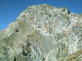
 4.49 mi
 +2,152 ft
 -2,175 ft
 3h 55
3h 55
 Difficult
 Departure from Le Monêtier-les-Bains (Hautes-Alpes)
Preliminary note: this challenging hike is recommended for experienced walkers.Warning: the final section, from the top of the Yret chairlift to the summit of the Rocher de l’Yret , is extremely tricky, as the slope is very steep and the rock slabs are slippery.
Walks near Rocher de l'Yret
Du Monêtier-les-Bains au Lauzet
6.28 mi
+2,336 ft
-1,742 ft
4h 55
 Moderate
Departure from Le Monêtier-les-Bains (Hautes-Alpes)
Moderate
Departure from Le Monêtier-les-Bains (Hautes-Alpes)
3ème étape du Tour du combeynot : découverte de la vallée de la Guisane en passant par le chemin du Roy pour arriver à l'Alpe du Lauzet
Monêtier-les-Bains - Vallouise
 12.62 mi
+3,307 ft
-4,285 ft
8h 40
Difficult
Departure from Le Monêtier-les-Bains (Hautes-Alpes)
12.62 mi
+3,307 ft
-4,285 ft
8h 40
Difficult
Departure from Le Monêtier-les-Bains (Hautes-Alpes)
E10th stage lasting 8 hours, covering 21 km, with 1,000 m of ascent and 1,200 m of descent. A very pleasant stage with no technical difficulty, offering magnificent views of the Barre des Écrins at 4,100 m and the very impressive Pelvoux at 3,900 m.
For the more adventurous, there is the option of taking a detour to climb up to Lac de l’Eychauda by leaving theGR® 54 at the Col de l’Eychauda. The stage ends in the village of Pelvoux, which, despite the fatigue, is well worth a quick visit.
Crossing from Ailefroide to Chambran via the Cime du Paillon
 4.39 mi
+4,193 ft
-3,497 ft
6 hrs
4.39 mi
+4,193 ft
-3,497 ft
6 hrs
 Very difficult
Departure from Pelvoux (Hautes-Alpes)
Very difficult
Departure from Pelvoux (Hautes-Alpes)
An alpine hike, largely off-trail, through very wild terrain; not particularly difficult but requiring sure-footedness. You’re more likely to encounter chamois than people! Stunning views of the Pelvoux.
Setting off early means you can complete much of the ascent in the shade.
From Le Lauzet to the Col du Lautaret
4.19 mi
+1,325 ft
-26 ft
3h 05
Moderate
Departure from Le Monêtier-les-Bains (Hautes-Alpes)
Stage4 of the Tour du Combeynot: from the Guisane Valley to the Col du Lautaret
Vallouise - Pré de la Chaumette Mountain Hut
 13.54 mi
+5,381 ft
-3,255 ft
10 hrs
Very difficult
Departure from Vallouise (Hautes-Alpes)
13.54 mi
+5,381 ft
-3,255 ft
10 hrs
Very difficult
Departure from Vallouise (Hautes-Alpes)
The Col de l'Aup Martin and the Pas de la Cavale from the Onde Valley, leading into the Champoléon Valley.
The Aup Martin – what a pass!
Note: This route is a stage of the Tour de l'Oisans but it is very challenging, particularly in early summer when there is still snow on the Col de l'Aup Martin. For this reason, a diversion has been put in place starting from Vallouise, passing through Puy Saint-Vincent, the Col de la Pousterle and the Fournel valley. You then join the Pas de la Cavale (GR®54A).
Refuge du Chardonnet - Arsine
11.94 mi
+2,608 ft
-4,436 ft
7h 45
Difficult
Departure from Névache (Hautes-Alpes)
This third stage of the crossing of France, following the 45th parallel as closely as possible, is long and difficult but absolutely magnificent. You will discover or rediscover the two jewels that are the Écrins and Meije massifs. Most of the route is on the GR® 50 and GR® 57. The paths are well marked and well maintained.
This stage can be divided into four sections: 1) an ascent to the Col du Chardonnet; 2) the descent to Lauzet; 3) the ascent to the Col du Lautaret; 4) the descent to Arsine.
Alpe de Villar d'Arêne Mountain Hut - Monêtier-les-Bains
 9.66 mi
+1,266 ft
-3,271 ft
5h 35
Difficult
Departure from Villar-d'Arêne (Hautes-Alpes)
9.66 mi
+1,266 ft
-3,271 ft
5h 35
Difficult
Departure from Villar-d'Arêne (Hautes-Alpes)
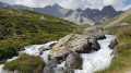
Stage9 of this route links the Refuge de l’Alpe de Villar-d’Arêne to Monêtier-les-Bains, taking a short detour to the Lac du Glacier d’Arsine, surrounded by the Pics de Chamoissière, d’Arsine, de Neige Cordier, the Pointe Cézanne and the Montagne des Agneaux. Unfortunately, the Arsine Glacier is suffering from global warming. The section starting from the pass along the Petit Tabuc stream in the valley, known as the Réou d'Arsine, is magnificent and very wild.
From Alpe de Villard-d'Arène to Monêtier-les-Bains
 9.74 mi
+1,289 ft
-3,261 ft
5h 35
Moderate
Departure from Villar-d'Arêne (Hautes-Alpes)
9.74 mi
+1,289 ft
-3,261 ft
5h 35
Moderate
Departure from Villar-d'Arêne (Hautes-Alpes)
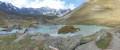
Stage2 of the Tour du Combeynot: From the Romanche to the Guisane Valley via the Col d'Arsine, this stage takes place at the foot of the Agneaux
Fontcouverte Campsite - Lac de la Ponsonnière
 7.08 mi
+3,691 ft
-1,391 ft
6h 30
Difficult
Departure from Névache (Hautes-Alpes)
7.08 mi
+3,691 ft
-1,391 ft
6h 30
Difficult
Departure from Névache (Hautes-Alpes)
For this first three-day stage, the route offers magnificent views of the Écrins Massif at the Col du Chardonnet and then of the Grand Lac. We have chosen to camp at Lac de la Ponsonnière, but it is entirely possible to camp on the heights of the Grand Lac, near the pastoral house. This allows you to shorten the duration of this first day slightly and, above all, reduce the elevation gain by around 200m.