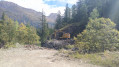
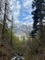
The Crête des Lauzières, starting from Monêtier-les-Bains

Circular walk through the woods of Monêtier leading to the Bachas midway station, and descent via theGR®54.

Details

38383
Creation:
Last update:
Last review:
  • Walking
    Activity: Walking
  • ↔
    Distance: 5.59 mi
  • ◔
    Average duration: 4h 40 
  • ▲
    Difficulty: Moderate

  • ⚐
    Back to start: Yes
  • ↗
    Ascent: + 2,395 ft
  • ↘
    Descent: - 2,388 ft

  • ▲
    Highest point: 7,123 ft
  • ▼
    Lowest point: 4,806 ft

Description of the walk

Park in the Monêtier thermal baths car park.

(S/E) Take the tarmac road leading to the Grand Tabuc valley.
Walk to the telephone box.

(1) Turn left onto the wide track. At the first crossroads, turn right onto the path – this is theGR®54“Tour de l’Oisans”. You’ll soon reach the Chalets de Charvet.

(2). Continue up theGR® (signposted and marked in red and white).
You’ll reach the junction with the discovery trail.

(3) Turn left onto this path – it is also the Crête des Lauzières trail. After a steep climb followed by a flat section and then another climb, you’ll reach the viewing point overlooking the valley.

(4) Continue along level ground, then up a short slope to reach the Bachas plateau.

(5) Head down the track and quickly turn right onto theGR®54(signposted). Follow the Selle valley to reach the hamlet of Tronchet.

(6) Turn left onto the yellow-marked path, cross the Selle, and initially head down the ski run. At a bend, leave the ski run on your right and stay on the path. Reach the footbridge over the Tabuc torrent, cross it, and follow a short climb to the Grangettes chalets.

(7) Continue following the yellow markings and the signposts until you reach the junction from the outward journey.

(1) Return along the road to the car park (S/E).

Waypoints

  1. S/E : mi 0 - alt. 4,806 ft - Car park at the Monêtier thermal baths
  2. 1 : mi 0.39 - alt. 4,951 ft - Crossroads with a telephone box
  3. 2 : mi 0.78 - alt. 5,266 ft - Chalets de Charvet
  4. 3 : mi 1.41 - alt. 5,837 ft - GR54/PR junction
  5. 4 : mi 2.02 - alt. 6,801 ft - Viewpoint
  6. 5 : mi 2.67 - alt. 7,119 ft - Bachas
  7. 6 : mi 3.84 - alt. 5,971 ft - Le Tronchet
  8. 7 : mi 4.39 - alt. 5,597 ft - Chalets des Grangettes
  9. S/E : mi 5.59 - alt. 4,810 ft - Car park at the Monêtier thermal baths

Notes

Water point at the Chalets des Grangettes.
Bar at Les Bachas.

Worth a visit

A pleasant walk through the Monêtier ski area, which has the advantage of taking you almost entirely off the ski runs.
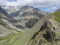
However, the view over the ski area is magnificent; skiers will recognise the Cibouit, Yret and Eychauda runs – famous names in these parts.
After the walk, a visit to the Monêtier thermal baths is the perfect way to unwind.

Always be cautious and plan ahead when you're outdoors. Visorando and the author of this route cannot be held responsible for any accidents occurring on this route.

The GR® and PR® markings are the intellectual property of the Fédération Française de Randonnée Pédestre.

Reviews and comments

4.1 / 5
Based on 3 reviews

Reliability of the description
4.3 / 5
Ease of following the route
4.7 / 5
Route interest
3.3 / 5
Helene102
Helene102

Overall rating : 4.7 / 5

Date of your route : Aug 21, 2023
Reliability of the description : ★★★★★ Very good
Ease of following the route : ★★★★★ Very good
Route interest : ★★★★☆ Good
Very busy route : No

A walk mainly through the forest, in the shade, which is lovely on very hot days.
The climb is steep, but the descent is easier, especially with walking poles.
You’ll cross several small streams, which have little flow in late August, but there may be more water in spring when the snow melts.

Machine-translated

mauricejeannine
mauricejeannine

Hello,
I always appreciate the insight and relevance of your comments, which are also very informative. The Visorando website is of a very high standard and we’ve got into the habit of consulting it when planning our walks.
With regard specifically to the Crète des Lauzières, you do indeed mention a ‘steep’ climb, but what struck us was its length, and we didn’t feel rewarded by the beauty of the route (though this is, of course, a personal opinion). We do, however, have extensive experience of mountain walking. I highlighted how the route can prove challenging in wet weather, as, in many places, the paths are earthen and not stabilised by stones. Thank you for your very interesting comments. Kind regards.

Machine-translated

bernardino
bernardino ★

Hello
Thank you for your comment regarding this route through the Monêtier woods. You’re quite right to mention how steep the climb is. And yes, in the mountains, the paths do go up and down. This has two consequences:
- going uphill is hard on your breathing,
- on the descent, it’s hard on the knees.
That is, in fact, the point you’re making.
However, the technical details do clearly state that this route involves a fairly significant elevation gain, which gives a good idea of the difficulty you can expect.
You also mention the increased difficulty caused by rain; yes, mountain paths (as well as those on the plains, for that matter) are indeed more dangerous and slippery in such conditions. Thank you for this advice, which our friends will no doubt take into account.

Machine-translated

mauricejeannine
mauricejeannine

Overall rating : 3.7 / 5

Date of your route : Sep 16, 2017
Reliability of the description : ★★★★☆ Good
Ease of following the route : ★★★★★ Very good
Route interest : ★★☆☆☆ Disappointing

The climb up to La Crète, as described, is very, very steep from the GR54 junction (3) and involves a very long ascent. A panoramic view opens up on reaching La Crète, where there are signposts (nature trail). However, La Crète is heavily wooded, so the view is limited. Furthermore, on La Crète, we follow the snowshoe route, which is rather unpleasant. The descent along the Grand Tabuc is a little more pleasant but, on the whole, this route is rather disappointing and, in any case, very tiring on the knees. Best avoided in wet weather as the very steep paths are mostly dirt tracks which are likely to be very slippery when wet.

Machine-translated

severine30
severine30

Overall rating : 4 / 5

Date of your route : Jun 29, 2017
Reliability of the description : ★★★★☆ Good
Ease of following the route : ★★★★☆ Good
Route interest : ★★★★☆ Good

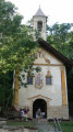
A lovely walk – it’s a shame the restored chapels aren’t open...

Machine-translated

bernardino
bernardino ★

Hello
As far as I can tell, no, this walk isn’t in the Parc des Ecrins or its buffer zone.
Enjoy your walk
Bernard

Machine-translated

Etatap
Etatap

Hello,

I’d like to know if dogs are allowed on this walk?

Kind regards,

Claire

Machine-translated

Other walks in the area

For more walks, use our search engine .

The GPS track and description are the property of this route's author. Please do not copy them without permission.