


Bruno13

 Visorando Member
 Premium user
 - Gender: man
Sign up:
Published route(s)
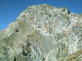
 Rocher de l’Yret seen from the top of the Bachas chairlift
 4.49 mi
 +2,152 ft
 -2,175 ft
 3h 55
3h 55
 Difficult
 Departure from Le Monêtier-les-Bains (Hautes-Alpes)
Preliminary note: this challenging hike is recommended for experienced walkers.Warning: the final section, from the top of the Yret chairlift to the summit of the Rocher de l’Yret , is extremely tricky, as the slope is very steep and the rock slabs are slippery.