


Refine your search for walks in Rivière de la Génie Longue
Rivière de la Génie Longue walks


 Around Saint-Pé-de-Bigorre
 Visorando Member
 4.35 mi
 +512 ft
 -538 ft
 2h 25
 Moderate
 Departure from Saint-Pé-de-Bigorre (Hautes-Pyrénées)
In the Hautes-Pyrénées, near Lourdes, Saint-Pé-de-Bigorre reveals some of its charms during this hike: architecture, limestone massif and caves (with views of the Gave de Pau and the surrounding mountains), and even its Devil's Bridge!
Meadows of Garrapit and Bénac on the slopes of the Araü
 5.24 mi
+1,903 ft
-1,903 ft
4h 05
Moderate
Departure from Saint-Pé-de-Bigorre (Hautes-Pyrénées)
On the forgotten trails of Saint-Pé-de-Bigorre No. 6
The Araü is the mountainous ridge jutting out from the Massif de Saint-Pé down to the Gave de Pau at the foot of the village. Its imposing, entirely wooded silhouette conceals pretty clearings, once meadows, some well-known paths and others forgotten, used only by hunters and hiking enthusiasts beneath the tall trees of the forest.
Its summit, towering arrogantly over the village, is the Soum de las Toupiettas (1,357m).
Soum de la Génie Braque via the Tres-Croutz forest
 6.27 mi
+3,698 ft
-3,698 ft
6h 05
 Difficult
Departure from Saint-Pé-de-Bigorre (Hautes-Pyrénées)
A lovely mid-mountain hike through the lush forest of Saint-Pé-de-Bigorre (or Tres-Croutz or Crouts = Three Crosses in Bigourdan). The first quarter of the hike is a bit challenging, as it is steep. You then pass through the Aülhet and Artigue mountain pastures, before following the ridge westwards to the summit of Soum de la Génie Braque. Well known to locals, this route offers a guaranteed change of scenery!
The valleys of Yerse and Aguée via Arriousec to Peyras
 10.62 mi
+4,695 ft
-4,678 ft
8 hrs
 Very difficult
Departure from Asson (Pyrénées-Atlantiques)
On the forgotten trails of Saint-Pé-de-Bigorre No. 5A long journey from the Ouzom Valley, through Les Aoules, to the Génies Valley, in the unfathomable Saint-Pé massif.In all seasons, the landscapes and forests are impressive and majestic.Its main attraction lies in the beauty of the two valleys crossed from end to end: the Yerse and the Aguée, sites of ancestral pastoralism where shepherds and their flocks lived from June to October. There are still many traces of this to be found.
 The Marbrières de la Génie Longue in Peyras
 4.95 mi
+351 ft
-381 ft
1.5 hrs
 Easy
Departure from Saint-Pé-de-Bigorre (Hautes-Pyrénées)
A short cycle ride along the banks of the Génie Longue torrent in the Saint Pé-de-Bigorre massif, where the forest of the same name begins, or the Très-Croutz (Trois-Croix in the Bigourdan dialect).
You’ll discover a cluster of buildings, completely overgrown by lush vegetation, which see very little sunlight.
This deeply mysterious forest and these abandoned buildings from the early 20th-century marble industry transport us into the land of the genies...
Walks near Rivière de la Génie Longue
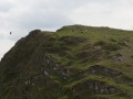
Très-Crouts Forest – Saint-Pé-de-Bigorre – Ridge Route
 8.64 mi
+3,868 ft
-3,822 ft
7h 20
Moderate
Departure from Asson (Pyrénées-Atlantiques)
This beautiful mid-mountain hike, suitable for experienced walkers, offers the chance to admire astonishing biodiversity and 360° panoramic views over the Piedmont plain and the main range of the Pyrenees.
After a strenuous climb, the route takes you across the mountain pastures on the Plateau de l’Isarce and along a stunning ridge – straddling the Hautes-Pyrénées and Pyrénées-Atlantiques departments – to the modest summit of the Soum de la Génie Braque. Well known to locals, this route offers a guaranteed change of scenery!
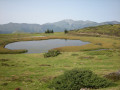
From the Col de Couraduque to the Col du Soulor via Lac de Soum
 5.01 mi
+1,083 ft
-738 ft
3h 15
Moderate
Departure from Aucun (Hautes-Pyrénées)
An easy walk with some lovely views. Using two cars (one at Couraduque and one at Soulor) makes this walk accessible to everyone. Otherwise, you can return via the same route in the opposite direction.
The Henri IV Trail
 20.70 mi
+732 ft
-1,421 ft
10h 10
Difficult
Departure from Lourdes (Hautes-Pyrénées)
A beautiful route linking Lourdes to Pau along an ancient Roman road steeped in history. The Henri IV trail stretches across the Hautes-Pyrénées and Pyrénées-Atlantiques departments, along the foothills of the Pyrenees.
From Les Aoules to Ferrières via the Soum de Souste and the Soum d’Arangou
4.42 mi
+2,241 ft
-1,962 ft
4h 00
Moderate
Departure from Arthez-d'Asson (Pyrénées-Atlantiques)
This walk is only suitable for walkers who are comfortable with steep and long climbs. This rarely used route offers a peaceful walk in absolute silence in the shade of the Monbula woods. You must first leave a car at the finish point on the D126, on the left-hand side of the road, and then walk to the Aoules car park. The walk can be done in either direction, but the descent towards Ferrières will be easier.
Estaing – Cauterets
 13.50 mi
+4,301 ft
-4,534 ft
9h 55
Difficult
Departure from Estaing (Hautes-Pyrénées) (Hautes-Pyrénées)
The second stage of the trek, starting from Estaing and heading towards the spa town of Cauterets, via Lakes Estaing and Ilhéou.
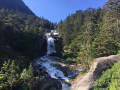
Cauterets – Wallon Marcadau Mountain Hut
 12.83 mi
+5,738 ft
-2,556 ft
10 hrs
Very difficult
Departure from Cauterets (Hautes-Pyrénées)
The third stage of the trek, starting from Cauterets and heading towards the Wallon Marcadau mountain hut via the high-altitude lakes (Embarrat, Pourtet and Nère), featuring in particular the magnificent climb to Pont d’Espagne alongside the waterfalls.
Gourette – Estaing
 11.76 mi
+3,691 ft
-4,915 ft
8h 35
Difficult
Departure from Eaux-Bonnes (Pyrénées-Atlantiques)
The first stage of the 9-day trek, linking the resort of Gourette to the village of Estaing as it winds its way between the two great Pyrenean passes of the Aubisque and the Soulor.
From Gourette to Saint-Lary-Soulan
109.40 mi
+31,391 ft
-33,186 ft
8 days
Very difficult
Departure from Eaux-Bonnes (Pyrénées-Atlantiques)
An 8-stage hiking tour, undertaken by two of us from 17 to 25 July 2019, between Gourette and Saint-Lary-Soulan. The route follows theGR®10trail for the most part, although we added a detour through the Marcadau Valley as well as a rest day in Gavarnie.
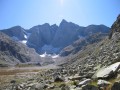
3 days in the Central Pyrenees Park from Cauterets
 30.88 mi
+10,197 ft
-10,226 ft
3 days
Difficult
Departure from Cauterets (Hautes-Pyrénées)
Explore the Pyrenees National Park (central section) with a trip to Spain, lakes and mountain passes at an altitude of 2,600 metres.
With an average elevation gain of ± 1,230 m and a distance of 17 km per day, this trip is, all in all, quite strenuous.
Please take into account the cumulative elevation gain and the distance to be covered.
The trip takes place between 1000 m and 2655 m altitude.
The start of this route is accessible by public transport (coaches and shuttle bus from Cauterets in summer).
From Cauterets to Ilhéou
 9.24 mi
+4,295 ft
-1,217 ft
8h 00
Moderate
Departure from Cauterets (Hautes-Pyrénées)
First day of a three-day route in the Central Pyrenees National Park.
This circular is best done from mid-June until the first cold spells.
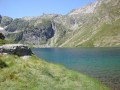
Ascent to Lac Noir, Col d'Ilhéou, Ilhéou Refuge and Lac d'Ilhéou.