Terzo Alpini Mountain Hut – Névache

This third stage of the route will take you to the village of Névache via the Col du Vallon, once again following theGRP® “Tour du Thabor”. The climb to the pass is difficult, particularly the section through the scree slope, a former glacier. Due to its exposure, the gully leading up to the pass is prone to snowfields.
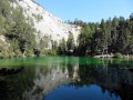
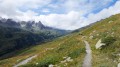
The scenery is fabulous. The descent towards Névache is superb, through a lush green valley, alongside a torrent and past a beautiful chapel.

This walk is part of a multi-day hike: The Thabor Circuit in 5 days

Details

1414629
Creation:
Last update:
Last review:
  • Walking
    Activity: Walking
  • ↔
    Distance: 8.80 mi
  • ◔
    Average duration: 6h 35 
  • ▲
    Difficulty: Difficult

  • ⚐
    Back to start: No
  • ↗
    Ascent: + 2,884 ft
  • ↘
    Descent: - 3,455 ft

  • ▲
    Highest point: 8,681 ft
  • ▼
    Lowest point: 5,233 ft

Photos

Description of the walk

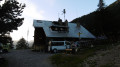
(S) From the Terzo Alpini refuge, rejoin theGR® 5 and 57, the track taken the previous day, to reach the Granges de la Vallée Étroite and the I Re Magi refuge.

(1) Continue to the junction where theGR® branches off to the right at the Pont de la Fonderie.

(2) Leave theGR® and head up to the left along the wide track to the Maison des Chamois.
On the right is a large cross.

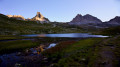
(3) Continue onthe GRP®, following the yellow and red markings. The path climbs steeply to the left in a series of hairpin bends. The slope is steep. Be careful at the junction: do not continue straight on into a small valley. Continue due west. Further up, go round the Tête du Chien. Enjoy the view here of the Seru and Mont Thabor.

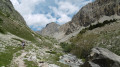
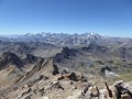
(4) Begin the long, south-facing ascent up the gully leading to the Col du Vallon. Make your way across a wide scree slope where large patches of snow may be found. The climb is very difficult. The Col du Vallon is at an altitude of 2,650 metres. At the summit, the view is extraordinary, both to the north towards the Thabor and to the south over the valley leading down to Névache.

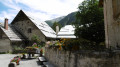
(5) Begin the descent into a lush green valley through which torrents flow. To the right, landslides indicate advanced erosion. During the descent, note a large rocky outcrop on the left: the Rochers de la Miglia and de la Paria. Reach the Chapelle St Michel after passing the Chalets du Vallon on your left.

(6) Continue the descent, keeping a southerly direction at all times, until you reach the junction with the D301T further down, the road leading to the Upper Clarée Valley.

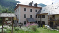
(7) Turn left onto this road and follow it to the village. You will then reach the ‘La Découverte’ lodge (E), your ‘stop for the day’.

Waypoints

  1. S : mi 0 - alt. 5,823 ft - Refuge Terzo Alipini
  2. 1 : mi 0.14 - alt. 5,781 ft - Refuge I Re Magi
  3. 2 : mi 1.4 - alt. 6,227 ft - Pont de la Fonderie
  4. 3 : mi 2.01 - alt. 6,716 ft - Maison des Chamois
  5. 4 : mi 2.99 - alt. 7,694 ft - Vallon
  6. 5 : mi 3.89 - alt. 8,681 ft - Col du Vallon
  7. 6 : mi 6.35 - alt. 6,955 ft - St Michel Chapel
  8. 7 : mi 8.28 - alt. 5,466 ft - RD301T
  9. E : mi 8.8 - alt. 5,233 ft - The Découverte lodge near the - Clarée (rivière)

Notes

A challenging stage, suitable only for experienced and fit walkers.
Thunderstorms are common at this time of year.
You’ll find water along the entire route.

Worth a visit

Névache: This typical village is well worth a visit, despite the fatigue of the stage.

Always be cautious and plan ahead when you're outdoors. Visorando and the author of this route cannot be held responsible for any accidents occurring on this route.

The GR® and PR® markings are the intellectual property of the Fédération Française de Randonnée Pédestre.

Other walks in the area

For more walks, use our search engine .

The GPS track and description are the property of this route's author. Please do not copy them without permission.