


Refine your search for walks in Réauville
Réauville walks


 The Abbey of Aiguebelle in Réauville
 Visorando Member
 9.91 mi
 +1,076 ft
 -1,073 ft
 5h 30
5h 30
 Moderate
 Departure from Réauville (Drôme)
This is a pleasant family walk, the first part of which takes place in the forest and leads to the Monastery of Aiguebelle, located on the loop. The second part leads through heathland and lavender fields to a plateau where the view gradually opens up to Mont Ventoux, the Dentelles de Montmirail, La Lance, the Baronnies and, closer by, the Château de Grignan and the Donjon de Chamaret.
Around Réauville
 3.85 mi
+233 ft
-233 ft
2h 00
3.85 mi
+233 ft
-233 ft
2h 00
 Easy
Departure from Réauville (Drôme)
Easy
Departure from Réauville (Drôme)
Short, easy walk around the pretty village of Réauville.
From Réauville to Aiguebelle Abbey
 4.92 mi
+499 ft
-486 ft
2h 40
Moderate
Departure from Réauville (Drôme)
4.92 mi
+499 ft
-486 ft
2h 40
Moderate
Departure from Réauville (Drôme)
A pleasant hike that takes you from Réauville, a charming village in the Drôme Provençale, to the Abbey of Notre-Dame d'Aiguebelle.
Route discovery through Réauville, Aiguebelle and Montjoyer
 9.25 mi
+912 ft
-899 ft
5h 05
Moderate
Departure from Réauville (Drôme)
9.25 mi
+912 ft
-899 ft
5h 05
Moderate
Departure from Réauville (Drôme)
A beautiful walk between the villages of Réauville and Montjoyer and the Abbey of Notre-Dame d'Aiguebelle.
Réauville via the Serre de la Motte, starting from Aiguebelle
 8.75 mi
+1,073 ft
-1,066 ft
4h 55
Moderate
Departure from Réauville (Drôme)
8.75 mi
+1,073 ft
-1,066 ft
4h 55
Moderate
Departure from Réauville (Drôme)
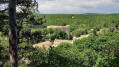
A pleasant, easy circular loop leading to the Serre de la Motte. Suitable for families and all seasons.
Circular route on the Rouvergue plateau via the cliffs
 6.94 mi
+509 ft
-495 ft
3h 40
Moderate
Departure from Chantemerle-lès-Grignan (Drôme)
6.94 mi
+509 ft
-495 ft
3h 40
Moderate
Departure from Chantemerle-lès-Grignan (Drôme)
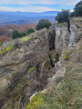
The first part of this route follows the edges of the Rouvergue plateau. From the top of the cliffs, it overlooks the Crevasses de Chantemerle, which appeared after a series of earthquakes that shook the region from June 1772 to December 1773. This promontory also offers superb panoramic views from west to east for 5 km. The second part of the route takes you on a pleasant walk across the plateau, from the undergrowth to cultivated land. In June, the lavender fields add extra charm to the Provençal farmhouses built on this land.
Chantemerle-lès-Grignan
 7.40 mi
+538 ft
-518 ft
3h 50
Easy
Departure from Chantemerle-lès-Grignan (Drôme)
7.40 mi
+538 ft
-518 ft
3h 50
Easy
Departure from Chantemerle-lès-Grignan (Drôme)
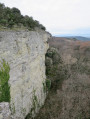
Discover the top of Chantemerle, through part of the Bois du Rouvergue, and return via the top of the crevasses.
 Pays de Grignan - From tower to cave
 Local authority11.90 mi
+279 ft
-302 ft
2.5 hrs
Moderate
Departure from Grignan (Drôme)
Local authority11.90 mi
+279 ft
-302 ft
2.5 hrs
Moderate
Departure from Grignan (Drôme)
This easy route takes you on a tour of the south of Grignan, with its truffle oaks and lavender fields. You’ll pass by the Saint-Barthélémy Chapel and the village of Chamaret with its famous hilltop tower. You’ll follow a picturesque path along the River Lez. On the way back, you’ll pass the famous Rochecourbière Cave and catch a glimpse of Madame de Sévigné’s ‘period table’.
Pays de Grignan - Vineyards and cabins
5.56 mi
+167 ft
-167 ft
1.5 hrs
Easy
Departure from Grignan (Drôme)
This route departs from Grignan and takes you along small roads and picturesque paths to visit the hamlet of La Grande Tuilière and the renowned Domaine de Montine wine estate. You will then take a path through the vineyards, with the added bonus of a beautiful view of the equally famous Château de Grignan. From there, a fun trail will take you back towards the village, then you will take the grassy paths to reach the end of your mountain bike ride.
Around Grignan via Les Montines
 4.59 mi
+279 ft
-276 ft
2h 20
Easy
Departure from Grignan (Drôme)
4.59 mi
+279 ft
-276 ft
2h 20
Easy
Departure from Grignan (Drôme)
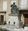
A pleasant, easy hike. Very charming thanks to the magnificent view of Grignan Castle, residence of the Comtesse de Sévigné, among others. Passing by the summit of Les Montines and a "sea of hills".
On the trail of the drystone shelters of Chamaret
 6.00 mi
+367 ft
-344 ft
3h 05
Easy
Departure from Chamaret (Drôme)
6.00 mi
+367 ft
-344 ft
3h 05
Easy
Departure from Chamaret (Drôme)
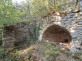
A circular loop, mostly shaded by undergrowth, where the trails are regularly used by the inhabitants of Chamaret and neighbouring villages. There are therefore many tracks, so you will need to remain vigilant if you want to find the well-hidden drystone shelters. In addition to the description, we recommend using the app's GPS.
Circular Chamaret to Grignan
 5.76 mi
+203 ft
-207 ft
2h 50
Easy
Departure from Chamaret (Drôme)
5.76 mi
+203 ft
-207 ft
2h 50
Easy
Departure from Chamaret (Drôme)
This easy route will allow you to discover two charming villages in Drôme Provençale with a rich architectural heritage. Pleasant in all seasons, it winds its way between vineyards and lavender fields, offering views of the Lance mountain and the nearby Baronnies from the plain.
Pays de Grignan - Rochecourbière
6.28 mi
+131 ft
-141 ft
1.5 hrs
Easy
Departure from Chamaret (Drôme)
This very easy route will first take you through the village and past the Chamaret Tower, then on to the market-gardening plateaus of Les Paluds and Les Marsenches. At a fork in the path, you’ll spot the beautiful stone cross at Les Vicaires, before discovering the fabulous Rochecourbière Cave and Madame de Sévigné’s stone table. Lovely paths through truffle oaks and lavender will take you back to Chamaret, passing by the wonderful Saint-Barthélémy Chapel.
The Crossroads - Pays de Grignan
19.47 mi
+1,112 ft
-1,112 ft
4 hrs
 Difficult
Departure from Chamaret (Drôme)
Difficult
Departure from Chamaret (Drôme)
This challenging route takes you along the banks of the Lez, then across the plain and up to the heights of Montségur-sur-Lauzon. This village has preserved the remains of the medieval castle and its ramparts, known as Vieux Montségur. You’ll continue along beautiful paths to the village of Solérieux. You will then climb to higher ground and arrive at a spot offering a superb view of Clansayes and its perched statue of the Virgin Mary. Following magnificent single tracks, you will cross part of the Rouvergue woods to reach Chamaret.
From the old TGC line to the new Grignan Discovery Trail
 6.38 mi
+180 ft
-203 ft
3h 25
Moderate
Departure from Chamaret (Drôme)
6.38 mi
+180 ft
-203 ft
3h 25
Moderate
Departure from Chamaret (Drôme)
A pleasant and informative family hike that connects two beautiful villages. Part of the route allows you to discover the history of the TGC (Taulignan-Grignan-Chamaret), a secondary railway line in the Drôme department that was abandoned in 1927. Another part follows the "De truffières en ramière" discovery trail through the countryside around Grignan, with information panels on the natural heritage and human activities in this corner of Provence.
From one bank of the Lez to the other
 7.12 mi
+469 ft
-492 ft
3h 35
Moderate
Departure from Chamaret (Drôme)
7.12 mi
+469 ft
-492 ft
3h 35
Moderate
Departure from Chamaret (Drôme)
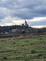
From Chamaret to Colonzelle, this hike can be enjoyed in all seasons, even in hot weather. This fairly shaded route runs from the left bank to the right bank of the Lez, offering several opportunities to cool off in the river. On the right bank, it takes you through the charming village of Chamaret, identifiable from afar by its tower (which can be visited), and past four well-preserved drystone shelters. On the left bank, the steeper terrain offers several viewpoints on a cliff-top path and runs alongside the old millstone quarries in the cliff.
Citelles valley and its hamlet, via the wind farm
 11.33 mi
+1,047 ft
-1,050 ft
2 hrs
Easy
Departure from Rochefort-en-Valdaine (Drôme)
11.33 mi
+1,047 ft
-1,050 ft
2 hrs
Easy
Departure from Rochefort-en-Valdaine (Drôme)
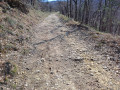
A route mainly following tracks and forest paths offering lovely 360° views, passing through the wind farm and its numerous wind turbines, from the Rhône Valley to Mont Ventoux, as well as a chance to discover the pretty little hamlet of Cîtelles and its valley.
The Cîtelles Stream
 5.92 mi
+682 ft
-686 ft
3h 20
Moderate
Departure from La Touche (Drôme)
5.92 mi
+682 ft
-686 ft
3h 20
Moderate
Departure from La Touche (Drôme)
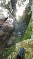
This is an easy hike that alternates between cool woodland and wide open trails on the plateau. You will pass through the hamlet of CÎtelles with its small chapel and waterfall, which is only accessible from above. The return journey follows the stream, where you can take a dip in places.
The route crosses the river four times via small bridges or large stones.
This is a very pleasant walk in summer, and the breaks by the water are very welcome.
Serre de Mirabel from Citelles
 6.56 mi
+837 ft
-840 ft
3h 45
Moderate
Departure from Montjoyer (Drôme)
6.56 mi
+837 ft
-840 ft
3h 45
Moderate
Departure from Montjoyer (Drôme)
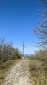
A lovely walk starting from the hamlet of Citelles, where the waterfall flows, and ending at the Serre de Mirabel. There are several viewpoints overlooking the Jabron valley as far as the foothills of the Vercors and the Mont Ventoux. The route is very varied, taking you through woodland, along tracks and paths, amidst forests of beech, oak and pine trees, and through fields of lavender.
The millstones at Colonzelle
 4.21 mi
+272 ft
-299 ft
2h 10
Easy
Departure from Colonzelle (Drôme)
4.21 mi
+272 ft
-299 ft
2h 10
Easy
Departure from Colonzelle (Drôme)
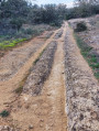
Family walk along the Lez. Different crops, including lavender, oak trees and vineyards, contrast with the cliffs. Pass through the quarry carved into the sandstone where thousands of millstones were carved for the mills.
The hilltop villages at the start of Allan
10.52 mi
+1,818 ft
-1,788 ft
6h 25
Moderate
Departure from Allan (Drôme)
From the old village of Allan to the castle of Rochefort-en-Valdaine, a beautiful hike on either side of the Citelle. Whether from the ruins of the old village of Allan, the castle of Rochefort or the many clearings along this hike, you will enjoy beautiful panoramic views of the Rhône valley and the surrounding mountains.
Moderator's note : private property issue? Alternative route possible, see reviews.
Ruins of the old village of Allan and Siméon's Cross
 5.94 mi
+689 ft
-682 ft
3h 20
Easy
Departure from Allan (Drôme)
5.94 mi
+689 ft
-682 ft
3h 20
Easy
Departure from Allan (Drôme)
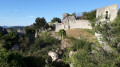
This hike to the ruins of Old Allan offers panoramic views of the Rhône Valley between Donzère and Cruas. The first part of the trail alternates between wide, open woodland paths and, halfway along, you will discover the Croix Siméon. The trail then becomes narrower and more winding, remaining shaded and sheltered.
Le Janeston
 4.22 mi
+653 ft
-673 ft
2h 30
Easy
Departure from Rochefort-en-Valdaine (Drôme)
4.22 mi
+653 ft
-673 ft
2h 30
Easy
Departure from Rochefort-en-Valdaine (Drôme)
From the medieval site of Rochefort-en-Valdaine, discover the slopes of the Citelles valley and climb up to the Janeston plateau. The prefix "jan" (broom wood, juniper heath) is characteristic of Mediterranean vegetation.
From Rochefort-en-Valdaine Castle to the ruins of Notre-Dame la Brune
 17.45 mi
+1,352 ft
-1,355 ft
3 hrs
Moderate
Departure from Rochefort-en-Valdaine (Drôme)
17.45 mi
+1,352 ft
-1,355 ft
3 hrs
Moderate
Departure from Rochefort-en-Valdaine (Drôme)
Route mainly following tracks and forest paths offering beautiful 360° views, from the Rhône Valley to Mont Ventoux. Circular route that circles the catchment area of the Citelles stream, from the Château de Rochefort-en-Valdaine to the ruins of Notre-Dame la Brune, passing through the wind farm and its numerous wind turbines.
The Cross of Simeon in Allan
 6.59 mi
+1,076 ft
-1,056 ft
4h 00
Moderate
Departure from Allan (Drôme)
6.59 mi
+1,076 ft
-1,056 ft
4h 00
Moderate
Departure from Allan (Drôme)
This hike is ideal for lovers of old buildings and nature. It takes you to the heights of Allan and its old village and 12th-century castle, now in ruins. It then leads into the heart of the forest, along small paths to La Croix de Siméon, erected in honour of a monk from Aiguebelle who was a missionary in Africa. Aimed at experienced hikers, this hike also offers panoramic views of Savasse and the Montélimar plain.
Circular of the Val des Nymphes at Creux Rouge
 4.48 mi
+446 ft
-459 ft
2h 25
Easy
Departure from La Garde-Adhémar (Drôme)
4.48 mi
+446 ft
-459 ft
2h 25
Easy
Departure from La Garde-Adhémar (Drôme)
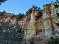
An easy circular for the whole family, starting from the Val des Nymphes site with its 12th-century Romanesque chapel, pond and springs, 2 km from La Garde Adhémar. This circular takes you through a mini Provençal Colorado that will delight children. However, avoid this route after heavy rain (it's slippery!) and during big game hunting season at weekends (wild boar hunts are quite frequent).
Via Pinet and Sagnac, starting from Espeluche
 5.59 mi
+568 ft
-581 ft
3h 05
Easy
Departure from Espeluche (Drôme)
5.59 mi
+568 ft
-581 ft
3h 05
Easy
Departure from Espeluche (Drôme)
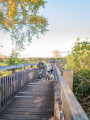
This walk starting from Espeluche takes you on a tour of the surrounding area along its narrow roads lined with lavender fields and forest paths, with views of the nearby hilltop villages.
Rochefort-en-Valdaine Castle
 7.14 mi
+1,234 ft
-1,230 ft
4h 20
Moderate
Departure from Espeluche (Drôme)
7.14 mi
+1,234 ft
-1,230 ft
4h 20
Moderate
Departure from Espeluche (Drôme)
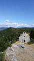
Starting from Espeluche, this circuit takes you along pretty paths in the Bois de Fonbrenoux to the partly ruined castle of Rochefort-en-Valdaine, which still has its 13th-century Saint-Blaise chapel, listed as a historic monument. It then continues along the ridges, offering beautiful views of the valley.
The Bois de Jamot
 6.91 mi
+945 ft
-935 ft
4h 00
Moderate
Departure from Espeluche (Drôme)
6.91 mi
+945 ft
-935 ft
4h 00
Moderate
Departure from Espeluche (Drôme)
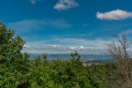
Walk through the Bois de Jamot, surrounded by the scent of pine trees, on a gentle path that heralds the colours of Provence.
Notre-Dame d'Aiguebelle Abbey from Espeluche
 10.62 mi
+1,450 ft
-1,434 ft
6h 10
Moderate
Departure from Espeluche (Drôme)
10.62 mi
+1,450 ft
-1,434 ft
6h 10
Moderate
Departure from Espeluche (Drôme)
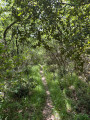
Starting from Espeluche, this walk will take you to Notre-Dame d'Aiguebelle Abbey. Passing through a variety of tracks, small paths and trails depending on the season, you will have the opportunity to discover a wide variety of flora and fauna.
The Barbara Chapel and the old village of Allan, starting from Espeluche
 8.90 mi
+1,207 ft
-1,184 ft
5h 10
Moderate
Departure from Espeluche (Drôme)
8.90 mi
+1,207 ft
-1,184 ft
5h 10
Moderate
Departure from Espeluche (Drôme)
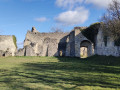
This walk will take you back to the 12th century with the ruins of the Chapelle Barbara and the old village of Allan. Various views of the village of Espeluche, Mont Ventoux and the Ardèche mountains.
The Chapel of Notre-Dame de Montceau
 8.25 mi
+810 ft
-801 ft
4h 30
Moderate
Departure from Espeluche (Drôme)
8.25 mi
+810 ft
-801 ft
4h 30
Moderate
Departure from Espeluche (Drôme)
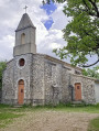
A hike that is not too difficult overall, with many tarmac sections but little traffic. The final climbs to reach Butte de Montceau, whose name means ‘little hill’, and the chapel are the only challenging parts of this route. The chapel was built on the site of ancient Gallo-Roman burial grounds that were later Christianised.
Rochefort-en-Valdaine Castle and IGN marker
 9.92 mi
+1,542 ft
-1,545 ft
5h 55
Moderate
Departure from Espeluche (Drôme)
9.92 mi
+1,542 ft
-1,545 ft
5h 55
Moderate
Departure from Espeluche (Drôme)
A walk to the Château de Rochefort-en-Valdaine already exists on Visorando, no. 1698620, but this one takes a completely different route.It also has a different start and finish point; it will take you to the highest point of Espeluche (IGN marker) via paths where, depending on the season, the flora and fauna will vary, as well as to the Château de Rochefort-en-Valdaine.You will pass through the charming little village of Espeluche.
Notre-Dame de Toronne from Clansayes
 5.43 mi
+735 ft
-745 ft
3h 10
Easy
Departure from Clansayes (Drôme)
5.43 mi
+735 ft
-745 ft
3h 10
Easy
Departure from Clansayes (Drôme)
This route takes you along pleasant paths in the heart of nature between Clansayes and Saint-Paul-Trois-Châteaux.
You will also enjoy beautiful views of the Vaucluse and Mont Ventoux, as well as the Rhône Valley and the Ardèche mountains.
The return journey is via the Combe du Verger, and you can reach the Notre-Dame de Toronne Chapel via its Way of the Cross.
When you arrive, take the time to visit the beautiful village of Clansayes.
The Citelle and Serre Pointu streams
 7.27 mi
+1,076 ft
-1,066 ft
4h 15
Moderate
Departure from La Touche (Drôme)
7.27 mi
+1,076 ft
-1,066 ft
4h 15
Moderate
Departure from La Touche (Drôme)
Let yourself be carried away by the diversity of the landscapes along this hike! The route takes you along the Ruisseau de Citelles stream and follows in the footsteps of its past, with old hamlets and mills, before climbing up to the plateau covered with lavender fields.
Around Mastaize
 5.27 mi
+407 ft
-436 ft
2h 45
Easy
Departure from La Touche (Drôme)
5.27 mi
+407 ft
-436 ft
2h 45
Easy
Departure from La Touche (Drôme)
With its mix of small country lanes, paths lined with fields and forest trails, this peaceful route offers a lovely escape into the countryside with views of the surrounding hills.
The ridges of Rochefort-en-Valdaine
 6.96 mi
+1,020 ft
-1,004 ft
4h 05
Moderate
Departure from La Touche (Drôme)
6.96 mi
+1,020 ft
-1,004 ft
4h 05
Moderate
Departure from La Touche (Drôme)
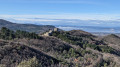
This lovely loop along the ridges of L'Izard and Mont Laroche offers magnificent views of the Roubion valley as far as the foothills of the Vercors and the 3 Becs.
Starting from the pretty village of La Touche, the route passes the castles of Rochefort-en-Valdaine, then the truffle fields of Janeston.
The hike also crosses the pretty little hamlet of Moulin de Bay on the riverbank, via a succession of varied paths and trails, which are sometimes steep but only for short distances.
The lapidary vats and the Val des Nymphes
 4.43 mi
+499 ft
-512 ft
2h 30
Easy
Departure from La Garde-Adhémar (Drôme)
4.43 mi
+499 ft
-512 ft
2h 30
Easy
Departure from La Garde-Adhémar (Drôme)
Above the Val des Nymphes, the IGN map refers to so-called "sacrificial stones". This magnificent hike allows you to see some of them, then revisit the magical site around the chapel.
The Val des Nymphes
 5.11 mi
+440 ft
-440 ft
2h 45
Easy
Departure from La Garde-Adhémar (Drôme)
5.11 mi
+440 ft
-440 ft
2h 45
Easy
Departure from La Garde-Adhémar (Drôme)
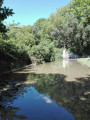
Most of the walk is through the woods in the Drôme Provençale. This route offers beautiful views of the Rhône valley and lavender fields, as well as a village classified as one of the most beautiful in France, with some buildings dating back to the Renaissance.
Around La Garde-Adhémar
 7.61 mi
+928 ft
-958 ft
4h 20
Moderate
Departure from La Garde-Adhémar (Drôme)
7.61 mi
+928 ft
-958 ft
4h 20
Moderate
Departure from La Garde-Adhémar (Drôme)
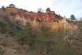
A beautiful route for exploring history and its vestiges. The geology of a little-known site (very beautiful passage through the ochre cliffs of a mini-Colorado). Gallo-Roman cult at the Val des Nymphes, springs and priory. Lapidary tanks reminiscent of ancient work dating back to Gallo-Roman times (millstones, known as "sacrificial stones", ancient wine presses dating from late Antiquity to the 12th or 13th century). Medieval fiefdom of the Adhémar family in the 12th century.
Bassin des Druides and castle in Montségur-sur-Lauzon
 6.90 mi
+538 ft
-528 ft
3h 40
Moderate
Departure from Montségur-sur-Lauzon (Drôme)
6.90 mi
+538 ft
-528 ft
3h 40
Moderate
Departure from Montségur-sur-Lauzon (Drôme)
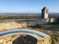
Discover the remains of local history: the 11th-century Barquets Chapel, the Martinet aqueduct bridge (1852), the Druids' Basin, 19th-century pumping stations, traces of an old quarry and troglodyte dwellings, St-Jean Chapel, and the ruins of the castle that was once the hideout of the Baron des Adrets.
Aleyrac - Citelles
 6.17 mi
+568 ft
-587 ft
3h 20
Easy
Departure from Aleyrac (Drôme)
6.17 mi
+568 ft
-587 ft
3h 20
Easy
Departure from Aleyrac (Drôme)
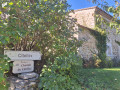
A peaceful hike along wide hillside paths, close to the picturesque, tiny, hidden village of Citelles.
The Navon by the ruins of Belle Eau
 3.71 mi
+479 ft
-479 ft
2h 05
Easy
Departure from Malataverne (Drôme)
3.71 mi
+479 ft
-479 ft
2h 05
Easy
Departure from Malataverne (Drôme)
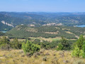
A circular route, often through woodland, along paths and small roads, between the villages of Malataverne and Donzère. Walkers will discover the remains of the ponds that adorned the Domaine de Belle Eau in the 19th century. A short climb takes you to the summit of the Navon, where you can admire a superb panorama of the Rhône valley.
Aleyrac Abbey
 5.20 mi
+663 ft
-669 ft
3h 00
Easy
Departure from Taulignan (Drôme)
5.20 mi
+663 ft
-669 ft
3h 00
Easy
Departure from Taulignan (Drôme)
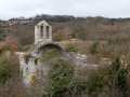
This loop leads to the moving ruins of the former Aleyrac Abbey. Along the way, you will enjoy views of the Grignan plain and the valley.
From Aleyrac to Serre de Forillon
 4.99 mi
+561 ft
-551 ft
2h 45
Easy
Departure from Aleyrac (Drôme)
4.99 mi
+561 ft
-551 ft
2h 45
Easy
Departure from Aleyrac (Drôme)
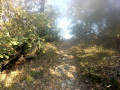
This walk follows wide forest tracks, leading to a viewpoint offering a 180° panorama of the Valdaine plain below, which is partly agricultural and partly wooded. A short circular route adds variety to the round trip.
The Portoise plain
 4.44 mi
+197 ft
-171 ft
2h 15
Easy
Departure from Portes-en-Valdaine (Drôme)
4.44 mi
+197 ft
-171 ft
2h 15
Easy
Departure from Portes-en-Valdaine (Drôme)
This route, with very little elevation gain, winds along the narrow roads of Portes-en-Valdaine, offering a 360° panoramic view of the village: its characteristic bell tower, its old village centre and the Serre de Mirabel in the background.
Short circular loop around Puygiron and the Chapelle Saint-Bonnet
 2.34 mi
+200 ft
-187 ft
1h 15
Easy
Departure from Puygiron (Drôme)
2.34 mi
+200 ft
-187 ft
1h 15
Easy
Departure from Puygiron (Drôme)
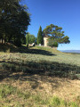
A short country walk surrounded by beautiful scenery near Montélimar.
Coste Chaude from the village of Puygiron
 4.29 mi
+367 ft
-371 ft
2h 20
Easy
Departure from Puygiron (Drôme)
4.29 mi
+367 ft
-371 ft
2h 20
Easy
Departure from Puygiron (Drôme)
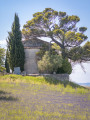
This walk goes around Coste Chaude, the dominant peak of Puygiron, before skirting the lavender fields and the Saint-Bonnet Chapel.
Around Mastaize between La Bâtie-Rolland and La Touche
 4.52 mi
+469 ft
-492 ft
2h 30
Easy
Departure from La Touche (Drôme)
4.52 mi
+469 ft
-492 ft
2h 30
Easy
Departure from La Touche (Drôme)
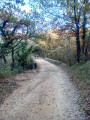
Through wooded and agricultural areas in the Drôme Provençale between Montélimar and Dieulefit.
Saint-Paul-Trois-Châteaux Heritage Walk
 Tourist office2.00 mi
+66 ft
-66 ft
1h 00
Easy
Departure from Saint-Paul-Trois-Châteaux (Drôme)
Tourist office2.00 mi
+66 ft
-66 ft
1h 00
Easy
Departure from Saint-Paul-Trois-Châteaux (Drôme)
This route, through the picturesque streets of Saint-Paul-Trois-Châteaux, allows you to stroll whilst discovering the town walls, fountains, wash houses and listed monuments, as well as part of the Promenade des Jardins, also known as the Coulée Verte.
The three chapels of Sainte-Juste, Chabrières and Saint-Sépulcre
 9.69 mi
+1,171 ft
-1,142 ft
5h 30
Moderate
Departure from Saint-Paul-Trois-Châteaux (Drôme)
9.69 mi
+1,171 ft
-1,142 ft
5h 30
Moderate
Departure from Saint-Paul-Trois-Châteaux (Drôme)
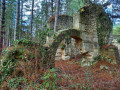
This is a pleasant walk along small paths, mainly through the woods. The various vantage points offer 360° panoramic views of the surrounding plains and mountain ranges. Crossing the underground quarries of Saint-Restitut gives you an insight into the difficult work of the quarrymen. There are numerous remains of dwellings around these quarries. A visit to the village of Saint-Restitut is also enjoyable.
Around Souspierre
 9.80 mi
+2,638 ft
-2,638 ft
6h 50
Difficult
Departure from Souspierre (Drôme)
9.80 mi
+2,638 ft
-2,638 ft
6h 50
Difficult
Departure from Souspierre (Drôme)
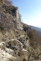
For experienced hikers, this is a beautiful hike, partly through the woods on unmarked trails. After a very beautiful passage along the ridge, they lead to cliffs followed by a dizzying descent into a rocky ridge to the Grotte de l'Ermite, a natural excavation in the rocks. Above, stand the summit of Châtelard and the ruins of an ancient watchtower dating from the Middle Ages, destroyed during the Wars of Religion. The panoramic view over the valley is superb.