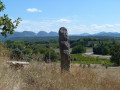
Pays de Grignan – The Roman Road

Starting amongst stone walls and lavender fields, you’ll then follow a path along the banks of the Lez to reach Le Calvaire, where the ancient Roman road begins. You’ll reach Colonzelle, then Chamaret via the Saint-Barthélémy Chapel. The route then takes you through the village’s narrow streets. You’ll come to the stone cross at Les Vicaires and walk alongside truffle oaks to the Grotte de Rochecourbière, before returning to the starting point.

Details

1214174
Creation:
Last update:
Last review:
  • Mountain biking
    Activity: Mountain biking
  • ↔
    Distance: 13.35 mi
  • ◔
    Duration according to the author: 2.5 hrs 
  • ▲
    Difficulty: Moderate

  • ⚐
    Back to start: Yes
  • ↗
    Ascent: + 361 ft
  • ↘
    Descent: - 351 ft

  • ▲
    Highest point: 663 ft
  • ▼
    Lowest point: 427 ft
  • ⚐ Country: France
  • ⚐
    Area: Dauphiné
  • ⚐ City: Chamaret (26230)
  • ⚑
    Start/End: N 44.396884° / E 4.883062°
  • ❏
    IGN map(s): Ref. 3039ET

  • ◶
    Type of surface: Not specified
  • ⇧
    Bike carrying: Not specified
  • ▲
    Difficulty: Not specified
  • Hour-by-hour weather

Description of the route

Mountain bike route marker no. 8
(S/E) From the car park at Place de la Libération, follow signpost no. 8, which leads to a lovely path lined with low stone walls. Further on, ride alongside a field of lavender until you reach a junction.

(1) Carry on straight ahead to reach the chimneys, where a picturesque, occasionally technical trail begins. Cross a small wooden footbridge. After a steep and technical climb, follow the River Lez along a smooth, rolling trail through the woodland until you reach a small road.

(2) Carry on straight ahead and turn left to join the D481. Watch out for cars! Turn left and continue along the road to reach Le Calvaire, heading towards Colonzelle.

(3) Take the path on the left to start the Voie Romaine. Watch out for a few technical sections, caused mainly by ‘plough wheels’. You will then reach the D231. Watch out for cars!

(4) Turn left towards Colonzelle and the ‘La Croix’ signpost. Turn left and cross the River Lez, then take a path on the right leading to Chamaret. Beautiful scenery lies ahead, and the route passes by the Saint-Barthélemy Chapel. Return to the starting point.

(S/E) At the church, cross the road to reach a typical narrow lane. Turn left onto the D71, then right. Continue along a small road until you join a path that leads to the D471; follow it to the right.

(5) Turn left and follow two more paths through the fields.

(6) When you reach the road, turn right, then head towards the D71. Watch out for cars! Cross straight ahead to follow a path leading very close to the Rochecourbière Cave. You can follow signpost no. 7 for 250 metres there and back to visit the cave.

(7) Turn right onto a lovely path, then follow a small road to the right until you reach the start of a ‘single track’ through truffle oaks. Continue across a plateau amidst the lavender fields. Head down the path to a three-way junction, and turn right, continuing on to the D71. Watch out for cars! Cross straight ahead.

(8) Turn left onto a lovely path, which also follows an ancient Roman road.
Follow signpost no. 8 to the finish. (S/E)

Waypoints

  1. S/E : mi 0 - alt. 591 ft - Place de la Libération (town hall)
  2. 1 : mi 0.89 - alt. 538 ft - Junction of three paths
  3. 2 : mi 2.38 - alt. 479 ft - Junction on a minor road
  4. 3 : mi 3.5 - alt. 476 ft - Le Calvaire signpost (alt. 155m)
  5. 4 : mi 5.35 - alt. 564 ft - Junction with the D231
  6. 5 : mi 7.96 - alt. 594 ft - D471
  7. 6 : mi 8.91 - alt. 594 ft - On the right-hand side of the road
  8. 7 : mi 10.31 - alt. 607 ft - Junction for access to the Rochecourbière Cave
  9. 8 : mi 12.43 - alt. 604 ft - D71 junction
  10. S/E : mi 13.35 - alt. 591 ft - Place de la Libération (town hall)

Notes

We strongly recommend that you take the IGN map referred to on these pages with you. Mountain bikers must be self-sufficient; professional guides are available if required. Emergency numbers: 18 or 112
Enquiries at the Pays de Grignan – Enclave des Papes Tourist Office: 04 75 46 56 75 (Grignan) and 04 90 35 04 71 (Valréas) / info@tourisme-paysdegrignan.com
Pays de Grignan Tourist Office
Valréas Tourist Office

Reviews and comments

4.7 / 5
Based on 2 reviews

Reliability of the description
5 / 5
Ease of following the route
4.5 / 5
Route interest
4.5 / 5
jpmjom
jpmjom

Overall rating : 5 / 5

Date of your route : May 30, 2021
Reliability of the description : ★★★★★ Very good
Ease of following the route : ★★★★★ Very good
Route interest : ★★★★★ Very good
Very busy route : No

A very varied route, both in terms of the paths taken (narrow country lanes, footpaths, a few scree slopes – though not difficult – and even a ford) and the scenery: lavender fields, of course, but also vineyards, olive groves and, not to mention, truffle oaks. At one point I must have got it wrong – I thought I was taking the route to the second ford, but in fact I ended up on the bypass that runs alongside a pigsty (which was very smelly!). It’s a shame I didn’t realise straight away. This route is also very hilly and is ideal for a leisurely walk, despite a few technical sections; round a bend in the path, we even saw a rabbit scampering off in front of us. Thank you for this very pleasant walk; the signposting is decent – I went the wrong way once but quickly got back on the right track.

Machine-translated

Goozi
Goozi
• Edited:

Overall rating : 4.3 / 5

Date of your route : Aug 08, 2020
Reliability of the description : ★★★★★ Very good
Ease of following the route : ★★★★☆ Good
Route interest : ★★★★☆ Good
Very busy route : No

A lovely route with varied scenery, offering a chance to connect with nature.
You’ll be sharing the path with walkers and joggers, but it’s all good fun.
Be aware of a few short technical sections on a mountain bike (large rocky steps) which you’ll need to walk down when cycling the circular route in the suggested direction. Going the other way, it’s passable but technical (over about 20 metres).
The estimated time given is quite generous. It can easily be completed in 2 hours.

Machine-translated

Other walks in the area

For more walks, use our search engine .

The GPS track and description are the property of this route's author. Please do not copy them without permission.