Chantemerle-lès-Grignan crevasse site

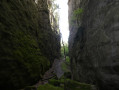
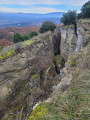
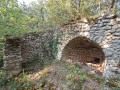
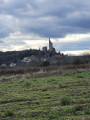
A short circular route offering the chance to explore a geological site dating back several thousand years, formed by impressive cliffs created following an earthquake in the 18th century.

Details

47769574
Creation:
Last update:
Last review:
  • Walking
    Activity: Walking
  • ↔
    Distance: 2.52 mi
  • ◔
    Average duration: 1h 20 
  • ▲
    Difficulty: Easy

  • ⚐
    Back to start: Yes
  • ↗
    Ascent: + 233 ft
  • ↘
    Descent: - 210 ft

  • ▲
    Highest point: 896 ft
  • ▼
    Lowest point: 696 ft

Photos

Description of the walk

Start from the car park at the village entrance when coming from Grignan, Place Bernard Barbier.

(S/E) Walk up the main road for a few tens of metres, then turn left onto Rue de la Côte. Keep right at the three-way junction and head towards Chemin des Amandiers.

(1) Turn left, pass a property on your left and you’ll soon come to a path on your right.

(2) Take this path and follow it to the next fork.

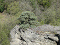
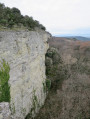
(3) Climb up to the left, then continue carefully along the path that runs along the edge of the rocks until you reach an open area with a rocky outcrop jutting out to the right.

(4) Turn back and return to the previous junction.

(3) Take a hairpin bend to the left, then quickly take the path on the left marked by a sign reading ‘Danger, risk of rockfalls’. After passing through a section of scrub, enter the canyon and arrive at a fork.

(5) Walk a few metres back and forth along the left-hand path, passing the base of a tree that has grown between the two cliffs, then return.

(5) Turn left and continue to the exit of the canyon.

(6) Then return along the same route you took on the way out until you reach the path coming down from the top of the cliffs.

(3) Carry on straight ahead and, following the route back along the same path as on the way out, join the Chemin des Amandiers.

(1) Walk down this path until you emerge onto Rue de l’Ancienne Forge. Turn right and return to the car park (S/E).

Waypoints

  1. S/E : mi 0 - alt. 696 ft - Car park at the entrance to the village
  2. 1 : mi 0.2 - alt. 755 ft - T-junction A/R
  3. 2 : mi 0.31 - alt. 784 ft - Path on the right
  4. 3 : mi 0.43 - alt. 791 ft - T-junction A/R
  5. 4 : mi 1.03 - alt. 892 ft - Open area
  6. 5 : mi 1.8 - alt. 840 ft - Junction in the canyon
  7. 6 : mi 1.88 - alt. 837 ft - End of the canyon
  8. S/E : mi 2.52 - alt. 696 ft - Car park at the entrance to the village

Notes

The path that runs along the edge of the cliff sometimes passes close to the drop-off – take care!

The path at the bottom of the canyon is signposted as dangerous due to the risk of falling rocks.

(6) The path then continues for a further hundred metres before reaching a private property where access is strictly prohibited.

Worth a visit

Reviews and comments

4.8 / 5
Based on 2 reviews

Reliability of the description
5 / 5
Ease of following the route
4.5 / 5
Route interest
5 / 5
Denis26
Denis26 ★

Sorry for the inconvenience

Machine-translated

Monique38
Monique38

Disappointed. Impossible to cross certain sections of the crevasses. The trail is closed due to "private property" at WP 6 and also further up the trail: I had to turn back twice without being able to complete the entire hike.

Machine-translated

Denis26
Denis26 ★

Monique38, when I did the hike, the private property was located at WP6, which is why we had to turn back.
Is this still the case, or is it before?

Machine-translated

Monique38
Monique38

Disappointed. Impossible to cross certain sections of the crevasses. The trail is off-limits, "private property": I had to turn back without being able to complete the entire hike.

Machine-translated

Luga26
Luga26

Overall rating : 5 / 5

Date of your route : Nov 03, 2024
Reliability of the description : ★★★★★ Very good
Ease of following the route : ★★★★★ Very good
Route interest : ★★★★★ Very good
Very busy route : Yes

A short walk offering great geological interest, particularly along the path inside the cliffs

Machine-translated

Isabelle 1234
Isabelle 1234
• Edited:

Overall rating : 4.7 / 5

Date of your route : Oct 11, 2024
Reliability of the description : ★★★★★ Very good
Ease of following the route : ★★★★☆ Good
Route interest : ★★★★★ Very good
Very busy route : No

Thank you for this lovely two-part walk. We didn’t have much time, and this route was ideal.
The autumn colours and glorious sunshine really brought out the best in the route.
Please note that the upper section isn’t suitable for young children as much of it runs along the edge of the cliff. The views are lovely.
The lower section is quite interesting too, as you pass through two gorges. The path is narrow and runs through dense vegetation, but it’s not particularly difficult.
You need to follow the signposts carefully, but they’re clear.

I would have liked to add some photos, but I don’t think that’s possible

Machine-translated

Other walks in the area

For more walks, use our search engine .

The GPS track and description are the property of this route's author. Please do not copy them without permission.