The Priory of L’Enfourchure

This route, running along the edge of the Othe Forest, takes you around the Prieuré de l’Enfourchure and Dixmont Church. The route is marked in yellow with the YonnePR® label. It is situated 12 km north of Joigny.

Details

n°843780
Creation:
Last update:
Last review:
  • Walking
    Activity: Walking
  • ↔
    Distance: 8.11 mi
  • ◔
    Average duration: 4h 15 
  • ▲
    Difficulty: Moderate

  • ⚐
    Back to start: Yes
  • ↗
    Ascent: + 614 ft
  • ↘
    Descent: - 597 ft

  • ▲
    Highest point: 764 ft
  • ▼
    Lowest point: 427 ft

Description of the walk

Park in the car park at the Prieuré de l’Enfourchure.

(S/E) Head north towards the woods. After the bridge, take the path on the left, ignoring all turnings to the left or right, until you reach a Fork in the road at the Dixmont cemetery.

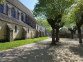
(1) Walk down the street on the left. At the junction, turn right towards the church. Follow Rue Saint-Protais to the right. At the fountain, turn left onto Route des Bordes for 300 m, then turn left onto Route d’Armeau for 500 m. Walk up Chemin des Misois. Follow the path that leads from it to rejoin the D122 road.

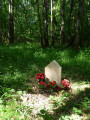
(2) Take this road straight ahead for a few metres, then head up the path opposite. Cross a new road at right angles at a memorial stone, and continue for a further 1 km through the woodland. The path becomes more enclosed. Join the D122 again, turn right onto it and head for the Petit Bois crossroads.

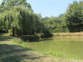
(3) Turn sharply left and head downhill to fords the Sucré. Go up the road on the right. At the hamlet of Les Brûleries, turn left onto the Chemin du Sucré for 250 metres. Follow the path to the left, which goes round a pond. Continue to the woods, follow the edge of the woods for 50 m to the left and head into the woods. The path follows the bed of the Ru Bignon (usually dry, spelt ‘Rubignon’ on the IGN map). On leaving the woods, head towards the hamlet of La Grande Hâte.

(4) In the square, turn right onto Rue de la Grande Fontaine. At the water tower, cross the D 20 and head towards La Tuilerie. Walk down Rue du Château d’Eau.

(5) At the crossroads, turn right onto the path that runs alongside a garden with a gazebo. Follow the edge of the woods until you reach a path junction in the Bois d’Hérisson.

(6) When the path begins to descend, enter the woods via a track on the left. At the gazebo, follow the path to the right and return to the car park (S/E).

Waypoints

  1. S/E : mi 0 - alt. 479 ft - Priory car park - Prieuré de l'Enfourchure
  2. 1 : mi 1.23 - alt. 479 ft - Dixmont Cemetery
  3. 2 : mi 2.13 - alt. 571 ft - D122 junction
  4. 3 : mi 3.94 - alt. 604 ft - Le Petit Bois
  5. 4 : mi 6.05 - alt. 741 ft - La Grande-Hâte
  6. 5 : mi 6.59 - alt. 738 ft - La Tuilerie
  7. 6 : mi 7.57 - alt. 597 ft - Bois d’Hérisson
  8. S/E : mi 8.11 - alt. 476 ft - Priory car park - Prieuré de l'Enfourchure

Always be cautious and plan ahead when you're outdoors. Visorando and the author of this route cannot be held responsible for any accidents occurring on this route.

The GR® and PR® markings are the intellectual property of the Fédération Française de Randonnée Pédestre.

Reviews and comments

4.2 / 5
Based on 2 reviews

Reliability of the description
4 / 5
Ease of following the route
4.5 / 5
Route interest
4 / 5
letsim
letsim

Overall rating : 4.3 / 5

Date of your route : Aug 11, 2019
Reliability of the description : ★★★★☆ Good
Ease of following the route : ★★★★★ Very good
Route interest : ★★★★☆ Good

A very pleasant walk, combining woodland and open countryside, with a slight elevation gain.
A few things to bear in mind:
- it’s best to park your car in Dixmont (near the church) rather than at Le Prieuré (where there’s no proper car park)
- avoid hunting seasons...
- 4 hours for the duration of the walk is really quite a generous estimate...

Machine-translated

alainumpapa
alainumpapa

Overall rating : 4 / 5

Date of your route : Jul 12, 2019
Reliability of the description : ★★★★☆ Good
Ease of following the route : ★★★★☆ Good
Route interest : ★★★★☆ Good

Dixmont is a charming village... but the priory alone is worth the trip, and as I set off on this walk from La Grande Vallée (a nearby hamlet), I made sure to save the best for last so I could really savour the site and its setting.

Machine-translated

Other walks in the area

For more walks, use our search engine .

The GPS track and description are the property of this route's author. Please do not copy them without permission.