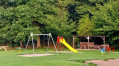
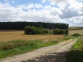
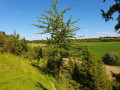
Some of the highlights of the northern slope of the Canche Valley

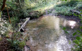
A walk taking in a wide variety of paths and landscapes. There’s something for everyone, young and old alike. You’ll also come across some blue springs.

Details

n°23026788
Creation:
Last update:
Last review:
  • Walking
    Activity: Walking
  • ↔
    Distance: 7.31 mi
  • ◔
    Average duration: 3h 45 
  • ▲
    Difficulty: Moderate

  • ⚐
    Back to start: Yes
  • ↗
    Ascent: + 427 ft
  • ↘
    Descent: - 407 ft

  • ▲
    Highest point: 466 ft
  • ▼
    Lowest point: 177 ft

Description of the walk

Park in the car park at Ligny-sur-Canche Town Hall.

(S/E) Head up towards the village church, turn left onto Rue de l’Église and then turn right onto Rue Claude. Continue left along Rue de la Flaque until you reach the end of the road.

(1) Turn right onto the wide path marked in yellow; this is the Chemin de Hautecôte. You will then join the D112.

(2) Take care here: proceed with caution. Head slightly left onto the D112 and, at the next junction, turn right at a 90° angle to pass between the wind turbines. Walk alongside the Bois Féroux and continue to the junction with the D109.

(3) Turn left to reach, before the village of Flers, the junction ofthe GR®121Aand theGRP® du Ternois Sud.

(4) Turn left here and follow the red and white markings ofthe GR®121A. You’ll soon reach the edge of the Bois Féroux; keep to the left to follow this edge fora while. Then enter the Bois de Boubers. Take care here: some sections may be muddy.
Carry on until you reach the edge of the woodland at a junction with a tarmac road.

(5) Keep straight ahead, ignore the road and continue to follow the red and white markings ofthe GR®121A. Wind your way through the woods before reaching the springs. There are a few footbridges to cross over them, but take particular care on the last one crossing the Canche as it is currently (June 2022) in very poor condition. You will then come to a junction of paths.

(6) Turn slightly left and stay on theGR® until you reach the junction with Rue du Bourg.

(7) Leave theGR®, turn right and immediately take the path that branches off to the left between the houses to reach the new school. Admire the lovely layout of this neighbourhood, then cross the Canche once more before emerging onto the pretty square in front of the church and the castle.

(8) Now follow the signposts forthe GR® and the Sentier de l’Écoucherie once more. Return to the junction you passed on the way out

(1) Return to the town hall car park by turning right onto Rue de la Mairie, opposite Rue de l’Église, before turning left onto Rue du Marais (S/E).

Waypoints

  1. S/E : mi 0 - alt. 203 ft - Ligny-sur-Canche Town Hall car park - Canche (fleuve)
  2. 1 : mi 0.31 - alt. 223 ft - Junction marking the end of the circular loop
  3. 2 : mi 1.5 - alt. 456 ft - D112
  4. 3 : mi 2.52 - alt. 325 ft - D109
  5. 4 : mi 2.96 - alt. 397 ft - GR121A
  6. 5 : mi 4.6 - alt. 194 ft - Exit at Fond de Boubers
  7. 6 : mi 5.03 - alt. 187 ft - Path junction
  8. 7 : mi 5.6 - alt. 187 ft - Rue du Bourg junction
  9. 8 : mi 5.93 - alt. 194 ft - Church and castle
  10. S/E : mi 7.31 - alt. 203 ft - Ligny-sur-Canche Town Hall car park

Notes

Between (5) and (6), take care as some sections may be muddy.

Worth a visit

(4) You can head up to the village of Flers to admire the castle and the church.

Always be cautious and plan ahead when you're outdoors. Visorando and the author of this route cannot be held responsible for any accidents occurring on this route.

The GR® and PR® markings are the intellectual property of the Fédération Française de Randonnée Pédestre.

Reviews and comments

4 / 5
Based on 2 reviews

Reliability of the description
3.5 / 5
Ease of following the route
4 / 5
Route interest
4.5 / 5
ulm80
ulm80

Overall rating : 4 / 5

Date of your route : Aug 28, 2022
Reliability of the description : ★★★★☆ Good
Ease of following the route : ★★★★☆ Good
Route interest : ★★★★☆ Good
Very busy route : No

A lovely, shady route – brilliant!

Machine-translated

Tarja44
Tarja44

Overall rating : 4 / 5

Date of your route : Jul 26, 2022
Reliability of the description : ★★★☆☆ Average
Ease of following the route : ★★★★☆ Good
Route interest : ★★★★★ Very good
Very busy route : No

We made a few changes to the route. Instead of following the route from 1 to 2, we decided to walk the route from 1 to 7 in reverse. As it was already hot, the shaded PR path was too tempting to resist. Then, on reaching Boubers, we took the D112 to rejoin the route between 2 and 3. We followed the rest of the route, making sure to rejoin the trail, this time from 7 to 1. But, to be honest, this path is really lovely and it wasn’t a bother to walk it again.
Thank you for this lovely walk.

Machine-translated

Other walks in the area

For more walks, use our search engine .

The GPS track and description are the property of this route's author. Please do not copy them without permission.