Four villages in Champagne through the woods from Pourcy

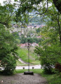
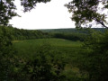
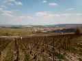
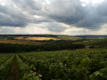
This is a short walk through the woods that will allow you to discover several pretty villages: Pourcy, Chamery, Écueil and Ville-Dommange, with its famous Saint-Lié Chapel. Stunning views of Reims and its cathedral.

Details

3361443
Creation:
Last update:
Last review:
  • Walking
    Activity: Walking
  • ↔
    Distance: 10.18 mi
  • ◔
    Average duration: 5h 30 
  • ▲
    Difficulty: Moderate

  • ⚐
    Back to start: Yes
  • ↗
    Ascent: + 948 ft
  • ↘
    Descent: - 942 ft

  • ▲
    Highest point: 873 ft
  • ▼
    Lowest point: 499 ft
  • ⚐ Country: France
  • ⚐ City: Pourcy (51480)
  • ⚑
    Start/End: N 49.157124° / E 3.911298°
  • ❏
    IGN map(s): Ref. 2712E
  • Hour-by-hour weather

Photos

Description of the walk

Start from the car park at the Maison du Parc in Pourcy.

(S/E) With your back to the Maison du Parc, turn left onto the Chemin de Nanteuil. At the cemetery, turn left onto the Sentier de la Rosière, then walk 50 m to the right along the Rue de la Barbe aux Canes. Look out for a path entrance on the left, before the house and the sign indicating the walking routes.

(1) Take the path and walk to the corner of the vineyards.

(2) At the vineyard, turn left onto the path running alongside it. At the T-junction, veer right along the vineyards and continue along this path, which then enters the woods. After 1 km, you’ll reach a forest track.

(3) Carry on straight ahead along the forest track for about 300 metres until you reach a track junction.

(4) Take the path on the left. Walk 500 m until you reach a T-junction.

(5) At this junction, turn right for 30 metres, then turn left. This track continues through the woods and passes close to Heurtebise Farm (pastures and cropland). Shortly after the farm, you’ll reach a junction.

(6) At the junction, turn left. The path is badly rutted by forestry vehicles. Continue for 600 m until you reach the vineyards. Walk alongside them until you reach the D 980 road.

(7) At the road, turn right until you reach the crossroads.

(8) Turn left and walk to the Chapelle Saint-Lié.

(9) After a break at the chapel, return to the road.

(8) Cross the D6 and continue straight ahead. You are now on theGRP®. Follow this path until you reach a Y-junction.

(10) At the junction, head straight ahead onto theGR®142, which enters the woods. Continue along this path, which eventually leads to the vineyards above Écueil. Walk alongside the vineyards for 200 metres until you reach a crossroads where you leave the GR®.

(11) At the crossroads, carry on straight ahead, skirting the woodland. Walk to a T-junction, where you rejoin the GR®.

(12) At the crossroads, turn right onto the path that runs alongside the vineyard, then enters the woods. Follow theGR® signposts and ignore all paths branching off to the right. The path rejoins the vineyards and descends towards the village of Chamery. Enter the village via Rue des Prés Eloy and walk to Rue Haute.

(13) At the T-junction, turn right and leave the village. Stay on this path which climbs towards the woods, signpostedGRP® de l’Ardre. Do not take the paths to the right or left; stay on the wide path. Pass in front of the wayside cross (hard to see, on the right).

(14) When you can see the Ferme d’Écueil, take the path on the left. After 200 m, turn right onto the path (which is not very visible) that enters the woods alongside the pasture.

(15) At the crossroads, cross the wide track and take the path opposite. Continue along this red and yellow-marked path which descends towards the village of Pourcy.

(16) When you reach the road, turn right and enter the village. Turn left at the crossroads, then right, and finally left at the cemetery, and walk to the Maison du Parc (E).


Waypoints

  1. S/E : mi 0 - alt. 505 ft - Maison du parc naturel de la Montagne de Reims
  2. 1 : mi 0.29 - alt. 525 ft - Start of the path
  3. 2 : mi 0.47 - alt. 574 ft - Crossroads by the vineyards
  4. 3 : mi 1.76 - alt. 863 ft - Forest track
  5. 4 : mi 1.94 - alt. 873 ft - Start of the path
  6. 5 : mi 2.33 - alt. 817 ft - Crossroads
  7. 6 : mi 3.14 - alt. 820 ft - Start of the path
  8. 7 : mi 3.87 - alt. 709 ft - Junction with the D 980
  9. 8 : mi 3.95 - alt. 692 ft - Junction at the chapel
  10. 9 : mi 4.1 - alt. 725 ft - Sain-Lié Chapel
  11. 10 : mi 4.74 - alt. 774 ft - Crossroads
  12. 11 : mi 5.62 - alt. 801 ft - Junction with and departure from the GR
  13. 12 : mi 6.01 - alt. 732 ft - Junction with and return to the GR
  14. 13 : mi 7.68 - alt. 515 ft - T-junction (Rue Haute)
  15. 14 : mi 8.53 - alt. 860 ft - T-junction near the Écueil farm
  16. 15 : mi 8.86 - alt. 833 ft - Crossroads
  17. 16 : mi 9.83 - alt. 584 ft - Road at the entrance to Pourcy
  18. S/E : mi 10.18 - alt. 512 ft - Montagne de Reims Nature Reserve Visitor Centre. - Ardre (rivière)

Notes

The route follows signposted paths in places. From Pourcy to Ville-Dommange, however, there are no signposts. Using the app will be a help if you’re not used to reading a map.

Starting point at the Maison du Parc: car park, information, toilets, picnic area.

There’s a lovely picnic area by the chapel (9). Water is available at the cemetery.

Worth a visit

Champagne producers in the villages you pass through.

Alternatives:

Between (11) and (12), you can follow theGR® route to reach the church at Écueil, just outside the village.

Possible shortcuts between (4) and (11) and between (6) and (10). In this case, you do not go as far as the chapel.

Always be cautious and plan ahead when you're outdoors. Visorando and the author of this route cannot be held responsible for any accidents occurring on this route.

The GR® and PR® markings are the intellectual property of the Fédération Française de Randonnée Pédestre.

Reviews and comments

4.1 / 5
Based on 3 reviews

Reliability of the description
4.7 / 5
Ease of following the route
4 / 5
Route interest
3.7 / 5
virgule
virgule

Hello,

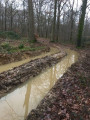
I will go back to check whether it is necessary to reroute the start of this route. The area in question is always more or less impassable in winter when there has been heavy rain. The last time I went there, in February 2025, we had to go through the woods because the path, due to a lack of maintenance (clearing of the ditches), had turned into a quagmire.

Machine-translated

User 21802846

Overall rating : 3.7 / 5

Date of your route : Mar 23, 2026
Reliability of the description : ★★★★★ Very good
Ease of following the route : ★★★★☆ Good
Route interest : ★★☆☆☆ Disappointing
Very busy route : No

The first 3 kilometres of the track are impassable; forestry machinery has destroyed everything, so there’s no point in going there. I wouldn’t recommend it at all.

Machine-translated

virgule
virgule

Hello,

I did part of this route again yesterday. As far as the mud is concerned, it’s perfectly manageable.

At point 5, it’s easy to take a wrong turn and end up in Courmas or somewhere else. The app is a real bonus, as the route isn’t signposted.

Machine-translated

virgule
virgule

My gut tells me that right now, on set, it’s rather muddy.

Machine-translated

virgule
virgule

Thank you for this review.

GPS tracking is recommended.

Absolutely – in fact, it’s mentioned in the guidebook. It’s neither the Camino de Santiago nor the GR20. If you get lost, no one will come to your rescue. The upside is that it’s very peaceful.

Machine-translated

berthomas
berthomas

Overall rating : 4.7 / 5

Date of your route : Dec 11, 2020
Reliability of the description : ★★★★★ Very good
Ease of following the route : ★★★★☆ Good
Route interest : ★★★★★ Very good
Very busy route : Yes

A lovely walk on a cold autumn morning. Using GPS is recommended.

Machine-translated

virgule
virgule

Thank you for this feedback. It’s true that it’s tricky to find your way around in the woods. There are mountain bike signposts, but I don’t mention them as they can be moved.

Even if you take the wrong path, you’ll inevitably end up at the edge of the vineyards and find your way back on track. In situations like this, nothing beats the app.

Thanks for the tip about the picnic area. Personally, I take the easy option on this route – I don’t go all the way down to Chamery; I take a shortcut by the poplars.

Machine-translated

Pascal Denis 51
Pascal Denis 51

Overall rating : 4 / 5

Date of your route : Sep 04, 2020
Reliability of the description : ★★★★☆ Good
Ease of following the route : ★★★★☆ Good
Route interest : ★★★★☆ Good
Very busy route : No

A lovely walk in the fine weather of late summer, and during the grape harvest… it was a bit tricky to find your way through the woods between Pourcy and La Chapelle-Saint-Lié (lots of paths and no signposts).
There’s a spot for a picnic in Chamery (tables near the motorhome site)
The return journey through the woods between Chamery and Pourcy is very pleasant

Machine-translated

virgule
virgule

Hello,

This is a good hike for hot weather, as there are plenty of wooded areas.

Machine-translated

Other walks in the area

For more walks, use our search engine .

The GPS track and description are the property of this route's author. Please do not copy them without permission.