Country:
 City:
City:


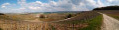
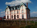
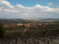
Park in the car park by the church/cemetery, which is located just outside the village of Écueil.
(S/E) From the car park, head north along the paths through the vineyards towards Sacy Castle. This section will allow you to warm up before climbing onto the plateau that separates Sacy from Courmas.
(1) Turn right to get closer to the château (for a better view), then retrace your steps and follow the path which first climbs towards the picnic area, then continues uphill along the path between the woods (on the left) and the vineyards (on the right).
(2) Enter the Bois de la Fosse via the path that climbs, then after about 50 m take the path on the right (from here on, the general route sometimes deviates from the map to avoid puddles, which can be numerous if the weather is – or has been – wet). Continue along this path and, before it opens out onto the vineyards, take a sharp left-hand hairpin bend to take the path on the left heading south-west.
(3) After 1 km, take the path on the left (you could carry on straight ahead, but this detour avoids the muddy path – if the weather is wet).
Follow this track for about 500 metres before turning onto the track on the right, which you’ll also follow for 500 metres before reaching the junction with a good track; take this to the right for about 200 metres until you reach a crossroads.
(4) Turn left, then after about thirty metres, take the path branching off to the right towards the north-west, which you’ll follow downhill to the village of Courmas.
(5) Shortly after entering the village, take the first street on the left and immediately turn left again to follow the path which climbs through the fields.
(6) From here, there isn’t really a defined path for about 400 metres, and the general idea is to head south-west until you come to a clearly marked path. Turn right and follow the path uphill alongside the woodland (wooden observation posts are visible at the edge of the woodland).
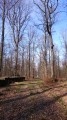
(7) Here, carry on in the same direction, entering the woodland and crossing through it until you emerge into a field.
Carry on along the edge of the woodland (which is on your right this time).
(8) Enter the woodland via a small path which then turns left and joins a very clear track; follow this straight on for just over 1km, passing under some power lines.
(9) Turn left and you’ll soon reach a wide, well-graveled track, which you’ll take and follow to a large crossroads.
(10) Take the path on the right and follow it for about 600 m.
(11) Turn onto the path on the left (marked) or continue straight on to join theGR®142.
Follow theGR®142to the left, which winds its way through this part of the geological cirque that encircles the village of Chamery on the right, offering some lovely views.
(12) Here, you have two options:
- follow theGR® to the right to return directly to the starting car park,
- follow the marked route if you’d like to enjoy a few more lovely views: take the path on the left, which climbs slightly at the start; then, once you’re directly opposite the church and the cemetery, turn onto the path on the right, which descends steeply towards the car park (S/E).

 Visorando Member
 Difficult
  Association / Club / Walk leader
 Easy
Easy