Puy de Manse with return via Manse Vieille

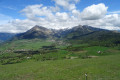
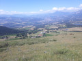
A small summit with a 360° view over the Champsaur countryside and the surrounding peaks.
Editor’s note added on 12/09/2021: there is an issue in the second half of the walk; a round trip seems preferable: see the comments at the bottom of the page

Details

3209928
Creation:
Last update:
Last review:
  • Walking
    Activity: Walking
  • ↔
    Distance: 3.77 mi
  • ◔
    Average duration: 2h 50 
  • ▲
    Difficulty: Moderate

  • ⚐
    Back to start: Yes
  • ↗
    Ascent: + 1,306 ft
  • ↘
    Descent: - 1,306 ft

  • ▲
    Highest point: 5,358 ft
  • ▼
    Lowest point: 4,239 ft

Photos

Description of the walk

Coming from Gap towards Ancelle on the D13, 2.6 km after the roundabout, park in the bend on the left (space for two cars).

(S/E) Retrace your steps for about fifty metres to the start of the walk.
Turn right onto the Route du Puy de Manse path and follow it for 250 m until you reach the sign for Puy de Manse 2.4 km.

(1) Turn left. Follow the path for about 600 m until you reach the next sign.

(2) Turn right and follow this newly marked path to its end, reaching the summit of Puy de Manse – marked by a cross (elevation 1637) – whilst keeping the fence on your left.
At the summit, there is a viewing platform, pending the installation of an orientation board.

(3) The walk continues across the pastures of the Montagne du Puy, heading due south.

(4) At around 1,505 m, continue down the steep slope, keeping to the right towards the hamlet of Manse Vieille (1,289 m). This is the least pleasant part of the walk. When you reach the road, continue along it to the right.

(5) In the hamlet, at the first bend to the left, take the path on the right which leads to a spring catchment (elevation 1302).

(6) A few metres before the wire fence, take the path that climbs to the right. From there, follow this path back to the original crossroads.

(1) Return to the car park via the same route (S/E).

Waypoints

  1. S/E : mi 0 - alt. 4,406 ft - Start at the bend
  2. 1 : mi 0.19 - alt. 4,449 ft - Common junction for out-and-back route
  3. 2 : mi 0.61 - alt. 4,573 ft - On the right, an uphill path
  4. 3 : mi 1.34 - alt. 5,358 ft - Puy de Manse (1640 m)
  5. 4 : mi 1.74 - alt. 4,925 ft - Steep descent towards the hamlet
  6. 5 : mi 2.18 - alt. 4,239 ft - Hamlet of Manse Vieille. On the right
  7. 6 : mi 2.38 - alt. 4,272 ft - Spring catchment. On the right
  8. S/E : mi 3.77 - alt. 4,406 ft - Start at the bend

Reviews and comments

3.2 / 5
Based on 8 reviews

Reliability of the description
3.3 / 5
Ease of following the route
2.5 / 5
Route interest
3.8 / 5
Claude6432
Claude6432

Overall rating : 2 / 5

Date of your route : Sep 08, 2021
Reliability of the description : ★★☆☆☆ Disappointing
Ease of following the route : ★☆☆☆☆ Very disappointing
Route interest : ★★★☆☆ Average
Very busy route : No

The climb to the summit is very pleasant, quite challenging, with magnificent views of the surrounding peaks. The three 360° orientation boards are very well made. However, as previous comments have noted, the descent via Manse Vieille is downright acrobatic and lacks even the slightest signposting to indicate the route to follow.
So the conclusion remains the same: this is a hike best done as a return trip via the ascent path to the Puy de Manse cross.

Machine-translated

BAMX
BAMX

Overall rating : 2 / 5

Date of your route : Aug 22, 2021
Reliability of the description : ★★☆☆☆ Disappointing
Ease of following the route : ★☆☆☆☆ Very disappointing
Route interest : ★★★☆☆ Average
Very busy route : No

There is now a car park at the start of the walk. It’s a very pleasant walk up to the Manse cross at the summit. There are now three information boards, as there’s a 360° view. After that, it’s a disaster: the descent is virtually impossible as it’s dangerous on the scree. We had to zigzag down the steeply sloping meadows to reach Manse Vieille. Then, at point 6, there was no path climbing to the right, no signposting; the fence protecting the water catchment must have been extended. There, too, we had to improvise to find the return path.
In conclusion, I do not recommend this walk, unless you’re doing a round trip to the summit (point 3).

Machine-translated

selmy1950
selmy1950

Overall rating : 3 / 5

Date of your route : Mar 10, 2021
Reliability of the description : ★★★☆☆ Average
Ease of following the route : ★★☆☆☆ Disappointing
Route interest : ★★★★☆ Good
Very busy route : No

An easy climb, with a superb 360° view from the summit. The descent to Manse Vieille is difficult off-trail and can even be dangerous if the grass is wet!! After Manse Vieille, the path disappears after the water intake. You have to head down towards the road to find a track that takes you back to the path further up, with an additional 100 metres of elevation gain.

Machine-translated

corando54
corando54

Overall rating : 2.7 / 5

Date of your route : Jul 27, 2020
Reliability of the description : ★★★☆☆ Average
Ease of following the route : ★★☆☆☆ Disappointing
Route interest : ★★★☆☆ Average
Very busy route : No

The descent to Manse Vieille is very difficult; what’s more, after passing this hamlet at point 6, it was impossible to find the path before the culvert, so we had to climb back up off-trail to get back on the path!
Otherwise, there’s a lovely view from the top of Le Puy

Machine-translated

Topogeo
Topogeo

Overall rating : 3.7 / 5

Date of your route : Jul 19, 2020
Reliability of the description : ★★★★☆ Good
Ease of following the route : ★★★☆☆ Average
Route interest : ★★★★☆ Good
Very busy route : No

We opted for a return route via the west, which is longer but more varied.

Machine-translated

Claude6432
Claude6432

Overall rating : 5 / 5

Date of your route : Jun 19, 2020
Reliability of the description : ★★★★★ Very good
Ease of following the route : ★★★★★ Very good
Route interest : ★★★★★ Very good
Very busy route : No

A lovely walk. Easy to park and set off. Lots of marmots on the first part of the walk. Unfortunately, at that time of year, there was a shepherd with his flock and a rather unfriendly Patou right next to the path: a slightly tricky bit to get past and not very reassuring.
At the summit, there’s a lovely view of the surrounding area.

Machine-translated

Roubaud Eliane
Roubaud Eliane

Overall rating : 3.3 / 5

Date of your route : Jul 08, 2020
Reliability of the description : ★★★☆☆ Average
Ease of following the route : ★★★☆☆ Average
Route interest : ★★★★☆ Good
Very busy route : No

A return trip is preferable as the descent is poorly signposted; it involves walking through very tall grass, off the path; not recommended.
On the other hand, the view from the summit is magnificent.

Machine-translated

Roubaud Eliane
Roubaud Eliane

Overall rating : 3.7 / 5

Date of your route : Jun 19, 2020
Reliability of the description : ★★★★☆ Good
Ease of following the route : ★★★☆☆ Average
Route interest : ★★★★☆ Good
Very busy route : No

A lovely walk with stunning views. This continues right up to the summit of the Puy de Manse.
However, the return via Manse Vieille was disappointing; there were no signposts for the path down. So it was a very steep descent through the broom, ‘as best we could’, with no markings at all.
At the end of May, work was underway on the water catchments, and sheep pens with Patou dogs were blocking the usual path.
I’d recommend doing a round trip.

Machine-translated

Other walks in the area

For more walks, use our search engine .

The GPS track and description are the property of this route's author. Please do not copy them without permission.