Country:

 City:
City:


From the Col de Manse, take the D14 towards La Rochette. At the junction with the D292, take the small pass on the left to reach the hamlet. Park at the junction of Rue de la Chapelle and Chemin des Jardins.
(S/E) Follow the Chemin des Jardins, heading south-east, to leave the hamlet. The tarmac soon gives way to a dirt track which leads to a large crossroads.
(1) Take the Faudon forest track opposite, still heading south-east, towards Clot Loubine.
(2) Turn left to continue along the forest track, heading north, towards Faudon.
(3) Head uphill to the left and leave the main track for a footpath, heading north-east towards Lac de Faudon.
(4) Go round the lake on the right (north shore) and continue towards Béal Trouble, heading north-west. Pass a spring with three metal drinking troughs and join a path coming from the right (Crête des Auréous).
(5) Carry on straight ahead, heading north-west, then follow the path on the right to climb through the grass towards the small pass known as Coulon du Château. Note that it is possible here to take a short detour to the ruins of the village of Faudon by taking the path on the left before heading back up to the right towards Coulon du Château.
At the junction, head left up towards the small pass, heading north-west towards Saint-Philippe via Coulon du Château and Les Dents.
(6) Take the path on the left to continue along the PR® (yellow markings), heading west towards Saint-Philippe. The path crosses a small, rocky section (Les Dents, 1,670 m) where you may occasionally need to use your hands for support, but it presents no major difficulty.
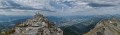
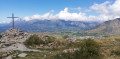
Continue along the well-marked path, heading south-west, to climb the rocky ridge (avoiding the large boulders as best you can) andreach the summit (a cross on a cairn). Enjoy the 360° panorama!
(7) Descend alongthe ridge line, which is sometimes winding, heading north-west, skirting around vegetation and rocks.
(8) Turn left, heading west, to follow the edge of the forest and reach the alpine meadows. At the junction (altitude 1,605 m),take the PR® to the right, heading north-west, for about 50 m until you reach another junction.
(9) Turn left, heading south-west, to leave the PR®.Follow the main path between the forest on the right and the meadow running along the ridge. This becomes a track, with several drovers' roads allowing you to wind your way down through the grass and trees. After a wide bend to the south-west, you’ll reach a crossroads.
(10) Head down the meadow opposite, heading south-west then south, towards the hamlet of Le Collet. Reach the first houses, then follow Rue de la Chapelle to the junction with Chemin du Pra du Bez.
(11) Turn right, heading south-west, to continue down Rue de la Chapelle and reach the small car park (S/E).
 Visorando Member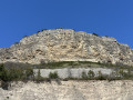
 Easy
Easy 
 Association / Club / Walk leader
 Difficult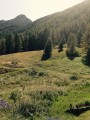
 Very difficult