


Refine your search for walks in Forest-Saint-Julien
Forest-Saint-Julien walks


 Pont Blanc Heritage Trail via the circular route of the Canaux
 Visorando Member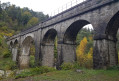
 7.83 mi
 +984 ft
 -968 ft
 4h 25
4h 25
 Moderate
 Departure from Forest-Saint-Julien (Hautes-Alpes)
What a rich heritage is on display all along this circular route. A railway heritage where trains have never actually run. Right from the start at the Gare car park, don’t look for the station – it was never built. Roman heritage along the magnificent Roman road in this mountainous region. Heritage relating to water management: aqueducts, canals and waterwheels. Agricultural heritage unique in France: the Champsaur mountain bocage. Built heritage: a chapel, a bread oven and farmhouses. In short, you can explore all this heritage at your own pace.
Up the Gap Canal: from Pont de Frappe to Les Ricous
 6.71 mi
+328 ft
-489 ft
3h 20
6.71 mi
+328 ft
-489 ft
3h 20
 Easy
Departure from Chabottes (Hautes-Alpes)
Easy
Departure from Chabottes (Hautes-Alpes)
A lovely, idyllic walk with virtually no elevation gain, easy and shaded. Ideal for families. You can walk part of the route and turn back, or tackle it in short sections. Of course, it’s possible to do this walk in the opposite direction.
The canal is always covered, so you can’t see the water.
Please note that between the start and point 2 there is a steep descent through the woods.
Puy de Manse with return via Manse Vieille
 Association / Club / Walk leader
 3.77 mi
+1,306 ft
-1,306 ft
2h 50
Moderate
Departure from Forest-Saint-Julien (Hautes-Alpes)
3.77 mi
+1,306 ft
-1,306 ft
2h 50
Moderate
Departure from Forest-Saint-Julien (Hautes-Alpes)
A small summit with a 360° view over the Champsaur countryside and the surrounding peaks.
Editor’s note added on 12/09/2021: there is an issue in the second half of the walk; a round trip seems preferable: see the comments at the bottom of the page
Circular Puy de Manse starting from the Col de Manse
 4.88 mi
+1,434 ft
-1,447 ft
3h 30
Moderate
Departure from Ancelle (Hautes-Alpes)
4.88 mi
+1,434 ft
-1,447 ft
3h 30
Moderate
Departure from Ancelle (Hautes-Alpes)
Ascent of the Puy de Manse from the Col de Manse, returning via the east with views of the Puy.
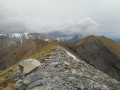
The summit of Coste Belle from the Laye station
 7.34 mi
+2,500 ft
-2,500 ft
5h 35
Moderate
Departure from Laye (Hautes-Alpes)
7.34 mi
+2,500 ft
-2,500 ft
5h 35
Moderate
Departure from Laye (Hautes-Alpes)
Climb one of the Champsaur peaks from the Laye ski resort, enjoying the cool forest, rocky ravines and earthy slopes. The initial loop gives way to a round-trip climb. The final section is on a beautiful ridge with steep slopes on either side.
Grand tour of Golf Bayard to the Drac Canal
6.07 mi
+591 ft
-574 ft
3h 20
Easy
Departure from Gap (Hautes-Alpes)
A beautiful circular loop around the Col Bayard oxygenation centre, very varied and without any significant elevation gain, offering 360-degree views and breathtaking vistas of the Champsaur.
From Bayard Golf Course to the Drac Canal
6.28 mi
+594 ft
-577 ft
3h 25
Moderate
Departure from Gap (Hautes-Alpes)
A lovely circular route offering a varied 360° view, with little elevation gain.
Bayard Plateau fitness trail
3.82 mi
+266 ft
-249 ft
2h 00
Easy
Departure from Gap (Hautes-Alpes)
This refreshing walk on the Col Bayard takes you into the heart of a plateau dedicated to sports enthusiasts at an altitude of 1,300 metres! A fairly gentle and varied route, with paths through the woodland, shaded trails and small hills with a slight elevation gain. Breathtaking views over the Champsaur.
Short tour of Chaillol
4.68 mi
+965 ft
-945 ft
3h 00
Moderate
Departure from Saint-Michel-de-Chaillol (Hautes-Alpes)
A short, easy circular loop around Chaillol, starting from Chaillol village, suitable for families. Passes over the Canal Malcros.
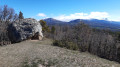
The Buzon Viaduct and the Gap Canal, starting from Les Jaussauds
 5.30 mi
+505 ft
-522 ft
2h 55
Easy
Departure from Gap (Hautes-Alpes)
5.30 mi
+505 ft
-522 ft
2h 55
Easy
Departure from Gap (Hautes-Alpes)
A lovely walk along the Gap balconies. From the Lac des Jaussauds picnic area, the route descends along the route of the old (and never completed) Gap–La Mure railway line, including a crossing of the Buzon viaduct, recently converted into a cycle route.It then climbs back up to the Réserve des Manes, passes the Peyre Ossel boulder, and follows the Canal de Gap to the Réserve Georges Serres, offering beautiful panoramic views of the Gap region.
From Chaillol 1600 to Chantaussel
 3.05 mi
+121 ft
-1,138 ft
1h 30
Easy
Departure from Saint-Michel-de-Chaillol (Hautes-Alpes)
3.05 mi
+121 ft
-1,138 ft
1h 30
Easy
Departure from Saint-Michel-de-Chaillol (Hautes-Alpes)
A short walk, with very little uphill climb and no difficulty, starting from Chaillol 1600 to the hamlet of Chantaussel (municipality of Saint-Julien-en-Champsaur).
Round-trip walk: you’ll need at least two cars.
Mal Cros Canal starting from Chaillol 1600
 4.40 mi
+814 ft
-781 ft
2h 45
Moderate
Departure from Saint-Michel-de-Chaillol (Hautes-Alpes)
4.40 mi
+814 ft
-781 ft
2h 45
Moderate
Departure from Saint-Michel-de-Chaillol (Hautes-Alpes)
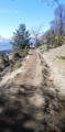
Hike along the remains of the Mal Cros Canal, starting from Chaillol 1600. This canal supplied water for irrigation in the area from a glacier above the Champoleon valley (Drac Blanc).
Col de la Pisse from Chaillol 1600
 9.42 mi
+2,766 ft
-2,743 ft
6h 45
9.42 mi
+2,766 ft
-2,743 ft
6h 45
 Difficult
Departure from Saint-Michel-de-Chaillol (Hautes-Alpes)
Difficult
Departure from Saint-Michel-de-Chaillol (Hautes-Alpes)
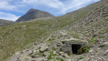
A hike mostly along a balcony path in a sort of cirque, before reaching the foot of the Vieux Chaillol with a lovely panorama. This hike also offers the chance to discover the remains of the Malcros Canal. A somewhat crazy project which, from 1881 to 1923, ensured the water supply to the valleys from a... glacier! Despite the elevation gain, the route involves ascending and descending fairly gentle and very even slopes.
The Pic du Tourond
 8.69 mi
+3,894 ft
-3,898 ft
7h 25
Difficult
Departure from Saint-Michel-de-Chaillol (Hautes-Alpes)
8.69 mi
+3,894 ft
-3,898 ft
7h 25
Difficult
Departure from Saint-Michel-de-Chaillol (Hautes-Alpes)
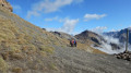
This hike will allow you to discover all the contrasts of the Champsaur mountains, from the pleasant fields of Chaillol and the mountain forests with deciduous and coniferous trees to the high-altitude pastures and the stony summit at over 2,700m.
Pic Queyrel via the Col du Viallet
 10.95 mi
+3,176 ft
-3,153 ft
7h 50
Difficult
Departure from Saint-Michel-de-Chaillol (Hautes-Alpes)
10.95 mi
+3,176 ft
-3,153 ft
7h 50
Difficult
Departure from Saint-Michel-de-Chaillol (Hautes-Alpes)
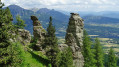
On this hike, nature is the artist, offering us geological formations carved into the sandstone, each one as astonishing as the next.
Not to mention Pic Queyrel with its extensive panorama from the horizontal ridge line that connects the two high points.
At the end of the hike, you can discover the remains of the Malcros Canal. A somewhat crazy project which, from 1881 to 1923, supplied water to the valleys from a... glacier.
The Balcony of Champsaur
 6.14 mi
+1,572 ft
-1,558 ft
4h 10
Moderate
Departure from Saint-Michel-de-Chaillol (Hautes-Alpes)
6.14 mi
+1,572 ft
-1,558 ft
4h 10
Moderate
Departure from Saint-Michel-de-Chaillol (Hautes-Alpes)
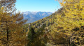
A balcony walk offering magnificent views of the plain at the entrance to the Champsaur.
Le Vieux Chaillol from Chaillol 1600
 14.63 mi
+5,338 ft
-5,338 ft
8 hrs
14.63 mi
+5,338 ft
-5,338 ft
8 hrs
 Very difficult
Departure from Saint-Michel-de-Chaillol (Hautes-Alpes)
Very difficult
Departure from Saint-Michel-de-Chaillol (Hautes-Alpes)
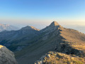
This is a long hike to reach the Pic du Vieux Chaillol (3,163 m), a landmark peak in the southern Hautes-Alpes landscape.
Please note that the elevation gain is only 1,530m and not 1,706m as stated on the information sheet.
 Saint-Philippe, starting from Ancelle Castle
 4.09 mi
+1,309 ft
-1,286 ft
4 hrs
Moderate
Departure from Ancelle (Hautes-Alpes)
4.09 mi
+1,309 ft
-1,286 ft
4 hrs
Moderate
Departure from Ancelle (Hautes-Alpes)
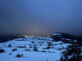
A snowshoe hike over varied terrain, starting in the Pré Matheron meadow, followed by a route through the undergrowth where you create your own path by weaving through the forest until you reach the junction with the ridge line. There, the landscape opens up towards the south.
Chapeau de Napoléon
 2.56 mi
+774 ft
-774 ft
1h 50
Easy
Departure from La Rochette (Hautes-Alpes) (Hautes-Alpes)
2.56 mi
+774 ft
-774 ft
1h 50
Easy
Departure from La Rochette (Hautes-Alpes) (Hautes-Alpes)
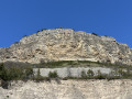
An iconic cliff and viewpoint in the Gap area, the Chapeau de Napoléon is easily accessible and offers breathtaking views of the Avance valley and the Gap basin.
Route du Pic Queyrel and double arch route
 8.28 mi
+3,117 ft
-3,100 ft
6 hrs
Very difficult
Departure from Saint-Michel-de-Chaillol (Hautes-Alpes)
8.28 mi
+3,117 ft
-3,100 ft
6 hrs
Very difficult
Departure from Saint-Michel-de-Chaillol (Hautes-Alpes)
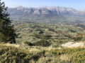
This hike in the Champsaur is marked by curious geological formations in the sandstone.
It is worth taking your time and looking up.
The double arch is a little off the main route, so you have to go out of your way to find it, but it's well worth the detour.
Lake Faudon and the summit of Saint-Philippe, seen from the small pass of Collet d’Ancelle
5.02 mi
+1,050 ft
-1,037 ft
3h 15
Moderate
Departure from Ancelle (Hautes-Alpes)
An easy walk starting from the hamlet of Collet d’Ancelle, taking you to the Saint-Philippe promontory (a former fortified site) via Lac de Faudon, a veritable treasure trove of Alpine biodiversity, and close to the ruins of the village of Faudon. This summit, situated above the resort of Ancelle, offers a beautiful panoramic view of the Gap basin, the Champsaur and the Écrins massif.