Circular Puy de Manse starting from the Col de Manse

Ascent of the Puy de Manse from the Col de Manse, returning via the east with views of the Puy.

Details

3628387
Creation:
Last update:
Last review:
  • Walking
    Activity: Walking
  • ↔
    Distance: 4.88 mi
  • ◔
    Average duration: 3h 30 
  • ▲
    Difficulty: Moderate

  • ⚐
    Back to start: Yes
  • ↗
    Ascent: + 1,434 ft
  • ↘
    Descent: - 1,447 ft

  • ▲
    Highest point: 5,358 ft
  • ▼
    Lowest point: 4,262 ft

Photos

Description of the walk

Start from the Col de Manse. Park at the start of the Puy de Manse track.

(S/E) Follow the track to the quarry and turn left.

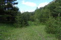
(1) On leaving the quarry, follow the path to the left which runs alongside the mountain pastures (lots of marmots). Then turn right almost 180° and follow the track to the start of the ridge, taking care to close the gates behind you to keep the animals out.

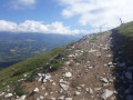
(2) Turn left, then follow the ridge to the summit (cross).

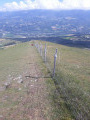
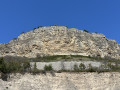
(3) Head off-track into the mountain pasture, without getting too close to the cliffs on the right (west). Make your way to the next summit.

(4) Descend towards the hamlet of Manse Vieille (no obvious track) and join the tarmac road.

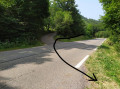
(5) Turn left, heading east, and at the junction (elevation 1317), turn left. Follow the road until you reach a track that climbs up to the left.

(6) Turn left, carry on straight ahead without heading down to Sauron Farm, then keep right at the next three-way junction to climb towards the radio masts. Pass these, then begin the descent until you come alongside a wide track.

(7) Carry on straight ahead without joining this track, which you’ll come across further down at a place called Escalier. Then follow it to the right until you reach the D13.

(8) Turn left and return to the starting point (S/E).

Waypoints

  1. S/E : mi 0 - alt. 4,409 ft - D13 road x track
  2. 1 : mi 0.19 - alt. 4,518 ft - Quarry
  3. 2 : mi 0.87 - alt. 4,869 ft - Ridge
  4. 3 : mi 1.23 - alt. 5,358 ft - Puy de Manse (1640 m)
  5. 4 : mi 1.5 - alt. 5,259 ft - Secondary summit – Descent into the mountain pasture
  6. 5 : mi 1.98 - alt. 4,262 ft - The hamlet of Manse Vieille
  7. 6 : mi 3.19 - alt. 4,685 ft - Junction
  8. 7 : mi 4.09 - alt. 4,642 ft - Track
  9. 8 : mi 4.71 - alt. 4,409 ft - D13 road
  10. S/E : mi 4.88 - alt. 4,409 ft - D13 road x track

Notes

No water sources.
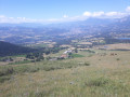
An open route with a panoramic view of the peaks.
Stunning views at the summit and throughout the circular route.

Worth a visit

Views of the region’s major mountain ranges.

Reviews and comments

3.8 / 5
Based on 4 reviews

Reliability of the description
4 / 5
Ease of following the route
3 / 5
Route interest
4.5 / 5
Clairette63
Clairette63

Overall rating : 3 / 5

Date of your route : Sep 02, 2024
Reliability of the description : ★★★★☆ Good
Ease of following the route : ★★☆☆☆ Disappointing
Route interest : ★★★☆☆ Average
Very busy route : No

The climb up the hill is easy, but there really isn’t a path leading back to the road. So it wasn’t straightforward – we almost turned back. The return journey is mainly along the road. I’d recommend doing the round trip to the hill, which is actually very pleasant.

Machine-translated

Jojobubu62
Jojobubu62

Overall rating : 4 / 5

Date of your route : Jan 01, 2024
Reliability of the description : ★★★★☆ Good
Ease of following the route : ★★★☆☆ Average
Route interest : ★★★★★ Very good
Very busy route : Yes

A lovely route, though we did get a bit lost on the descent from Puy de Manse through the pastures. But there’s little risk of getting lost.

Machine-translated

Topogeo
Topogeo
• Edited:

Hello. This is a mountain pasture area with fences. Please ignore the animal tracks and follow the path running parallel to the ridge through the paddocks.

Machine-translated

Mitou05
Mitou05
• Edited:

Overall rating : 4.3 / 5

Date of your route : Apr 26, 2023
Reliability of the description : ★★★★☆ Good
Ease of following the route : ★★★★☆ Good
Route interest : ★★★★★ Very good
Very busy route : No

Hello
We were unable to complete the section between 2 and 3 due to the strong wind, which could have knocked us over given our weight and age: over 80.
Kind regards.
Marie

Machine-translated

chevalley@wanadoo
chevalley@wanadoo
• Edited:

Overall rating : 5 / 5

Date of your route : Apr 21, 2023
Reliability of the description : Not used / Not applicable
Ease of following the route : Not used / Not applicable
Route interest : ★★★★★ Very good
Very busy route : No

Hello
This walk was already on Visorando with a different route.
We didn’t do this walk because the section between points 2 and 3 isn’t on a path and looks quite tricky.
Question: do you need to be an experienced hiker, or is it easily accessible?

Machine-translated

Other walks in the area

For more walks, use our search engine .

The GPS track and description are the property of this route's author. Please do not copy them without permission.