Les Hauts d’Orville

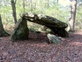
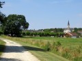
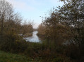
The village of Orville is situated in the Boischaut Nord de l’Indre natural region, on the border with the Cher department. This walk allows you to explore the surrounding area, notably its pretty little restored church, a few standing stones and the Moulin de Venet.

Details

n°24080022
Creation:
Last update:
Last review:
  • Walking
    Activity: Walking
  • ↔
    Distance: 6.06 mi
  • ◔
    Average duration: 3h 00 
  • ▲
    Difficulty: Easy

  • ⚐
    Back to start: Yes
  • ↗
    Ascent: + 213 ft
  • ↘
    Descent: - 220 ft

  • ▲
    Highest point: 486 ft
  • ▼
    Lowest point: 318 ft
  • ⚐ Country: France
  • ⚐ City: Orville (Indre) (36210)
  • ⚑
    Start/End: N 47.152041° / E 1.792038°
  • ❏
    IGN map(s): Ref. 2123SB, 2124SB, 2223SB, 2224SB
  • Hour-by-hour weather

Photos

Description of the walk

Park behind the church.

(S/E) Walk back to the entrance, near the Town Hall. With your back to the Town Hall, take the D16 on the right and follow the yellow signposts. Turn left onto Route d’Anjouin, pass the cemetery and then the Loumas farm.

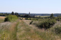
(1) Just after the bridge, take the grassy path on the right. Walk up through the fields, then turn left at the crossroads.

(2) Then head back down to the right and turn left twice.

(3) At the hamlet of Dalhuet, rejoin Route d’Anjouin on the right, cross the Fouzon and carry on straight ahead to reach Champ Martin.

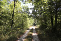
(4) Climb the Montée des Épinettes, keeping the Route du Moulin on your right. Continue uphill until the road becomes a track as it enters a wood. 100 metres further on, turn left onto a path that takes you up to the heights of Orville.

(5) At the crossroads where there is a fine group of standing stones, carry on straight ahead for 20 metres, then turn left onto a wide, tree-lined track. Once you reach Prinçay, cross the hamlet to the right, then first turn left then right to reach some large farm buildings.

(6) Pass by some more standing stones in the farmyard and carry on straight ahead. Walk alongside the woodland, then enter it, following the path which curves to the right and leads to the corner of a field.

(7) Head down to the left into the small valley, through the woods, until you reach the Moulin de Venet. Cross the Fouzon again and follow the road that branches off to the left. At the bend to the right, carry on straight ahead along a grassy track until you rejoin the small road leading to Fontaine de Venet.

(8) At the last house, turn right onto a farm track and head for the Baudonnière estate.

(9) Turn left and carefully follow the D16 back to Orville and its church (S/E).

Waypoints

  1. S/E : mi 0 - alt. 374 ft - Church car park
  2. 1 : mi 0.56 - alt. 341 ft - Grassy path on the right.
  3. 2 : mi 1.28 - alt. 397 ft - Turn right
  4. 3 : mi 2.02 - alt. 335 ft - Dalhuet, on the right - Fouzon (cors d'eau) - Affluent du Cher
  5. 4 : mi 2.23 - alt. 335 ft - Champ Martin, Montée des Épinettes
  6. 5 : mi 2.68 - alt. 486 ft - Standing stones, on the left
  7. 6 : mi 3.19 - alt. 453 ft - Prinçay
  8. 7 : mi 3.82 - alt. 413 ft - Turn left
  9. 8 : mi 4.92 - alt. 351 ft - Venet Fountain, on the right
  10. 9 : mi 5.59 - alt. 371 ft - La Baudonnière, D16, on the left
  11. S/E : mi 6.06 - alt. 374 ft - Church car park

Notes

No difficulty; make sure you wear sturdy shoes as there are different types of surface.
Toilets near the church.

Worth a visit

Reviews and comments

5 / 5
Based on 1 review

Reliability of the description
5 / 5
Ease of following the route
5 / 5
Route interest
5 / 5
marco rando
marco rando

Overall rating : 5 / 5

Date of your route : Mar 04, 2026
Reliability of the description : ★★★★★ Very good
Ease of following the route : ★★★★★ Very good
Route interest : ★★★★★ Very good
Very busy route : No

Great diversity between forest and field

Machine-translated

Other walks in the area

For more walks, use our search engine .

The GPS track and description are the property of this route's author. Please do not copy them without permission.