Pombie – Astún

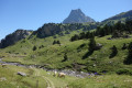
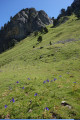
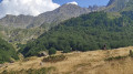
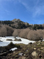
Day two: return to Astún from the Pombie Refuge, via the Col and the Peyreget hut, then Lake Castérau and the Col des Moines. Compared to the first day, the elevation gains are a little steeper, with the final ascent covering nearly 520 m. The atmosphere is different: no ridges, but lakes and valleys!

This walk is part of a multi-day hike: Comment ne pas faire le tour du Pic du Midi d'Ossau

Details

12052846
Creation:
Last update:
Last review:
  • Walking
    Activity: Walking
  • ↔
    Distance: 6.75 mi
  • ◔
    Average duration: 5h 35 
  • ▲
    Difficulty: Difficult

  • ⚐
    Back to start: No
  • ↗
    Ascent: + 2,838 ft
  • ↘
    Descent: - 2,490 ft

  • ▲
    Highest point: 7,575 ft
  • ▼
    Lowest point: 5,384 ft

Photos

Description of the walk

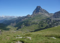
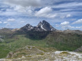
(S) Leave the Pombie refuge via the path signposted for the Col de Peyreget, heading due west. The path is well-marked and the climb is fairly short. Reach the Col de Peyreget, situated just below the peak. Here, enjoy a sweeping view, particularly of the peaks further east in the range (Balaïtous, Vignemale).

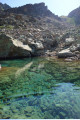
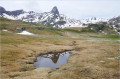
(1) Begin the descent, which is easy at first, before entering a challenging scree slope. To navigate this, follow the cairns placed here and there – though not always in the best positions – choosing the most suitable boulders to place your feet on. The use of walking poles is not recommended here. You’ll reach the end of this scree slope at two charming little lakes.

(2) Continue on and walk alongside the large Lac de Peyreget. Carry on downhill to reach another junction near the Cabane de Peyreget, which is clearly visible on the left.

(3) Head diagonally left towards the hut. Descend this valley, finishing the descent by crossing a steep slope that ends in a path with tight hairpin bends. You’ll reach the junction at the Cabane de Cap de Pount. Here, join theGR®®108. From now on, you’ll be on well-used paths.

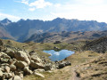
(4) Take the path to the left uphill, follow the Gave de Bouis and pass close to the Cabanes de la Hosse. Follow the tight hairpin bends to reach Lac Castérau.

(5) Follow the lake along its right bank and continue uphill until you reach thePR®® junction above Lac Bersou (altitude 2008).

(6) Turn left, staying on theGR®® marked in red and white. Continue uphill to reach the Col des Moines (2,169) on the French-Spanish border.

(7) Begin a short descent to reach the Ibón del Escalar, which is usually quite busy.

(8) Head up to the left to join a dirt track and follow it until you reach the top station of the Astún chairlift.

(E) Take the chairlift back down to the Astún ski resort.

Waypoints

  1. S : mi 0 - alt. 6,667 ft - Refuge de Pombie
  2. 1 : mi 0.81 - alt. 7,575 ft - Peyreget Pass
  3. 2 : mi 1.17 - alt. 7,083 ft - Small lakes
  4. 3 : mi 2.2 - alt. 6,299 ft - Crossroads. Peyreget hut
  5. 4 : mi 3.01 - alt. 5,397 ft - GR108 junction
  6. 5 : mi 4.18 - alt. 6,381 ft - Lac Castérau
  7. 6 : mi 4.58 - alt. 6,565 ft - GR-PR junction
  8. 7 : mi 5.37 - alt. 7,126 ft - Col des Moines
  9. 8 : mi 5.77 - alt. 6,834 ft - Ibon de Escalar
  10. E : mi 6.75 - alt. 7,044 ft - Telesilla de los Lagos

Notes

  • This is a high-altitude route and should only be undertaken in safe weather conditions: no risk of thunderstorms or fog.
  • There is little guaranteed drinking water along the route (due to livestock).
  • Be aware of the timetable for the last chairlift descent (usually around 5 pm – check in advance). If the chairlift is not running, take the path down from the lake’s spillway (Ibón de Escalar).
  • An IGN map is recommended; the Spanish map is also useful. You can access it via the Visorando app, but please note: there is no mobile signal except in the vicinity of the lakes’ chairlift, and you cannot be guaranteed to be able to charge your phone at the refuge. Consequently, you should also bring a paper map and always put your phone in aeroplane mode. Please note: Visorando also allows you to download the map in advance so you no longer need to rely on 4G.
  • High-top boots are recommended (safer for navigating the rocky terrain).
  • Shelter is available at the Peyreget shepherds’ hut.

This route passes through a protected area, which may be subject to special regulations:

Worth a visit

You’ll see the Pic du Midi d’Ossau (also known as ‘Jean-Pierre’) from every angle.

Always be cautious and plan ahead when you're outdoors. Visorando and the author of this route cannot be held responsible for any accidents occurring on this route.

The GR® and PR® markings are the intellectual property of the Fédération Française de Randonnée Pédestre.

Reviews and comments

5 / 5
Based on 1 review

Reliability of the description
5 / 5
Ease of following the route
5 / 5
Route interest
5 / 5
bobca
bobca

Machine-translated

Christophe c
Christophe c

Overall rating : 5 / 5

Date of your route : Aug 10, 2026
Reliability of the description : ★★★★★ Very good
Ease of following the route : ★★★★★ Very good
Route interest : ★★★★★ Very good
Very busy route : Yes

A magnificent walk with exceptional views.

Machine-translated

Other walks in the area

For more walks, use our search engine .

The GPS track and description are the property of this route's author. Please do not copy them without permission.