


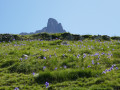
- A mountain hike, to be undertaken only in safe weather conditions and from early June onwards.
- Overnight stay at the Refuge de Pombie (book in advance).
- We suggest shortening the outward and return journeys by taking the ‘Télésiège des Lacs’ chairlift at Astún, if it is operating. Check in advance.
- There is little drinking water along the route.
- An IGN map is recommended; a Spanish map is also useful. You can access it via the Visorando app, but please note: there is no mobile signal except as far as Punta Mala Cara and the Col de Pombie, and you cannot be guaranteed to be able to charge your phone at the refuge. Consequently: make sure you also bring a paper map and always switch your phone to aeroplane mode.
How not to walk the Pic du Midi d’Ossau circuit


For a change from the usual ‘tours of…’, we suggest a round-trip crossing from the Col du Somport area to the Pombie Refuge, below the peak, taking different paths on the way there and back.
A two-day cross-border hike, deliberately avoiding the overcrowded areas such as the Col du Pourtalet, Ayous and Lac de Bious-Artigues, etc.
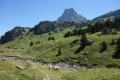
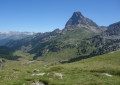
The first day offers stunning views: grassy ridges; the second even more so: flower-filled valleys. Magnificent views.
Details
Creation:
Last update:
Last review:
-
 Activity: Walking
-
 Distance: 12.71 mi
-
 Average duration: 2 days
-
 Difficulty: Difficult
-
-
 Back to start: Yes
-
 Ascent: + 4,544 ft
-
 Descent: - 4,560 ft
-
-
 Highest point: 7,674 ft
-
 Lowest point: 5,384 ft
-
 Country:
Spain
-
 Areas: Pyrenees, Vallée d'Ossau
-
 City:
Jaca
-
 Start/End: N 42.814534° / W 0.491605°
-


 Hour-by-hour weather
Photos

Stages of the route
This route needs several days, find the details below:
Notes
This route passes through a protected area, which may be subject to special regulations:
Reviews and comments
4.5 / 5
Based on 2 reviews
Reliability of the description
4.5 / 5
4.5 / 5
Ease of following the route
4 / 5
4 / 5
Route interest
5 / 5
5 / 5


User 30626648
Overall rating : 4.3 / 5
Date of your route : Aug 30, 2026
Reliability of the description : ★★★★☆ Good
Ease of following the route : ★★★★☆ Good
Route interest : ★★★★★ Very good
Very busy route : Yes
To be honest, it’s a really good walk.
I just found it a bit tricky to follow the path at the start.
And the walk gets very, very busy in high season – this could be mentioned on Visiorando.
Machine-translated

simon2716
Overall rating : 4.7 / 5
Date of your route : Aug 27, 2022
Reliability of the description : ★★★★★ Very good
Ease of following the route : ★★★★☆ Good
Route interest : ★★★★★ Very good
Very busy route : Yes
A magnificent hike done in the opposite direction (day 1: the lakes; day 2: the ridges), given that the weather forecast predicted better visibility the following day – and that proved to be the case. A real treat, with plenty of wildlife to spot!
Doing the walk in the opposite direction to the description did throw us off a bit on the unmarked section of the ridges stage (between points 7 and 5). The landmarks are different from those in the guide; you can’t see the Ravin Noir in the distance as you’re approaching from behind. We had to consult our compass and IGN map briefly.
When you reach point 7, keep the Pène de la Glère (tooth-shaped and rising to over 2,300 m) clearly in your sights to reach the grassy plain; once there, you must pass at the foot of the Pène, skirting the three small hills (which rise to around 1,960 m) on the left, then immediately head south-west towards the PAA de la Gradillère, following a narrow path marked by cairns.
As stated in the description: under no circumstances should you set out on this hike in foggy conditions.
Thank you, bobca, for this lovely route!
Machine-translated
Other walks in the area
Astún - Pombie
 Visorando Member
 5.96 mi
+1,706 ft
-2,070 ft
4h 15
 Moderate
 Departure from Jaca (Huesca)
This is the first day of a cross-border hike that takes you to the Pic du Midi d'Ossau, starting from an unusual point, the Col du Somport, rather than the Col du Pourtalet.Overnight stay at the Refuge de Pombie is essential, so remember to book in advance.
From the Col d’Astún to the Col des Moines
 3.43 mi
+883 ft
-912 ft
2h 20
Moderate
Departure from Jaca (Huesca)
If you’re in the Col du Somport area and the weather is clear (and safe), this short circular route will delight you in no time. Thanks to the chairlift, you’ll reach the starting point quickly, and the ridge walk will allow you to admire the surroundings at your leisure in a unique way. The route is unmarked but clearly defined.
From Puerto Astun to Col des Moines
 3.79 mi
+1,552 ft
-1,572 ft
3h 05
Moderate
Departure from Jaca (Huesca)
This hike climbs steeply over a short distance, but the path is passable. The hike takes you to Lake Escalar and the Col des Moines. It offers a variety of viewpoints.
From Somport to Astún via the ridges – HIKE TO SEE AGAIN
 6.86 mi
+2,782 ft
-2,795 ft
5h 35
Difficult
Departure from Aísa (Huesca)
Hike to revisit
A little-used border hike offering views of the three valleys of Aspe, Canfranc and Ossau from above. Stunning views in all directions. Route for hikers: you will need to find your bearings at the start as there are no signposts. The end of the route can be avoided by hikers who suffer from vertigo.
The Bois du Sansanet and the Col Causiat around Somport
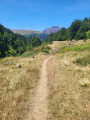 4.92 mi
+978 ft
-981 ft
3h 05
 Easy
Departure from Urdos (Pyrénées-Atlantiques)
An easy loop allowing you to discover the diversity of landscapes and natural areas on the northern flank of the Col du Somport. The climbs are gentle and the route is fairly easy to follow, provided you have a map on your phone with GPS. In addition, the Espace Somport is a pleasant place to relax. Everything you need for a "cool hike"!
Visorando app recommended
The Chiniprés hut
 2.29 mi
+1,161 ft
-177 ft
2h 05
Moderate
Departure from Canfranc (Huesca)
A relatively short route to one of the best viewpoints in the upper Canfranc Valley, offering views of both Canfranc-Gare international station and the Candanchú ski resort.
To the Gentiane plateau from the Chalet Cadier
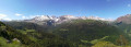 3.40 mi
+1,152 ft
-1,138 ft
2h 35
Moderate
Departure from Urdos (Pyrénées-Atlantiques)
If you’re looking for a route in the Somport area that’s less busy than the one to Lac d’Estaens but just as beautiful, this one might be just what you’re after. It’s a modest route (fairly short, suitable for all) but offers spectacular views across the entire border range around Somport. You might even come across walkers accompanied by one or two donkeys, for whom this route is a classic.
Circular loop via Lac d’Estaëns or Ibon de Astanès
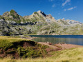 6.71 mi
+2,218 ft
-2,221 ft
5h 00
Moderate
Departure from Urdos (Pyrénées-Atlantiques)
It is a peaceful valley where a thin stream flows, where large herds of horses and cows graze in the calm air, indifferent to this geological feature, this reddish earth, on the border between Spain and France and Lac d'Estaëns (Ibon de Astanès).
For more walks, use our search engine .
The GPS track and description are the property of this route's author. Please do not copy them without permission.

