From the Cabane de l’Araille to Lac de Roumassot

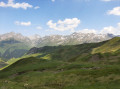
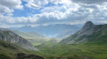
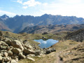
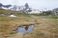
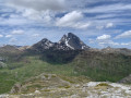
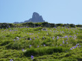
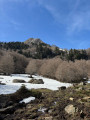
The first stage of this beautiful hike. Not particularly demanding, with no specific difficulties apart from the distance. Featuring magnificent scenery, views of the south face of the Pic du Midi d’Ossau and the lakes. The route includes a bivouac at Lac de Roumassot with a breathtaking view of the Ossau! The path is well signposted from start to finish, with quite varied scenery: mountain pastures, rocky outcrops and lakes.

Details

102429767
Creation:
Last update:
Last review:
  • Walking
    Activity: Walking
  • ↔
    Distance: 8.25 mi
  • ◔
    Average duration: 6h 05 
  • ▲
    Difficulty: Difficult

  • ⚐
    Back to start: No
  • ↗
    Ascent: + 2,595 ft
  • ↘
    Descent: - 2,162 ft

  • ▲
    Highest point: 7,503 ft
  • ▼
    Lowest point: 5,620 ft

Description of the walk

Start from the car park on the side of the D934, situated below the Cabane de l’Araille, about 1 km before reaching the Col du Pourtalet, coming from Laruns.

(S/E) From the car park, take the track – closed to all vehicles – on the other side of the D934. Carry on straight ahead, following a mountain stream on your left, pass beneath the Cabane de la Glère and continue along the path to the Col d’Astu.

(1) Continue to the right along the path that follows the ridge to the Pic d’Astu. It’s not difficult, but for those with a fear of heights, it can be quite daunting. At the summit, there’s a 360° view of Spain and the Pic du Midi d’Ossau.

(2) Carry on along the ridge to reach the Col des Moines (a junction where several hiking trails meet; it gets quite busy here).

(3) Turn right and head down to the next junction.

(4) Keep to the left and climb the path that leads to Lac Bersau, then head downhill to the Refuge d’Ayous (where you can stop for a break and top up your water supplies).

(5) Continue the descent past a succession of stunning lakes: the Ayous Lakes, Lake Gentau, Lake du Miey and Lake Roumassot. Set up camp at the latter lake, which is less frequented than the previous ones, as they are too close to the refuge. Extraordinary views of the Pic d’Ossau, both at sunset and sunrise, with ibex on the ridges silhouetted against the setting sun (E).

Waypoints

  1. S : mi 0 - alt. 5,653 ft - Parking de la Cabane de l'Arraille
  2. 1 : mi 3.67 - alt. 7,188 ft - Col d'Astu (2189 m)
  3. 2 : mi 4.07 - alt. 7,362 ft - Pic d'Astu (2279 m)
  4. 3 : mi 5.19 - alt. 7,123 ft - Col des Moines
  5. 4 : mi 6 - alt. 6,581 ft - Junction - Lac Castérau
  6. 5 : mi 7.3 - alt. 6,453 ft - Refuge d'Ayous (1980m)
  7. E : mi 8.25 - alt. 6,070 ft - Lake Roumassot - Lacs d'Ayous

This route passes through a protected area, which may be subject to special regulations:

Worth a visit

Pic d’Astu, mountain lakes (the Ayous lakes, amongst others), mountain hut, viewpoints.

Other walks in the area

For more walks, use our search engine .

The GPS track and description are the property of this route's author. Please do not copy them without permission.