Pombie Refuge, starting from Caillou de Soques

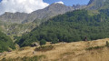
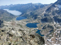
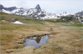
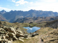
With its small lake fringed by large boulders, the Pombie Refuge is the starting point for all ascents and climbs to the Pic du Midi d’Ossau. There are two possible routes to reach it: via the Cirque d’Anéou or via the Caillou de Soques. This route describes the approach via the Caillou de Soques.

Details

35997249
Creation:
Last update:
Last review:
  • Walking
    Activity: Walking
  • ↔
    Distance: 6.26 mi
  • ◔
    Average duration: 4h 55 
  • ▲
    Difficulty: Moderate

  • ⚐
    Back to start: Yes
  • ↗
    Ascent: + 2,385 ft
  • ↘
    Descent: - 2,418 ft

  • ▲
    Highest point: 6,667 ft
  • ▼
    Lowest point: 4,409 ft

Photos

Description of the walk

Park in the Caillou de Soques car park.

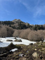
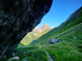
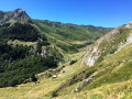
(S/E) Walk down to the bottom of the valley below the road, passing to the right of two huts. Cross a bridge and head back up the opposite side, following a winding path. Enter the forest and continue climbing.
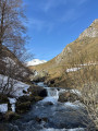
Pass through a clearing and reach a footbridge over the Ruisseau de Pombie.

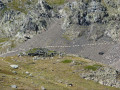
(1) Cross this footbridge and head left, traversing uphill. Pass through a meadow and then over the rocks of a scree slope. Reach a flat area below the Cabane de la Glère.

(2) Head left, cross two footbridges and climb up to the left. At the top of the small outcrop, turn right to reach the Cabane de Puchéou.

(3) Continue along the hillside until you reach the stream bed. Follow the stream upwards, skirting a large scree slope. On a long, gentle slope, follow the path straight ahead through the grass, then climb the switchbacks to the Refuge de Pombie.

(4) Head back down the same route to return to the Caillou de Soques car park (S/E).

Waypoints

  1. S/E : mi 0 - alt. 4,616 ft - Caillou de Soques car park
  2. 1 : mi 1.29 - alt. 5,364 ft - Head up to the left, traversing across
  3. 2 : mi 1.62 - alt. 5,522 ft - Glère Hut
  4. 3 : mi 1.82 - alt. 5,666 ft - Puchéou Hut
  5. 4 : mi 3.12 - alt. 6,667 ft - Refuge de Pombie
  6. S/E : mi 6.26 - alt. 4,613 ft - Caillou de Soques car park

Notes

Please take care as this route is within the National Park; please ensure you comply with the regulations

This route passes through a protected area, which may be subject to special regulations:

Worth a visit

(4) View of the south-east face of Mont Ossau, Lake Pombie, marmots and chamois

Reviews and comments

5 / 5
Based on 2 reviews

Reliability of the description
5 / 5
Ease of following the route
5 / 5
Route interest
5 / 5
User 23068541

Overall rating : 5 / 5

Date of your route : Apr 14, 2026
Reliability of the description : ★★★★★ Very good
Ease of following the route : ★★★★★ Very good
Route interest : ★★★★★ Very good
Very busy route : No

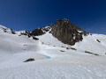
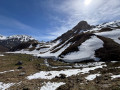
A superb hike with a steep climb at the start through a very pretty forest. We hadn’t brought snowshoes, which turned out to be a big mistake, as we soon encountered snow as we left the forest and the path was no longer visible at all, making it a bit dangerous at times. The climb up to the refuge was a bit tricky because, with no path and the snow, we had to navigate some fairly steep slopes. Once we reached the refuge, the view was magnificent and the lake must be very pretty, but it was completely covered in snow when we got there. The descent was more pleasant and we spotted marmots and chamois. We’ll cherish wonderful memories of this hike, which wasn’t easy but gave us a truly lovely experience!

Machine-translated

Hameaux Nathalie
Hameaux Nathalie

Overall rating : 5 / 5

Date of your route : Jul 08, 2024
Reliability of the description : ★★★★★ Very good
Ease of following the route : ★★★★★ Very good
Route interest : ★★★★★ Very good
Very busy route : No

A technically easy walk.
Stunning scenery and beautiful flowers.
The route ends at the lake, offering a choice of different routes to continue the walk.

Machine-translated

Other walks in the area

For more walks, use our search engine .

The GPS track and description are the property of this route's author. Please do not copy them without permission.