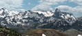
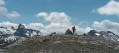
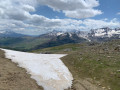
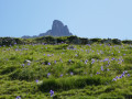
Pic du Pourtalet and Pic d’Estremère from the Col du Pourtalet

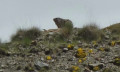
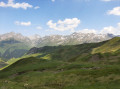
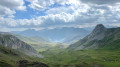
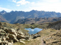
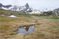
A short hike to the summits of two very close peaks. Superb views and a 360° panorama, particularly towards theCirque d’Anéou, the Pic du Midi d’Ossau and the Lurien Massif. You’re likely to spot marmots and chamois along the way.
Please note that whilst these peaks are in France, the majority of the route takes place in Spain and along the border ridge.

The GPX track may prove useful.

Details

75580532
Creation:
Last update:
Last review:
  • Walking
    Activity: Walking
  • ↔
    Distance: 3.15 mi
  • ◔
    Average duration: 2h 30 
  • ▲
    Difficulty: Moderate

  • ⚐
    Back to start: Yes
  • ↗
    Ascent: + 1,204 ft
  • ↘
    Descent: - 1,207 ft

  • ▲
    Highest point: 7,077 ft
  • ▼
    Lowest point: 5,869 ft

Photos

Description of the walk

Please note that there are no signposts (posts or markings) along the entire trail. You’ll have no trouble following the path.
Start at the Col du Pourtalet; park in the small car park, directly opposite the Maison du Parc des Pyrénées.

(S/E) The start of the trail is to the right of this building. 

(1) A few metres further on, turn right (south). The path then widens considerably and becomes a track suitable for vehicles. The gradient is gentle here. There’s a stunning panoramic view of the Formigal (Anayet) ski area and its peaks.
The track then turns slightly north-east.

(2) At this point, the path is barely marked for a few metres (head due north) before reaching the next fork.

(3) Take the path on your right to begin the ascent towards the peaks.

(4) At an altitude of 1,880 m, leave a small path (barely marked and barely visible) on your right to tackle a steep climb up to an unnamed pass, which marks the Spain–France border.

(5) Continue along the path on your left. Following the ridge, you’ll walk alongside the France–Spain border. Take care, as the slope is very steep on your left (west).

(6) A few metres further on, the path becomes less distinct, but the first summit (Pic du Pourtalet, 2,116 m) is clearly visible on your left and marked by a large cairn. Splendid views! Then head back down, following a narrow path that skirts a small, unnamed peak to the left, to reach the foot of the Pic d’Estrémère (alt. 2,165 m). You’ll need to use your hands a little (nothing too difficult) to navigate between the rocks and reach this second peak. Splendid views towards Le Lurien and the valley.

(7) Head back down the same route you took on the way up to the unnamed pass.

(5) Turn left and walk a few metres to listen, sit quietly for a few minutes and watch the marmots.

(8) Return once more to the unnamed pass.

(5) Head down to the left, following the same route back as on the way there, and return to the fork you passed on the way there.

(3) Carry on straight ahead and return to (S/E).

Waypoints

  1. S/E : mi 0 - alt. 5,873 ft - Pyrenees Park Visitor Centre
  2. 1 : mi 0.06 - alt. 5,909 ft - Junction of the lower circular loop
  3. 2 : mi 0.54 - alt. 6,024 ft - Path heading north
  4. 3 : mi 0.65 - alt. 6,115 ft - Junction used for both the outward and return journeys
  5. 4 : mi 0.79 - alt. 6,152 ft - Junction
  6. 5 : mi 1.07 - alt. 6,565 ft - Unnamed pass
  7. 6 : mi 1.42 - alt. 6,978 ft - Pic du Pourtalet (2135 m)
  8. 7 : mi 1.7 - alt. 7,077 ft - Pic d'Estrémère (2165 m)
  9. 8 : mi 2.27 - alt. 6,562 ft - Marmot Corner
  10. S/E : mi 3.15 - alt. 5,869 ft - Pyrenees Park Visitor Centre

This route passes through a protected area, which may be subject to special regulations:

Reviews and comments

4.1 / 5
Based on 4 reviews

Reliability of the description
4 / 5
Ease of following the route
4 / 5
Route interest
4.3 / 5
lecactus77
lecactus77

Overall rating : 5 / 5

Date of your route : Sep 14, 2025
Reliability of the description : ★★★★★ Very good
Ease of following the route : ★★★★★ Very good
Route interest : ★★★★★ Very good
Very busy route : No

A lovely little hike done on 14/9/2025 in glorious weather. I discovered the guidebook after completing the hike! I can confirm that the description is accurate. And if I had read it beforehand, I wouldn't have climbed the little unnamed "peak" at the foot of Pic d'Estrémère. We also didn't make the "detour" to Pic du Portalet. Magnificent panorama, the blueberry bushes have started to turn red, crocuses are in bloom everywhere, superb! We encountered a herd well protected by its two patous, but we got to know and respect each other.
The guidebook presented here and the route are very good and reliable. A GPS is highly recommended (thanks Visorando).

Machine-translated

User 27154514

Overall rating : 2.7 / 5

Date of your route : Aug 18, 2025
Reliability of the description : ★★☆☆☆ Disappointing
Ease of following the route : ★★☆☆☆ Disappointing
Route interest : ★★★★☆ Good
Very busy route : No

The start is well marked, but after that it's just a matter of following your instincts. We were still able to see some chamois and marmots.

Machine-translated

vovon
vovon

Overall rating : 4 / 5

Date of your route : Aug 17, 2025
Reliability of the description : ★★★★☆ Good
Ease of following the route : ★★★★☆ Good
Route interest : ★★★★☆ Good
Very busy route : No

area where sheep graze accompanied by two patous (sheepdogs) who do their job barking, but as soon as you walk around them, they do nothing

Machine-translated

danielfr40
danielfr40

Overall rating : 4.7 / 5

Date of your route : Jun 27, 2025
Reliability of the description : ★★★★★ Very good
Ease of following the route : ★★★★★ Very good
Route interest : ★★★★☆ Good
Very busy route : No

A lovely walk, not too difficult apart from a very steep climb which we didn’t try going down.
Despite the quality and accuracy of the route maps and descriptions, I missed a junction and (foolishly) thought I could get back on track further up – there was too much tall grass, and my partner wasn’t keen.
No marmots at the ‘Marmots’ junction, but a few chamois.
Lovely view from the Pic du Pourtalet.
The other peak isn’t as good
Thanks for the route and the description

Machine-translated

Other walks in the area

For more walks, use our search engine .

The GPS track and description are the property of this route's author. Please do not copy them without permission.