Refine your search for walks in Pointe de Rasis (2844m)
Pointe de Rasis (2844m) walks


 Visorando Member
Walks near Pointe de Rasis (2844m)
 Le Cros - Refuge de la Blanche
 6.63 mi
 +2,943 ft
 -906 ft
 5h 35
5h 35
 Difficult
 Departure from Saint-Véran (Hautes-Alpes)
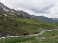
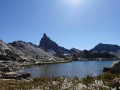
This is the first stage of this journey, half in Queyras and half in Ubaye. Follow the right bank of the Aigue Blanche, then continue along the Col de Saint-Véran trail, before enjoying a beautiful descent that leads to the lake and the Refuge de la Blanche.
The Refuge de la Blanche, starting from Saint-Véran
 8.69 mi
+1,814 ft
-945 ft
5h 35
8.69 mi
+1,814 ft
-945 ft
5h 35
 Moderate
Departure from Saint-Véran (Hautes-Alpes)
Moderate
Departure from Saint-Véran (Hautes-Alpes)
Via the Grand Canal, now completely disused, a long crossing opposite the Grande Tête des Toillies, ending at the Refuge de la Blanche and then at the observatory car park.
From Saint-Véran to Larche: Ubaye Transfrontière
 49.21 mi
+20,728 ft
-21,916 ft
5 days
49.21 mi
+20,728 ft
-21,916 ft
5 days
 Very difficult
Departure from Saint-Véran (Hautes-Alpes)
Very difficult
Departure from Saint-Véran (Hautes-Alpes)
A fantastic Franco-Italian ride between Saint-Véran and Larche! It will take you through strange places, from the solitary, green rocky landscapes of Saint-Véran to the fantastical, almost Dolomite-like terrain of the massif between Chambeyron and Orrenaye.
Saint Véran – Refuge de la Blanche
10.15 mi
+4,537 ft
-3,035 ft
8h 35
Difficult
Departure from Saint-Véran (Hautes-Alpes)
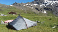
This serves as an introduction to a cross-border trek between Saint-Véran and Larche. We set off from the mountain pastures for a gentle approach to the border, through a rocky and colourful landscape that can at times be quite disorientating. There are no real difficulties, but a good understanding of how to read the terrain is sometimes necessary to avoid losing your way.
Saint-Véran – Agnel Mountain Hut
 9.64 mi
+3,963 ft
-2,103 ft
7h 55
Difficult
Departure from Saint-Véran (Hautes-Alpes)
9.64 mi
+3,963 ft
-2,103 ft
7h 55
Difficult
Departure from Saint-Véran (Hautes-Alpes)
This is the second stage ofthe GR®®58, but it takes a variant route via the Col de Saint-Véran or the Col de la Cavale and includes an ascent to an altitude of 3,000 metres at the Pic de Caramantran. There’s a magnificent view of Mount Viso at the highest point of this route. At the start of the season, there were still plenty of snowfields. This is a very wild route, which I recommend as an alternative to the Col de Chamoussière path, which tends to be quite busy.
Saint Véran - Col Agnel
 8.02 mi
+3,468 ft
-1,683 ft
6h 45
Difficult
Departure from Saint-Véran (Hautes-Alpes)
8.02 mi
+3,468 ft
-1,683 ft
6h 45
Difficult
Departure from Saint-Véran (Hautes-Alpes)
The fourth stage takes you towards the Italian border, offering beautiful views of Mont Viso.
Ceillac - Le Cros
6.30 mi
+3,386 ft
-2,585 ft
5h 50
Difficult
Departure from Ceillac (Hautes-Alpes)
This is the fourth and final stage of this journey between Queyras (05) and Ubaye (04). Passing through the Col des Estronques brings you back to the starting point in the hamlet of Cros.
Ceillac - Saint Véran
 7.82 mi
+4,321 ft
-3,045 ft
7h 20
Moderate
Departure from Ceillac (Hautes-Alpes)
7.82 mi
+4,321 ft
-3,045 ft
7h 20
Moderate
Departure from Ceillac (Hautes-Alpes)
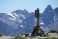
The third stage is entirely on theGR®58, heading towards the rising sun.