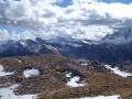
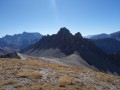
Tête de Rissace

This summit can be tackled as a round trip or as a traverse. The route described below is the traverse option: leave a car at the Mélezet ski resort car park.

Details

n°3120636
Creation:
Last update:
Last review:
  • Walking
    Activity: Walking
  • ↔
    Distance: 8.53 mi
  • ◔
    Average duration: 6h 30 
  • ▲
    Difficulty: Difficult

  • ⚐
    Back to start: No
  • ↗
    Ascent: + 2,933 ft
  • ↘
    Descent: - 4,075 ft

  • ▲
    Highest point: 9,551 ft
  • ▼
    Lowest point: 5,522 ft
  • ⚐ Country: France
  • ⚐
  • ⚐ City: Ceillac (05600)
  • ⚑
    Start: N 44.657661° / E 6.845503°
  • ⚑
    End: N 44.649815° / E 6.791773°
  • ❏
    IGN map(s): Ref. 3537ET, 3537ETR, 3637OT, 3637OTR
  • Hour-by-hour weather

Description of the walk

After leaving a car at the Mélezet car park, make your way to the Bois Noir car park. To do this, return to Ceillac and turn right onto the road that follows the Cristillan upstream along its left bank.

(S) Take the path on the left, which climbs gently, passing above the Bergerie du Bois Noir. Continue, keeping the Cristillan in sight in the distance, until you reach the Y-junction where two paths meet.

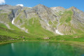
(1) Leave the path leading to the Col de la Cula on your left and take the one on the right. Cross the track at the Étable des Génisses or Cabane de la Lavine. Reach the edge of the woodland and begin the steep climb with numerous hairpin bends. Follow the Torrent de Clausis, cross it to emerge at Lac de Clausis.

(2) Continue the ascent due south; it ends after a few hairpin bends at the Col de Clausis.

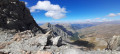
(3) Take care here: follow the path heading due west, which may be daunting for those prone to vertigo. Continue along the path to reach the summit of the Tête de Rissace.

(4) Begin the descent and reach the Col Albert.

(5) Turn right into the Vallon Souchier, where a hairpin bend to the left takes you onto the path at the foot of the Montagne de la Riche. Turn right onto this path, enter the Vallon d’Albert and reach the edge of the forest.

(6) Enter the forest and continue down a fairly steep slope. Arrive at the hamlet of La Riaille.

(7) Follow the road on to the hamlet of La Cime du Mélezet.

(8) Stay on the road. At the hamlet of Pied du Mélezet, turn left to reach the ski resort car park (E).

Waypoints

  1. S : mi 0 - alt. 6,663 ft - Bois Noir car park
  2. 1 : mi 0.86 - alt. 6,998 ft - Cula-Clausis crossroads
  3. 2 : mi 2.05 - alt. 8,028 ft - Lac de Clausis
  4. 3 : mi 3.13 - alt. 9,058 ft - Col de Clausis
  5. 4 : mi 3.62 - alt. 9,318 ft - Tête de Rissace
  6. 5 : mi 4.14 - alt. 9,321 ft - Col Albert
  7. 6 : mi 5.67 - alt. 7,671 ft - Edge of the forest
  8. 7 : mi 7 - alt. 6,339 ft - La Riaille
  9. 8 : mi 7.77 - alt. 5,951 ft - The summit of Mélezet, near the - Refuge de la Cime du Melezet
  10. E : mi 8.53 - alt. 5,522 ft - Mélezet car park

Notes

There are water sources in the streams, but it is advisable to purify the water.
Between (3) and (5): Caution is advised for those prone to vertigo, as the terrain here may cause concern. In that case, it would be safer to head back to the Bois Noir car park.

Worth a visit

A local resident of Ceillac has taken the trouble to place some unusual cairns along the road leading to Bois Noir. It’s well worth taking a few minutes to admire them.
A sneak preview here

Reviews and comments

5 / 5
Based on 1 review

Reliability of the description
5 / 5
Ease of following the route
5 / 5
Route interest
5 / 5
juliuskronos
juliuskronos

Overall rating : 5 / 5

Date of your route : Jul 21, 2020
Reliability of the description : ★★★★★ Very good
Ease of following the route : ★★★★★ Very good
Route interest : ★★★★★ Very good
Very busy route : No

Set off at 8.30 am from the Clos car park, arriving at Lake Clausis at 10 am (a very beautiful spot – best visited early before the crowds arrive), then on to the pass at 11 am (lovely views of the surrounding area), the ridge is fairly easy, with a slight incline on the scree, then arrival at Le Longuet/Tête de Rissace at midday for a bite to eat with a splendid 360-degree view (you can even see Le Viso between two ridges to the south-east)
It would be possible to descend via the Vallon d’Albert and the Mezelet

Machine-translated

Other walks in the area

For more walks, use our search engine .

The GPS track and description are the property of this route's author. Please do not copy them without permission.