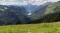
Pointe de Chésery and Tête de Lindaret

A summit offering high-mountain views at little cost. It is possible to make part of the descent via the Fantasticâble, a giant zip line.

Details

n°69765
Creation:
Last update:
Last review:
  • Walking
    Activity: Walking
  • ↔
    Distance: 4.35 mi
  • ◔
    Average duration: 3h 30 
  • ▲
    Difficulty: Moderate

  • ⚐
    Back to start: Yes
  • ↗
    Ascent: + 1,680 ft
  • ↘
    Descent: - 1,683 ft

  • ▲
    Highest point: 7,375 ft
  • ▼
    Lowest point: 5,840 ft

Description of the walk

Start from the Col de Bassachaux, accessible by car from Châtel (car park at the pass).

(S/E) Follow theGR®5(red and white markings) towards the Col de Chésery. A good track climbs gently towards the south-east.

(1) After a good kilometre, at the 1824-metre mark (signpost), turn left onto a well-marked track leading to the chairlift terminus. Pass in front of the Fantasticâble departure point.

(2) Continue south-east along the Rochassons ridge. The path winds gently uphill through rhododendrons before rising steeply across the pastures. After several hairpin bends, the slope levels out. Follow the ridge path to the summit.

(3) The descent follows the same route back to the Fantasticâble departure point.

(2) Walk past the chairlift arrival point, ignore the track on the left which you took on the way up, and continue along the ridge, heading north-west. The path is initially fairly flat before climbing again to the Tête des Lindarets.

(4) Continue downhill in the same direction. Cross a mountain bike track (take care). Continue downhill, following a few hairpin bends, until you reach the track you took on the way up. Follow it to the right to return to the Col de Bassachaux (S/E).

Waypoints

  1. S/E : mi 0 - alt. 5,843 ft - Col de Bassachaux
  2. 1 : mi 0.82 - alt. 5,988 ft - Junction: leave the GR
  3. 2 : mi 1.36 - alt. 6,325 ft - Fantasticâble departure point
  4. 3 : mi 2.2 - alt. 7,375 ft - Summit - Pointe de Chésery
  5. 4 : mi 3.76 - alt. 6,368 ft - Tête de Lindaret
  6. S/E : mi 4.35 - alt. 5,843 ft - Col de Bassachaux

Notes

Hiking boots and equipment are required.

No water sources were spotted along the route. There is a bar-restaurant at the Col de Bassachaux (S/E).

A detailed map is required (at the very least, the one accompanying this description).

Alternative descent route
At this point (2), thrill-seekers can descend via the Fantasticâble. This giant zip line (for a fee) takes you, in two sections, to the Col de Bassachaux road. You will then need to walk back up to reach your vehicle, or arrange to be picked up by those who have walked down. The cable crosses a valley several hundred metres above the ground: not for the faint-hearted!

Hike undertaken by the author on 24 July 2012.

Worth a visit

From the summit, there is a stunning, close-up view of the Dents du Midi and the Dents Blanches.

Always be cautious and plan ahead when you're outdoors. Visorando and the author of this route cannot be held responsible for any accidents occurring on this route.

The GR® and PR® markings are the intellectual property of the Fédération Française de Randonnée Pédestre.

Reviews and comments

3.7 / 5
Based on 2 reviews

Reliability of the description
3.5 / 5
Ease of following the route
3.5 / 5
Route interest
4 / 5
Yvette SCHLEGEL
Yvette SCHLEGEL

The elevation gain is not as stated… it’s greater, and perhaps an alternative route via the Col de Chésery should have been suggested.
Greater elevation gain… all the walkers we came across confirmed this… perhaps it should also be marked as a steep climb…

Machine-translated

Netra
Netra ★

Hello Yvette, thank you for your feedback.

“Elevation gain does not comply”… Does not comply with what?

Machine-translated

Yvette SCHLEGEL
Yvette SCHLEGEL

Overall rating : 3.3 / 5

Date of your route : Jun 29, 2026
Reliability of the description : ★★★☆☆ Average
Ease of following the route : ★★★☆☆ Average
Route interest : ★★★★☆ Good
Very busy route : Yes

The elevation gain is incorrect… it’s greater, and perhaps an alternative route via the Col de Chésery should have been suggested.

Machine-translated

regcrpx
regcrpx

Overall rating : 4 / 5

Date of your route : Aug 11, 2019
Reliability of the description : ★★★★☆ Good
Ease of following the route : ★★★★☆ Good
Route interest : ★★★★☆ Good

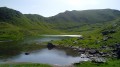
A well-signposted walk. The effort involved in the climb to the Pointe de Chésery is rewarded by the view over the green lake, Lake Chésery.

Machine-translated

Other walks in the area

For more walks, use our search engine .

The GPS track and description are the property of this route's author. Please do not copy them without permission.