Country:

 City:
City:


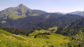
Starting point at the Col de Bassachaux, the end of theD228A roadwhich begins in the centre of the village of Châtel.
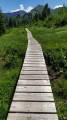
(S/E) At the signposts for the Col de Bassacheaux, follow an unmarked path north-west (do not turn left, west, towards the Alpage de Lens). This path winds its way through the vegetation to the Pointe de Lens.
(1) Continue along the path (due west) following the Arête des Fours to the Pointe des Lanches.
(2) Descend on the other side to reach the Col de l’Aup Couti (signposted).
(3) Head towards l’Aup Couti and the Chalets de Lens on the right. Follow a marked path down and cross a meadow before reaching a junction (signposted for l’Aup Couti).
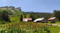
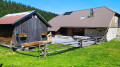
(4) Head towards the Chalets de Lens on the right (due east). After a slight climb, follow the path down to the Chalets de Lens.
(5) Take an alpine track to pass through the cluster of chalets and continue the descent, following the signs for the Alpage de Lens and Lenlevay.
(6) At the signposts for the Alpage de Lens, turn off onto the track on the right towards Lenlevay. Pass the chalets on your left and you’ll come to a wide left-hand bend in the track (wooden post).
(7) Leave the track and turn right onto an unmarked path that sometimes winds its way through the vegetation. The climb is quite steep until you reach the junction with a track (signposted for Les Grands Plans).
(8) Follow the signs for the Col de Bassachaux (red and white GR®5 markings). Parts of this path have been modified to protect the peat bogs. Follow this path southwards to climb up to the Col de Bassachaux road.
(9) Turn right and follow the road to its end, where you’ll find the car park (S/E).
 Visorando Member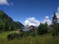

 Tourist office
 Easy
Easy 
 Difficult