Country:

 City:


From Le Petit-Bornand-les-Glières, take the Route de Cenise. Please note that the road is narrow and steep towards the end. In some sections, cars cannot pass each other. Two other car parks are available before the refuge if required.
(S/E) From one of these car parks, continue along the small road towards the Refuge de Cenise.
(1) From the refuge, head south-east; after 200 metres, leave the tarmac road and carry on straight ahead, keeping the Pic de Jallouvre in your sights.
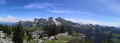
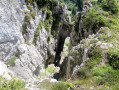
(2) Leave the houses on your right and carry on straight ahead; the path will curve slightly to the left, then take a sweeping bend to the right, running alongside a cliff. At the Passage de la Chèvre, you’ll cross a small, slippery section of sharp limestone pavement – take care!
Pass to the east of the Pointe de Sosay, after which the path becomes less steep. When you reach a junction, take care – the path is unmarked.
(3) Ignore the path to the right heading towards the Col de Sosay and turn left towards the Col du Rasoir. The start is easy, but the path gradually becomes steeper through the scree.
(4) Continue the ascent via a few hairpin bends, still heading towards the Col du Rasoir.
(5) Reach the Col du Rasoir and the trickiest part of the hike. Over a distance of about 250 metres, follow a path that is more or less well-marked, very narrow in places and wide enough for two people to pass in others. In any case, there’s little room for error – it’s steep on both sides of the path.
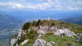
Walk along the northern side of the Pic de Jallouvre and, after a few small hairpin bends of varying difficulty – feel free to use your hands, but there’s nothing too exposed – you’ll reach the summit of the Pic de Jallouvre.
(6) For the descent, follow the path back the way you came, cross the Col du Rasoir once more, and head down the steepest section of the scree slope.
(4) As soon as you see a path branching off to the left across the scree, take it – this path is easier – pass beneath the Dent de Jallouvre and arrive at a fork.
(7) Carry on straight ahead for a round trip.
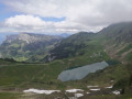
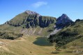
(8) You’ll reach the Col de Sosay, with lovely views over Lac de Lessy (reachable in about 20 minutes).
For the return journey, retrace your steps for 150 metres.
(7) Once back, ignore the path on the right and head left.
(9) Just before the small reservoir and amongst the sharp limestone pavement, take the path leading off to the left. Follow the paint marks (which are more or less faded) on the rock; the descent is not difficult. This time, go west of the Pointe de Sosay, cross a small stream (or not, depending on the season), then head a little way into the forest.
(10) Just after leaving the forest, you have two options depending on where you’ve parked:
- if you’re at the Refuge de Cenise, turn right.
- if you’re at one of the car parks before the refuge, turn left, walking past the two Comborse chalets. Follow the path, rejoin the access road to the refuge and head left until you reach the starting car park (S/E).

 Visorando Member
 Difficult

 Moderate