Pointe d’Andey, the Rochers de Leschaux and the Col de Cenise

A lovely walk around the Solaison Plateau via the Pointe d’Andey, then the Rochers de Leschaux, the Col de Cenise and finally the Grotte de la Glacière.

Please note: there are two tricky sections between points (9) and (10); ropes are in place.

Details

11054902
Creation:
Last update:
Last review:
  • Walking
    Activity: Walking
  • ↔
    Distance: 7.14 mi
  • ◔
    Average duration: 5h 50 
  • ▲
    Difficulty: Difficult

  • ⚐
    Back to start: Yes
  • ↗
    Ascent: + 2,884 ft
  • ↘
    Descent: - 2,907 ft

  • ▲
    Highest point: 6,352 ft
  • ▼
    Lowest point: 4,744 ft

Photos

Description of the walk

Start from the large car park situated in the middle of the Solaison Plateau. Access via Brizon (A40 Bonneville exit) or Mont Saxonnex (A40 Marnaz exit).

(S/E) Head towards the roundabout, then follow the road towards Pointe d’Andey for approximately 200 metres.

(1) At the first junction, turn right between the houses. You’ll come to a fork in the road.

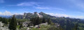
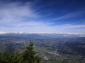
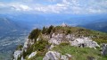
(2) Follow a small sign indicating a right turn (north). You’ll then begin the climb up through the mountain pastures; the slope is short but steep, straight up the hillside, with hardly any flat sections. Look back from time to time to admire the view. You’ll reach the Pointe d’Andey (views of Lake Geneva, the Salève and the Arve Valley, as well as the Bargy Range and the southern face of Mont Blanc).

(3) Then continue westwards, begin your descent and, after a few minutes, you’ll reach a pass.

(4) Turn left towards the Plateau de Solaison. The descent becomes less steep. You’ll reach the junction you passed earlier on the way up.

(2) Carry on straight ahead and rejoin the road.

(1) Follow the road to the right for about 500 metres and you’ll reach the Col de Solaison.

(5) Head south towards the Rochers de Leschaux via Les Berriers. After 200 m, turn left.
Initially, the path through the forest is easy, then you’ll start climbing up through the sharp limestone pavement.
Take great care: even in dry weather, the rock is slippery. Follow the yellow markings (or any other painted markings).
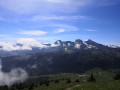
Reach the summit of the Rochers de Leschaux at an elevation of 1936 (views over Lake Geneva and the Bargy and Bornes ranges).

(6) Head towards Solaison via the Grotte de la Glacière. The path is easier on the descent but remains slippery nonetheless. You will eventually emerge from the sharp limestone pavement. At the fork in the path, turn left until you reach another fork.

(7) From this junction, you can:
- head straight to the junction at Le Perthuis by turning left.
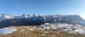
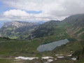
- or make a round trip to the Col de Cenise by turning right and following these directions. From the Col de Cenise, you can see the altiport, as well as a stunning view of the Bargy Massif and the Plateau de Cenise with its grassy slopes.

(8) Retrace your steps back to the fork.

(7) Turn right to reach another fork – Le Perthuis.

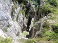
(9) Turn right towards Solaison and head for the Grotte de la Glacière. Beware of difficult sections: a ravine on your right, followed by two sections with ropes to help you descend.
The path is narrow in places, then you reach the cave.

(10) Continue along the rest of the path, which is straightforward: first downhill, then slightly uphill until you emerge from the forest and reach the road.

(11) Turn left onto the road, heading uphill towards the car park where you started (S/E).

Waypoints

  1. S/E : mi 0 - alt. 4,931 ft - Solaison car park
  2. 1 : mi 0.16 - alt. 4,954 ft - Junction of the southern circular loop
  3. 2 : mi 0.34 - alt. 4,993 ft - Junction of the northern circular loop
  4. 3 : mi 1.03 - alt. 6,093 ft - Pointe d'Andey (1877m)
  5. 4 : mi 1.15 - alt. 5,755 ft - Unnamed pass
  6. 5 : mi 2.17 - alt. 4,948 ft - Col de Solaison
  7. 6 : mi 3.53 - alt. 6,342 ft - Rochers de Leschaux – View of the - Lac Léman
  8. 7 : mi 5.05 - alt. 5,604 ft - Access to the Col de Canise
  9. 8 : mi 5.38 - alt. 5,659 ft - Col de Cenise
  10. 9 : mi 5.98 - alt. 5,436 ft - Intersection – Le Perthuis
  11. 10 : mi 6.19 - alt. 4,987 ft - Glacière Cave
  12. 11 : mi 6.91 - alt. 4,872 ft - junction – road
  13. S/E : mi 7.14 - alt. 4,931 ft - Solaison car park

Notes

Sturdy footwear is recommended for the sharp limestone pavement.
No water sources apart from on the Solaison Plateau; there are restaurants and bars.

Worth a visit

Lake Geneva, Salève and the Arve Valley are visible from the Pointe d’Andey, as are the Bargy Range and Mont Blanc.
From the Rochers de Leschaux, there is a lovely view of the Bornes and the Bargy.

Reviews and comments

4.7 / 5
Based on 2 reviews

Reliability of the description
5 / 5
Ease of following the route
5 / 5
Route interest
4 / 5
didier74350
didier74350
• Edited:

Overall rating : 4.7 / 5

Date of your route : Aug 08, 2026
Reliability of the description : ★★★★★ Very good
Ease of following the route : ★★★★★ Very good
Route interest : ★★★★☆ Good
Very busy route : No

A route allowing you to climb two peaks from the Solaison plateau, with remarkable views from each.
The descent is not particularly difficult but can prove tricky in wet weather.
Saw some ibex on the climb up the sharp limestone pavement… brilliant

Machine-translated

yobali
yobali

Overall rating : 4.7 / 5

Date of your route : May 11, 2026
Reliability of the description : ★★★★★ Very good
Ease of following the route : ★★★★★ Very good
Route interest : ★★★★☆ Good
Very busy route : No

I did this route early in the season (early May); there was still quite a lot of snow on the path near the Leschaux rock, but the snow wasn’t frozen, so there was no risk of slipping. On the way back, near the cave, the handrails (or rather, chains) came in handy because the ground was damp. It had rained the night before, so the ground was still very slippery on the roots and rocks, but in dry weather I think they’re there more for reassurance – though you still need to watch where you put your feet. I’ll do this route again this summer in dry, sunny and warm weather. A very nice route all the same, thank you.

Machine-translated

Other walks in the area

For more walks, use our search engine .

The GPS track and description are the property of this route's author. Please do not copy them without permission.