Country:
 City:
City:


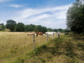
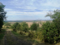

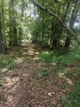
Car park on Chemin des Tuileries in Léning (site of the former silo).
(S/E) With your back to the road, follow the path continuing from the car park. After 200 m, it narrows; continue along it for 650 m. Walk alongside a private pond which you can make out on your left amongst the vegetation.
(1) Turn right onto the path (signposted with a yellow horizontal line) and walk through the forest (Grand Bois) for 1 km.
(2) As you emerge from the forest, at the Fork in the road, take the path on your left (signposting still visible). After 1 km, you’ll enter the village of Montdidier.
(3) After about ten metres, you’ll find yourself level with the orientation board. Continue along the main street to Montdidier Town Hall.
(4) Take Rue de la Côte on your right and walk until you reach the junction with the D88.
(5) Follow it to the left for about 150 metres.
(6) Turn right onto the track (signposted). After 800 metres, you’ll come to a forest track; follow it to the right for a few metres (there’s a pumping station here). Then take the first track on your left and follow it for 1.2 km.
(7) Just before the road, turn right onto the track (signposted). After 100 m, turn left.
(8) Cross the D88 and take the path directly opposite (signposted). After 150 m, at the Fork in the road, take the path on the left for 340 m.
(9) Turn onto the path on the left (signposted). Please note that this short section is not shown on maps but was created by the FFR, hence the signposting.
(10) At the end of the track, you’ll come out onto a forest road. Then take the track on the right (signposted), which will take you back to your starting point (S/E) after 2.5 km.

 Visorando Member

 Moderate
 Difficult