The circular route around the Étang de Lindre

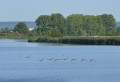
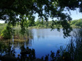
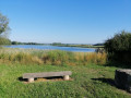
This long walk is best undertaken as a day trip. It is a route around the Étang de Lindre. Along the way, you’ll discover villages typical of our region as well as beautiful views of the Saulnois. A detour to the Tarquimpol Peninsula allows you to visit the eco-museum and make the most of the nearby waters of the Lindre. Strolling along the jetty and visiting the superb viewing points are truly enchanting experiences.

Details

n°3923965
Creation:
Last update:
Last review:
  • Walking
    Activity: Walking
  • ↔
    Distance: 15.31 mi
  • ◔
    Average duration: 7h 15 
  • ▲
    Difficulty: Difficult

  • ⚐
    Back to start: Yes
  • ↗
    Ascent: + 220 ft
  • ↘
    Descent: - 207 ft

  • ▲
    Highest point: 801 ft
  • ▼
    Lowest point: 676 ft
  • ⚐ Country: France
  • ⚐ City: Lindre-Basse (57260)
  • ⚑
    Start/End: N 48.802704° / E 6.735481°
  • ❏
    IGN map(s): Ref. 3514E, 3515E
  • Hour-by-hour weather

Photos

Description of the walk

The starting point is a car park located on the outskirts of Dieuze, on the D199E leading to Lindre-Basse.

(S/E) Take the path on the left (GR®5) just as you leave the car park and follow it to the shore of the Étang de Lindre.

(1) When you reach a three-way junction, turn right and continue for 400 metres until you reach a fork in the path, where you take the path on your left until you reach a crossroads approximately 2 km further on.

(2) At the crossroads, turn left onto the Route de Gelucourt and continue to the next crossroads, about 500 m away.

(3) Turn left onto the Route de Tarquimpol and stop here. On this peninsula, you can enjoy some beautiful views and visit the Maison du Pays des Étangs.

(4) Then retrace your steps and turn left back onto the D199 (Route de Dieuze), which you had left earlier. After 1 km, look out for the Château d’Alteville on your right.

::5: After the water tower, leave theGR® trail. Turn left and stay on the D199.

(6) At the entrance to Assenoncourt, 10 metres after the entrance sign, take the path on your left (don’t hesitate – it feels as though you’re entering a private property, but you’re actually on a public path). Follow it for 1.2 km until it ends.

(7) You’ll come out onto the D93; follow this to the left for 2 km. Pass through some woodland, go round the Étang d’Armessous and you’ll reach a fork in the road.

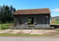
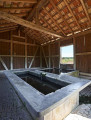
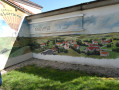
(8) Turn left towards Guermange onto the D91. At the crossroads with a cross, turn left. At the entrance to Guermange, you can see a unique wooden wash house. Continue along the main street, leave the village and carry on for 3 km, passing through another wooded area.

(9) Just past a wayside cross, at a fork in the road, take the path on your left for 800 m until you reach a farm (La Bellevue). Carry on straight ahead for 1.3 km until you come to a path on the left.

(10) Turn left onto this track for 340 m, then take the first track on your right for 2 km towards Lindre-Basse. Follow the road to the nearby crossroads.

(11) At the entrance to the village, turn into the first street on the left (Rue des Bouchets), which continues as Rue des Sablières. You’ll come out onto the main street

(12) Follow the main street to the left until it ends. You are now at the Étang de Lindre.

(13) Turn left and take the time to visit the Auspaires, which feature a remarkable observatory.

(14) Then retrace your steps.

(13) Walk along the jetty for 350 m.

(1) Turn right onto the path leading back to the car park where you started (S/E).

Waypoints

  1. S/E : mi 0 - alt. 686 ft - Car park located between Dieuze and Lindre-Basse
  2. 1 : mi 0.67 - alt. 696 ft - Along the banks of the Étang de Lindre
  3. 2 : mi 2.07 - alt. 699 ft - Turn left at the fork
  4. 3 : mi 2.42 - alt. 732 ft - Tarquimpol junction
  5. 4 : mi 3.01 - alt. 699 ft - Tarquimpol
  6. 5 : mi 4.96 - alt. 719 ft - Water tower. Towards the - Seille (Affluent de la Moselle)
  7. 6 : mi 5.58 - alt. 768 ft - Entrance to Assenoncourt
  8. 7 : mi 6.35 - alt. 771 ft - Junction on the D93
  9. 8 : mi 7.62 - alt. 735 ft - Junction on the D91
  10. 9 : mi 10.48 - alt. 738 ft - Path on the left
  11. 10 : mi 11.98 - alt. 751 ft - Path on the left
  12. 11 : mi 13.21 - alt. 709 ft - Rue des Bouchets
  13. 12 : mi 13.64 - alt. 686 ft - Main street
  14. 13 : mi 13.85 - alt. 696 ft - The jetty
  15. 14 : mi 14.13 - alt. 689 ft - Observatory
  16. S/E : mi 15.31 - alt. 686 ft - Car park located between Dieuze and Lindre-Basse

Notes

- Watch out for traffic on some sections (county roads).
- The route is largely exposed, so in very hot weather, remember to bring something to drink.
- This walk is ideal in rainy or very damp weather. You’ll be walking mostly on gravel or tarmac roads.

Worth a visit

Étang de Lindre
Étang de Lindre is a lake situated near Dieuze in the south-east of the Moselle department on the Lorraine plateau; it is the source of the Seille, a tributary of the Moselle and therefore a sub-tributary of the Rhine. The Lindre estate and its surroundings are designated as a Natura 2000 site and have held Ramsar site status since 2 February 2003.Covering 1,000 hectares, it is one of the largest ponds in the department. Shaped over the centuries by human activity, which created ponds, forests, hedgerows, fields and meadows, the Lindre Pond retains its natural character to this day.The creation of the Étang de Lindre probably dates back to the 11th or 12th century for fish farming, to supply the local population with fish and waterfowl. Its name is thought to derive from ‘linter’, a type of flat-bottomed boat. The current reservoir is believed to have been created by the Dukes of Lorraine in the 15th century. The pond also took on strategic importance for the defence of the Marsal stronghold established by Vauban, as breaching its dyke would allow its waters to flood the Seille valley, thereby protecting Marsal – a major centre of the salt industry – as well as Dieuze and, potentially, Metz.

Alteville Castle
Alteville Castle forms part of an estate comprising two castles (one dating from the 16th century and the other from the 17th), a farm, a pond, land and woodland. This property has been held for over a century by the Barthélemy family, a long-established family from Lorraine.

Tarquimpol
Situated in the south of the Moselle, in the Saulnois region, the village forms a peninsula on the Étang de Lindre and offers a prime vantage point from which to admire the local flora and fauna.
Here you will find ‘La Maison du pays des Étangs’, an interpretation centre. It provides the essential scientific and practical information needed to explore the site’s history, from the lost Gallo-Roman settlement to the present day (scale models, visual and audio displays, interactive games); the museum’s themes include archaeology, history and nature; an interpretive trail runs from Lindre-Basse to Tarquimpol. Educational activities for schools are organised here to showcase and promote the area’s heritage. The centre is currently undergoing a major development and regeneration project, the aim of which is to transform the Maison du Pays des Etangs into a hub for tourism, events, education and heritage training by 2022. The project involves the creation of three complementary spaces within the existing building and an extension in the form of a veranda in the garden:
A modern and engaging museum space for all ages, focusing on Tarquimpol’s heritage (particularly its archaeological and natural heritage) and highlighting the links between Tarquimpol and the surrounding sites associated with salt and the Roman presence
A catering area/tea room open to all, promoting local produce and short routes
A space for hosting groups and activities focused on promoting the archaeological and natural heritage…
These three main areas will be complemented by a 360° panoramic viewing platform (on the first floor of the extension). The facility will be complemented by the creation or restoration of a guided geological discovery trail on the Tarquimpol peninsula, enabling visitors to explore the main buried monuments in situ, which will be reconstructed in their original locations using augmented reality. A connecting trail linking Tarquimpol, Lindre and Basse-Dieuze will make the site accessible via sustainable modes of transport (walking, cycling, etc.).

Always be cautious and plan ahead when you're outdoors. Visorando and the author of this route cannot be held responsible for any accidents occurring on this route.

The GR® and PR® markings are the intellectual property of the Fédération Française de Randonnée Pédestre.

Reviews and comments

3.6 / 5
Based on 3 reviews

Reliability of the description
4 / 5
Ease of following the route
4 / 5
Route interest
2.7 / 5
Amandiine
Amandiine

Overall rating : 3.3 / 5

Date of your route : May 29, 2025
Reliability of the description : ★★★★☆ Good
Ease of following the route : ★★★★☆ Good
Route interest : ★★☆☆☆ Disappointing
Very busy route : No

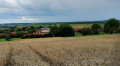
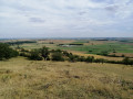
Half of the walk is along the road, with fields stretching as far as the eye can see. The main attraction of this walk is the physical exertion involved. Part of the pond was empty when we went for our walk. The pond is visible from a distance.

Machine-translated

Jacques R.
Jacques R.

Overall rating : 3.7 / 5

Date of your route : Feb 27, 2022
Reliability of the description : ★★★★☆ Good
Ease of following the route : ★★★★☆ Good
Route interest : ★★★☆☆ Average
Very busy route : No

I made a small oversight in the comment I left. This route is more suitable for cycling than for walking, for the reasons I mentioned in my previous comment.

Machine-translated

Jacques R.
Jacques R.

Overall rating : 3.7 / 5

Date of your route : Feb 27, 2022
Reliability of the description : ★★★★☆ Good
Ease of following the route : ★★★★☆ Good
Route interest : ★★★☆☆ Average
Very busy route : No

Hello, personally, I find this route uninteresting as it follows the road for the most part and is often a long way from the pond. Admittedly, there are a few lovely views, but that’s about it. Obviously, this is just my personal opinion, and I don’t want to discourage anyone from sharing their routes because of the effort involved.

Machine-translated

Other walks in the area

For more walks, use our search engine .

The GPS track and description are the property of this route's author. Please do not copy them without permission.