Route de la côte de Suisse

Circular walk around the small village of Suisse near Morhange. A walk comprising 50 per cent on footpaths and 50 per cent on quiet country lanes.

Details

574866
Creation:
Last update:
Last review:
  • Walking
    Activity: Walking
  • ↔
    Distance: 8.51 mi
  • ◔
    Average duration: 4h 05 
  • ▲
    Difficulty: Moderate

  • ⚐
    Back to start: Yes
  • ↗
    Ascent: + 203 ft
  • ↘
    Descent: - 207 ft

  • ▲
    Highest point: 968 ft
  • ▼
    Lowest point: 774 ft

Photos

Description of the walk

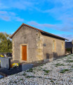
Start from the car park at Suisse church.

(S/E) Leave the car park and take the road immediately on the left (south-west). The route is marked by signposts with a Red Circle.

(1) Cross the railway line (take care) then turn left onto the small tarmac road and follow it alongside the railway line for about 750 metres.

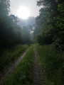
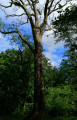
(2) Turn right onto a path through the woods. The path may be muddy, and an alternative track winds its way round the main path (which explains why the route deviates from the map).

(3) As you come out of the woods, take the small tarmac road on the left. Follow this main road, which changes direction twice: first to the left (north-north-east) and then to the right (east).

(4) Cross the bridge over the railway line and take a small road on the right until you reach the junction with the D20.

(5) Follow the road to the left until you reach the village of Landroff (watch out for cars).

(6) At the entrance to the village, take the road on the left to avoid the D20. Turn right immediately to rejoin the D20 and follow it to the left. A few metres before the church, take the small road on the right.

(7) On leaving the village, take the forest track on the left. After a right-hand bend, the climb is steady, heading north-east. There are a few small paths to the right or left; stay on the main track. On leaving the forest, the path may be muddy in wet weather.

(8) You’ll come out onto a small road; follow it to the left. When you reach the village of Eincheville, continue along the main road.

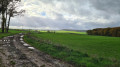
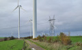
(9) Cross the D20 again (take care) and carry on straight ahead. On leaving the village, at the three-way junction, take the path on the left. It may not look like it, but the path climbs steadily, with a view of the wind turbines ahead. At the top of the hill, take the ridge path on the right.

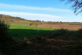
(10) Enjoy the view before the descent (a bench is available). The descent is quite steep with loose gravel (take care). You’ll come to a tarmac road; follow it to the left towards a farm. Walk through the farm and carry on straight ahead to return to the village of Suisse (S/E).


Waypoints

  1. S/E : mi 0 - alt. 781 ft - Church car park
  2. 1 : mi 0.2 - alt. 791 ft - Railway line
  3. 2 : mi 0.7 - alt. 804 ft - Junction
  4. 3 : mi 1.35 - alt. 833 ft - Exit from the woods
  5. 4 : mi 2.28 - alt. 830 ft - Bridge over the railway line
  6. 5 : mi 2.84 - alt. 827 ft - D20 road
  7. 6 : mi 3.26 - alt. 801 ft - Entrance to the village of Landroff
  8. 7 : mi 3.68 - alt. 801 ft - Forest track
  9. 8 : mi 4.98 - alt. 915 ft - Narrow road
  10. 9 : mi 5.96 - alt. 866 ft - D20 road
  11. 10 : mi 7.39 - alt. 965 ft - Viewpoint
  12. S/E : mi 8.51 - alt. 781 ft - Church car park

Notes

There are no water points on the route.
There are no major difficulties and the route can be completed in trainers.

Reviews and comments

4.4 / 5
Based on 3 reviews

Reliability of the description
4.5 / 5
Ease of following the route
4.7 / 5
Route interest
4 / 5
User 1256407

Overall rating : 4 / 5

Date of your route : May 05, 2026
Reliability of the description : ★★★★☆ Good
Ease of following the route : ★★★★☆ Good
Route interest : ★★★★☆ Good
Very busy route : Yes

A lovely walk, alternating between woodland and fields. Beautiful views

Machine-translated

User 3199271

Overall rating : 4.7 / 5

Date of your route : Jul 19, 2025
Reliability of the description : ★★★★★ Very good
Ease of following the route : ★★★★★ Very good
Route interest : ★★★★☆ Good
Very busy route : No

This walk around the village of Suisse has nothing to do with the country (the Swiss Confederation), of course, nor with what is known as ‘Little Lorraine Switzerland’, which is situated around Martincourt near Pont-à-Mousson (54).
The signposting on the ground (Red Circles) and the description on Visorando are spot on and accurate. For example, in section 2, the path is indeed muddy, even in dry weather! (Walk completed on 25 July). The route itself doesn’t offer any particular points of interest; it’s more of a walk for contemplative strollers: lovely views over fields, a few woods to pass through. There’s little shade. You pass through two villages (Landroff and Eincheville) with no drinking fountains, no shops, no cafés and no bakeries. They’re typical of the French countryside. It’s a route where you walk alone for kilometres, very peaceful for daydreaming and reflecting. Do watch out for blisters, though – I should have worn better socks.
Thanks to the person who wrote the description

Machine-translated

Christecol
Christecol

Overall rating : 4.5 / 5

Date of your route : Nov 16, 2022
Reliability of the description : Not used / Not applicable
Ease of following the route : ★★★★★ Very good
Route interest : ★★★★☆ Good
Very busy route : No

A lovely walk with no particular difficulties, taken after a thunderstorm. It’s worth noting that the route no longer quite follows the Red Circles; in fact, these take you along slightly less tarmac road. Here, you can see and hear a field of wind turbines (a faint hum, like a vacuum cleaner motor…).

Machine-translated

Other walks in the area

For more walks, use our search engine .

The GPS track and description are the property of this route's author. Please do not copy them without permission.