The Rabbit Walk in Albestroff

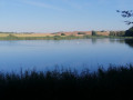
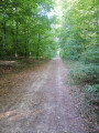
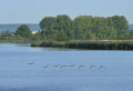
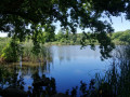
Take a close look at the route map and you’ll better understand the name of this route. Fortunately, it features another notable point of interest: the remarkable Étang d’Albestroff, a protected area teeming with wildlife. Most of the route runs through woodland along very wide paths. On hot days, this walk is ideal – for families, for example.

Details

n°25339578
Creation:
Last update:
Last review:
  • Walking
    Activity: Walking
  • ↔
    Distance: 5.41 mi
  • ◔
    Average duration: 2h 30 
  • ▲
    Difficulty: Easy

  • ⚐
    Back to start: Yes
  • ↗
    Ascent: + 52 ft
  • ↘
    Descent: - 56 ft

  • ▲
    Highest point: 820 ft
  • ▼
    Lowest point: 741 ft
  • ⚐ Country: France
  • ⚐ City: Insming (57670)
  • ⚑
    Start/End: N 48.949267° / E 6.875061°
  • ❏
    IGN map(s): Ref. 3614O
  • Hour-by-hour weather

Photos

Description of the walk

There is a large car park on the outskirts of Insming, heading towards Albestroff.

(S/E) With your back to Insming, follow the cycle and footpath along the D28 to the junction marked by a cross, near the Hospice Sainte-Anne.

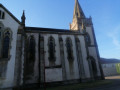
(1) Turn left towards the chapel (signposted with a yellow horizontal line). Turn left in front of the chapel, then right to reach the end of the site and the right-hand bend.

(2) Take the path straight ahead leading towards the edge of the woodland. Please note: this section does not appear on any map; it was created by the FFR (hence the signposting). This part is not very distinctive and you’ll feel as though you’re simply crossing a field for about a hundred metres.

(3) Once you reach the edge, follow the path along the edge of the woodland (signposted). You are now going round (actually, halfway round) a vast rectangular clearing. After about 500 metres, when you reach thethird corner of the clearing, enter the forest.

(4) Take the wide path on your right (signposted). It leads you in a straight line for nearly a kilometre along the edge of the Muehlwald woodland, near a pond.

(5) Turn left and walk along the large Albestroff Pond until you reach its embankment. You will then come to a smaller pond adjoining the previous one. Walk alongside this one too, continuing straight on for about 300 metres.

(6) Turn left and carry on straight along the path leading into the woods, heading north-east, until you reach a crossroads.
Take the path 90° to your right and, after 500 m, turn left onto a major forest track. You’ll reach another junction.

(7) Turn left at a right angle onto a forest track heading north-west. After about 1 km, the track curves slightly to the right and joins a junction where several tracks meet.

(8) Carry on straight ahead until you leave the forest and reach the entrance to Insming (signposted). You are now on Rue de la Forêt. At the end of Rue de la Forêt, carry on straight ahead (slightly to the left) along Rue du Faubourg (D88), then at the next junction, carry on straight ahead along Rue Saint-Jacques until you reach the junction with Rue Saint-Clément.

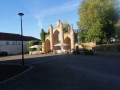
(9) Turn left towards the church onto Rue Saint-Clément. At the end of the street, at the junction, turn left onto Rue Sainte-Anne, which will take you back to your starting point after the wide right-hand bend (S/E).

Waypoints

  1. S/E : mi 0 - alt. 797 ft - Insming car park on Rue Sainte-Anne.
  2. 1 : mi 0.4 - alt. 820 ft - Hospice Sainte-Anne
  3. 2 : mi 0.6 - alt. 791 ft - Section not shown on maps
  4. 3 : mi 0.68 - alt. 781 ft - On the edge of the woods
  5. 4 : mi 1.03 - alt. 807 ft - Bois Muehlwald
  6. 5 : mi 1.49 - alt. 751 ft - The Albestroff pond
  7. 6 : mi 1.92 - alt. 745 ft - Forest track
  8. 7 : mi 2.95 - alt. 787 ft - Entrance to Insming
  9. 8 : mi 3.47 - alt. 787 ft - Crossroads
  10. 9 : mi 4.77 - alt. 778 ft - A stroll through Insming
  11. S/E : mi 5.41 - alt. 794 ft - Insming car park

Reviews and comments

3.4 / 5
Based on 3 reviews

Reliability of the description
3.7 / 5
Ease of following the route
3.3 / 5
Route interest
3.3 / 5
User 25801589
• Edited:

Hello
Thanks to the app, as there are very few signposts

Machine-translated

rando35250
rando35250

Overall rating : 4.3 / 5

Date of your route : Dec 30, 2024
Reliability of the description : ★★★★★ Very good
Ease of following the route : ★★★★☆ Good
Route interest : ★★★★☆ Good
Very busy route : No

A lovely walk to and from Munster! Through woods and past a pond!

Machine-translated

Maximumm
Maximumm

Overall rating : 3.3 / 5

Date of your route : Jun 03, 2024
Reliability of the description : ★★★★☆ Good
Ease of following the route : ★★★☆☆ Average
Route interest : ★★★☆☆ Average
Very busy route : No

It’s not easy to follow this route, as the paths are often obscured by lush vegetation following heavy rain, which has also left many muddy sections.
What’s more, the ponds along the route are currently dry.
But overall, it’s still an enjoyable walk.

Machine-translated

Camille.w
Camille.w

Overall rating : 2.7 / 5

Date of your route : Feb 18, 2024
Reliability of the description : ★★☆☆☆ Disappointing
Ease of following the route : ★★★☆☆ Average
Route interest : ★★★☆☆ Average
Very busy route : No

A disappointing walk, as there were no proper paths to speak of.
You cross fields and patches of woodland that used to be paths but aren’t any more.
As a result, in autumn or winter – as was the case on 18 February – you’re guaranteed to end up in slush, with your feet in water right in the middle of the fields.
The route should be reviewed to guide walkers along proper paths.
Otherwise, the area is lovely and the walk is still enjoyable.

Machine-translated

Other walks in the area

For more walks, use our search engine .

The GPS track and description are the property of this route's author. Please do not copy them without permission.