Refine your search for walks in Pithiviers
Pithiviers walks

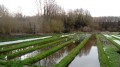
 Rimarde, Œuf and Salvin valleys starting from Yèvre-le-Châtel
 Visorando Member
 11.88 mi
 +236 ft
 -240 ft
 5h 40
 Moderate
 Departure from Yèvre-la-Ville (Loiret)
The fortress of Yèvre-le-Châtel overlooks the Œuf and Rimarde valleys, rivers that originate in the Forest of Orléans. From Yèvre-le-Châtel, the hike follows paths through the wide green belt that runs alongside each of the three rivers.
Chemin de la Rimarde from La Neuville-sur-Essonne
 Association / Club / Walk leader9.00 mi
+207 ft
-200 ft
4h 20
Moderate
Departure from La Neuville-sur-Essonne (Loiret)
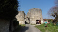
A very bucolic trail between the banks of the Rimarde with a few private mills, woods on the heights of Les Vaux, valleys on La Couture and Vautaupin (alternative route). Many varied landscapes. Pass by the mysterious fountain of Saint-Amand in the village of La Neuville-sur-Essonne.
Chemin de Beauce et Gatinais from Aulnay-la-Rivière
11.58 mi
+269 ft
-259 ft
5h 35
Moderate
Departure from Aulnay-la-Rivière (Loiret)
This route offers magnificent and varied landscapes between Beauce and Gâtinais, with hills and beautiful panoramas, the green Essonne valley, woods, cereal and beet fields, imposing farms and mills.
This is a long route that requires a good level of fitness.
Circular walk in the Orléans Forest from Chambon-la-Forêt
 6.08 mi
+75 ft
-75 ft
2h 50
 Easy
Departure from Chambon-la-Forêt (Loiret)
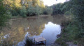
Starting from the village of Chambon-la-Forêt, known for Château de la Luzerne, the route will take you deep into the vast Orléans Forest. The undergrowth, filled with ferns and heather, is home to large wild animals in the tranquillity of the state-owned forest.
The mills of the upper Essonne valley
 6.68 mi
+66 ft
-69 ft
3h 10
Moderate
Departure from Briarres-sur-Essonne (Loiret)
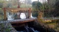
Before motorisation, milling was highly developed along the banks of the Essonne. This hike sets out to discover no fewer than five old water mills, whose presence has been documented since the 18th century. The route along the river is full of charm and the numerous reed beds add a touch of natural heritage to this very diverse hike.
Chemin du Larris from Briarres sur Essonne (45)
4.23 mi
+157 ft
-154 ft
2h 05
Easy
Departure from Briarres-sur-Essonne (Loiret)
A pleasant trail through woods and fields that climbs to the heights of Briarres-sur-Essonne, where the sheep pastures offer a magnificent panorama of the Essonne valley. A bucolic passage along the banks of the Essonne.
West of Chilleurs-aux-Bois
 Local authority6.32 mi
+23 ft
-23 ft
2h 55
Easy
Departure from Chilleurs-aux-Bois (Loiret)
This route is called "West of Chilleurs-aux-Bois - Route No. 5".
This circuit takes you on a tour of the western part of the commune and its main hamlets, starting from the centre of the village and the Lavau district: La Noue Glaçon, Le Coudray, Le Charme, L'Etang, Marcilly, Olivet, Ronville, Le Moulin de Pierre, La Fosse Aux Morts and Les Sapins. Return to the centre of the village via La Grande Gervaise.
You will pass close to the sites of two of the five grain mills that once stood in Chilleur-aux-Bois.
In Ronville, you will pass the boundary of the commune of Neuville-aux-Bois.
You will walk along the "fosse aux morts" (dead man's ditch), which reminds us that the 1870 war was very deadly in our region.
You will then reach the village and Saint-Pierre Church, a historic monument built between the13th and14th centuries.
The route is not particularly difficult and is mainly on roads.
Chemin de Saint-Fiacre from Dimancheville (45)
2.85 mi
+69 ft
-69 ft
1h 20
Easy
Departure from Dimancheville (Loiret)
Route through the Gâtinais countryside in Dimancheville (45), the smallest municipality in the canton of Puiseaux. The route runs alongside several properties (Orville mill, Augerville-la-Rivière castle park) and returns, across fields, to the municipality of Dimancheville along the Malesherbes - Puiseaux railway line.
This route presents no particular difficulties.
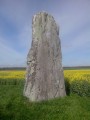
From Malesherbes to Maisse via the Menhir de la Pierre Droite
 10.16 mi
+404 ft
-577 ft
5h 00
Moderate
Departure from Malesherbes (Loiret)
On the edge of the Ile-de-France region, this hike from station to station follows the Essonne Valley from south to north. It takes forest paths, small roads with little traffic and paths between fields. This route allows you to discover an interesting heritage: mills, churches and castles, as well as a menhir and a polisher that attest to the ancient human occupation of the area.
From Malesherbes to Boutigny-sur-Essonne via the GR®1
16.44 mi
+686 ft
-843 ft
8 hrs
 Very difficult
Departure from Malesherbes (Loiret)
Taking place almost entirely in the Gâtinais Français Regional Nature Park, this stage follows the course of the Essonne river for quite a long time, sometimes on the right bank, sometimes on the left bank. The only section through fields is when leaving Buno-Bonnevaux. The rest of the route is unique in that it runs through woodland, with some parts reminiscent of the Forest of Fontainebleau with pine trees, sandstone outcrops and sandy areas. This hike can be divided into four sections as it passes not far from the stations of Boigneville, Buno-Gironville and Maisse.
 Malesherbes, circular loop around the Essonne
 18.17 mi
+682 ft
-686 ft
2.5 hrs
Moderate
Departure from Malesherbes (Loiret)
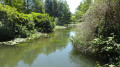
Around Malesherbes, a 29 km route along paths and lanes. Numerous small ponds dot the route.
Spirou route around the Buthiers leisure centre
5.51 mi
+374 ft
-381 ft
2h 50
Moderate
Departure from Buthiers (Seine-et-Marne) (Seine-et-Marne)
Welcome to the Buthiers Leisure Island. This discovery hike was specially created for a Year7 integration trip. Relatively easy and easily adaptable, it will allow you to have a great time. It allows you to discover all the landscapes of the Fontainebleau forest around the base and, of course, to observe the many activities on offer there.
Tour of the Buthiers Caves
5.95 mi
+344 ft
-315 ft
3h 00
 Difficult
Departure from Buthiers (Seine-et-Marne) (Seine-et-Marne)
A walk through the forest of the Île de Loisirs de Buthiers, taking in caves, rocks and forest paths.
The southern circular route is fairly easy and smooth, offering beautiful forest views, whilst the northern circular route is more technical, with several challenging sections over rocky terrain.
 The Juine Valley between Méréville and Saclas
 12.90 mi
+443 ft
-440 ft
1 hr
Moderate
Departure from Méréville (Essonne) (Essonne)
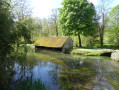
A very pleasant route that combines rural landscapes adorned with yellow when the rapeseed is in bloom and wooded, green landscapes along the Juine. And then, as you pass by, discover the watercress beds in Méréville and ride along what was once a Roman road to Saclas.