Circular walk in the Orléans Forest from Chambon-la-Forêt

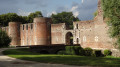
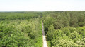
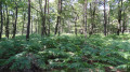
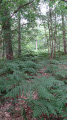
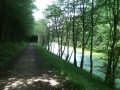
Starting from the village of Chambon-la-Forêt, known for Château de la Luzerne, the route will take you deep into the vast Orléans Forest. The undergrowth, filled with ferns and heather, is home to large wild animals in the tranquillity of the state-owned forest.

Details

3706161
Creation:
Last update:
Last review:
  • Walking
    Activity: Walking
  • ↔
    Distance: 6.08 mi
  • ◔
    Average duration: 2h 50 
  • ▲
    Difficulty: Easy

  • ⚐
    Back to start: Yes
  • ↗
    Ascent: + 75 ft
  • ↘
    Descent: - 75 ft

  • ▲
    Highest point: 463 ft
  • ▼
    Lowest point: 358 ft

Photos

Description of the walk

Start at the car park near the church in Chambon-la-Forêt

(S/E) From the car park, follow the local road, Rue du Cardinal de la Luzerne, on your left. Château de la Luzerne is visible provided you walk a short way along the gravelled path leading to it (there is no gate, a sign of the owner’s hospitality and goodwill). Continue in the same direction past the roundabout.

(1) Just before the water tower, turn right onto Rue des Tumuli towards La Sablonnière. Turn left onto Rue Transversale (there is an old house on the corner) and then, facing the dead-end street, turn immediately right. Two tumuli covered in vegetation are visible on the left-hand side along the street. To see the second tumulus, you need to walk a few dozen metres down the track on the left just before the junction.

(2) Keep to the left at the junction and continue along Route du Péage, past the lane leading to the Pont de la Prairie on the right.

(3) Leave the tarmac just before the Buisson d’Aronce and take the Chemin de l’Aulnay on the left. This path becomes tarmac and then crosses a side street.

(4) Turn right, then immediately left onto the grassy track bordered by a fence on your left. Turn right onto the cross-track, the Chemin des Ruelles.

(5) Turn left onto the small side street, Rue des Mobiles de la Charente. Cross the main road, Rue du Cardinal de la Luzerne, with care.

PR® signposting for the Forest

(6) Keep to the right at the Fork in the road onto the Route de la Forêt. This runs alongside the campsite and is followed by a compacted track as it enters the state-owned forest. This long forest track eventually crosses the D 109, Route de Rilly. Continue straight ahead onto the forest track.

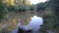
(7) Keep left at the Fork in the road onto the Route de Rodes. At the Cailloux crossroads, take the second path on the left. This runs alongside the Étang à Madame, which you can reach via the path on the right, then crosses a compacted track (with a table and benches).

No signposting

(8) When you reach a crossroads, turn left towards La Vieille Tuilerie, then right onto Route de Rilly. Turn right onto the cycle path between the departmental road and the sports facilities to return to the starting point (S/E) of the route near the church.

Waypoints

  1. S/E : mi 0 - alt. 387 ft - Car park near the church in Chambon
  2. 1 : mi 0.38 - alt. 404 ft - Turn right towards La Sablonnière
  3. 2 : mi 1.02 - alt. 384 ft - Turn left at the junction
  4. 3 : mi 1.48 - alt. 367 ft - Chemin de l’Aulnay on the left
  5. 4 : mi 1.9 - alt. 374 ft - Turn right, then immediately left
  6. 5 : mi 2.28 - alt. 384 ft - Turn left onto the small side street
  7. 6 : mi 2.47 - alt. 390 ft - Turn right at the fork in the road
  8. 7 : mi 3.54 - alt. 446 ft - Turn left at the fork in the road
  9. 8 : mi 5.51 - alt. 397 ft - Turn left towards La Vieille Tuilerie
  10. S/E : mi 6.08 - alt. 387 ft - Car park near the church in Chambon

Notes

The paths through the state-owned forest are protected by barriers that prevent access by any motorised vehicle.

Worth a visit

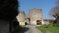
La Luzerne Castle is visible at the start of the walk. As it is privately owned, only the exterior of the castle is open to visitors.

Always be cautious and plan ahead when you're outdoors. Visorando and the author of this route cannot be held responsible for any accidents occurring on this route.

The GR® and PR® markings are the intellectual property of the Fédération Française de Randonnée Pédestre.

Reviews and comments

4.1 / 5
Based on 3 reviews

Reliability of the description
4.3 / 5
Ease of following the route
3.7 / 5
Route interest
4.3 / 5
User 11358826

Overall rating : 3.3 / 5

Date of your route : Sep 07, 2025
Reliability of the description : ★★★★☆ Good
Ease of following the route : ★★☆☆☆ Disappointing
Route interest : ★★★★☆ Good
Very busy route : No

There is a lack of signposting on the first section. Once you reach the forest section, the signposting reappears.
The first part is "bland" because it is mainly on the road.

Machine-translated

mlm
mlm

Overall rating : 5 / 5

Date of your route : Sep 24, 2024
Reliability of the description : ★★★★★ Very good
Ease of following the route : ★★★★★ Very good
Route interest : ★★★★★ Very good
Very busy route : No

a lovely walk

Machine-translated

MMIMI
MMIMI

Overall rating : 4 / 5

Date of your route : Feb 26, 2024
Reliability of the description : ★★★★☆ Good
Ease of following the route : ★★★★☆ Good
Route interest : ★★★★☆ Good
Very busy route : No

A lovely route, but impossible to follow without a GPS track.

Machine-translated

Other walks in the area

For more walks, use our search engine .

The GPS track and description are the property of this route's author. Please do not copy them without permission.